Peace Wall Belfast – The Most Popular Tourist Attraction in the City (FREE)
Updated On: March 04, 2024 by  Ciaran Connolly
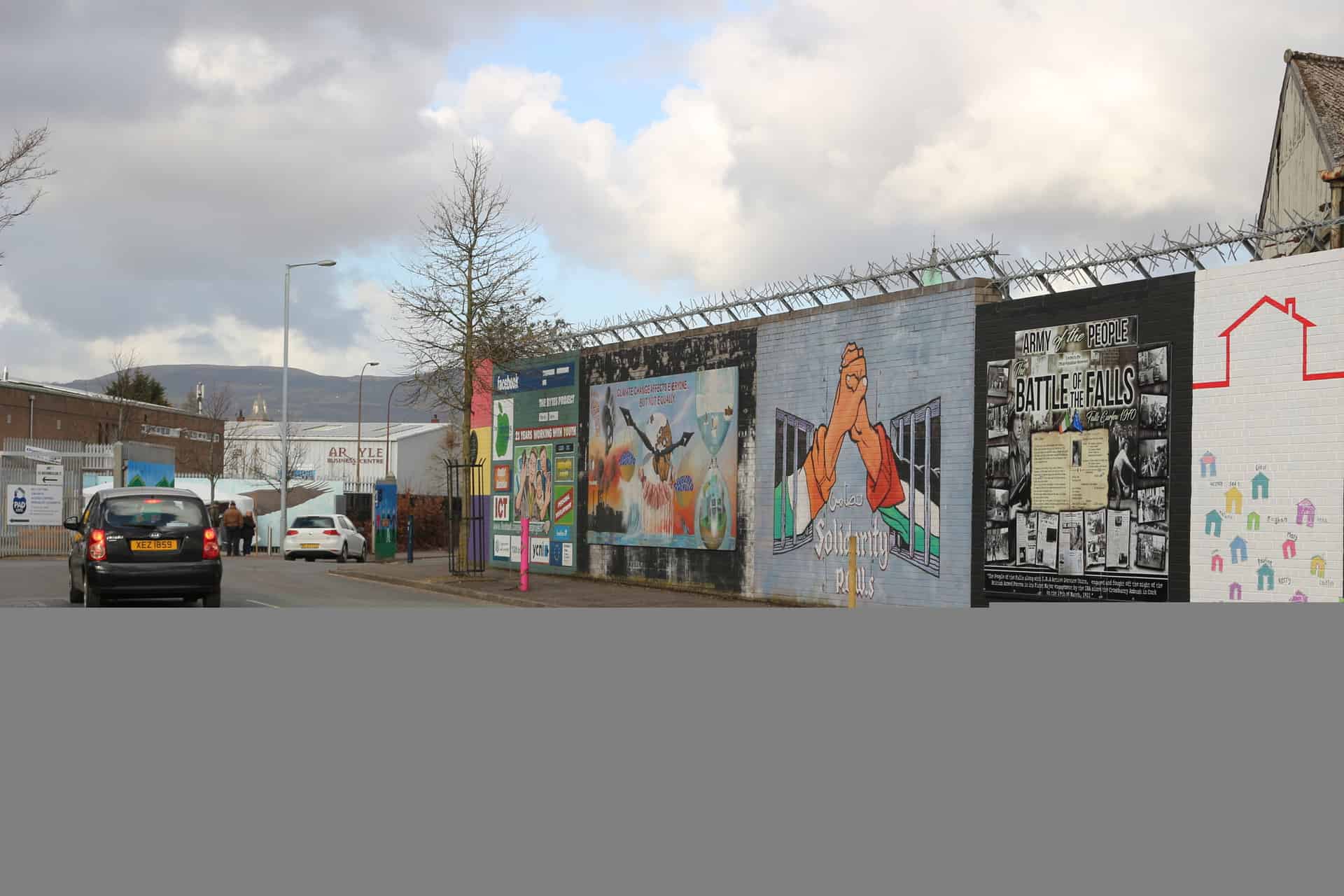
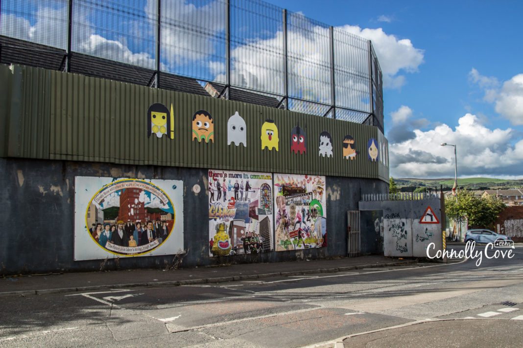
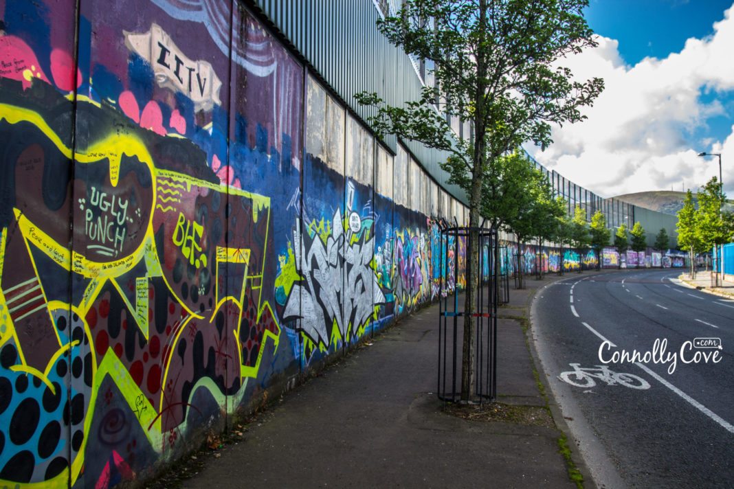
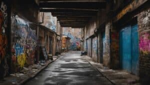
Peace Wall Belfast
The Peace Walls are a series of barriers that were erected across the course of “The Troubles” to separate Catholic and Protestant neighbourhoods, which are still visible throughout Northern Ireland today. They are located throughout Belfast, Derry, Portadown and elsewhere.
They tend to be visited daily by tourists, mainly in Belfast and Derry/Londonderry, where the majority of them can be found. The Peace Wall in Belfast is one of the biggest tourist attractions that people what to see when they visit the city.
Many black taxi tours will visit the Belfast Peace Wall as part of their tour, as do the tourist buses.
The purpose of the peace lines was to minimise the violent interactions between Catholics (most of whom are nationalists and identify as Irish) and Protestants (most of whom are unionists who identify as British).
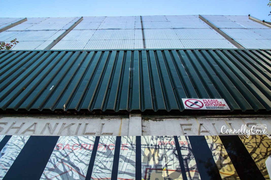
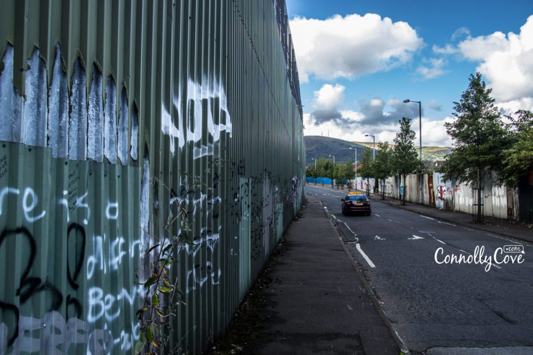
The Peace Walls (also called dividing walls or Belfast’s Berlin Wall) range in length from a few hundred yards to over three miles. They may be made of iron, brick, and/or steel and are up to 25 feet high. Some of the walls actually have gates allowing passage during daylight hours, but they remain closed during the night.
The best way to see them – if they are a primary focus of your visit, is to get one of the Belfast Black Cab Tours and ask them to take you to “Berlin Ireland”, or for a mural tour of Belfast, including the areas of Belfast that have these Peace Walls.
History of the Peace Walls
The first Peace Walls were built in 1969 following the outbreak of civil unrest when Nationalist communities came under attack by loyalist mobs with the assistance of the now-defunct Royal Ulster Constabulary (RUC). Indeed, historical accounts point to the burning of Bombay Street and the Seige of Short Strand as initial explanations for the first barriers. They were originally meant to stay up for only six months but were later increased in number and spread throughout several locations. In recent years, they have become a somewhat tragic tourist attraction.
The Removal of the Peace Walls
In 2008, the possibility of removing the walls was discussed, and in 2011, Belfast City Council agreed to develop a strategy regarding the removal of the walls. Although a study indicated that 69% of residents believed that the peace walls should not be removed due to the continuing possibility of violence, several initiatives led by local communities resulted in the opening of a number of interface structures for a trial period.
In January 2012, the International Fund for Ireland launched a Peace Walls funding programme in an effort to support local communities in beginning to work on tearing down the Peace Walls. In May 2013, the Northern Ireland Executive committed to the removal of all peace lines by mutual consent by 2023.
It is important to note that Northern Ireland currently has a higher number of Peace Walls than at any other point in the state’s history: a reminder that tensions have continued to bubble under the surface for over 20 years following the Good Friday peace agreements.
The Conundrum of Tearing Down the Northern Ireland Peace Walls
According to The Guardian, a secret report conducted by the Northern Irish government criticised the speed with which walls, gates and fences were being constructed in Belfast to separate Catholics and Protestants. The report claimed that the walls created an “atmosphere of abnormality” in the city.
The walls were constructed to bring a sense of ‘peace’ and prevent any forms of violence between both communities on either side. However, violence has persisted in some areas even after the construction of a barrier. Interface violence is particularly widespread during the summer months when the marching season and the summer holidays start.
Other commentators suggest that the walls were constructed by the British Government to perpetuate division as part of a ‘divide and conquer’ policy perpetuated in colonies across the world, including India.
Recently, Jonny Byrne, a lecturer in politics at the University of Ulster, likened the Peace Walls to the Berlin Wall by saying, “The Berlin Wall had to come down for Berlin to be normalised. We have normalised Belfast without taking down the walls.”
North Belfast witnessed some of the worst violence during The Troubles.
Some efforts to restore mobility between both sides of the fences have worked since, in 2011, a “peace gate” was installed in the iron fence of Alexandra Park.
“The difficulty in any peace wall conversation is that a lot of the initial conversations revolve around a sense of loss. What will I lose?’ asks Ian McLaughlin of the Lower Shankill Community Association.
The answer to Belfast’s peace wall conundrum lies in regeneration, says McLaughlin. “Our core business at one time was peace-building, but now we have a dual approach – regenerating our community and building relations with our neighbours.”
In August 2016, Belfast tore down its first peace wall 18 years after the Good Friday Agreement that brokered a peace deal for the region. By 2023, all of Northern Ireland’s 48 peace walls will be demolished, according to Government pledges. However, the lack of progress and political discourse around the issue has stunted progress, with neighbours continuing to be divided along communal lines.
President Barack Obama once addressed the issue to a crowd in Belfast, “There are walls that still stand, there are still many miles to go.” He added, “You have to remind us of hope again and again and again. Despite resistance, despite setbacks, despite hardship, despite tragedy, you have to remind us of the future again and again and again.”
Northern Ireland’s government says it wants to bring down every wall by 2023. But it seems that the process can only happen slowly and gradually in order to placate all parties involved.
Dr Byrne, a University of Ulster academic, co-wrote a 2012 report on people’s attitudes to the walls. His report revealed that a total of 69% living near a wall would fear for their safety if it were ever torn down, while 58% say they would worry about the police’s ability to contain any resulting violence. But 58% also say they would like to see them come down “at some point in the future”.
Different places have different fears, Dr Byrne says, “Community safety, fear of being attacked. But also fear of the unknown. People don’t like to change. People are comfortable with what they know…[In] each community, the approach is so different. In some communities, the walls mark where some families lost loved ones (during The Troubles). In others, there are concerns about anti-social behaviour and youth violence,” he says. “When you get down to the micro-level, it (removing the walls) becomes very difficult. None of this was envisaged when the British military was putting them up.”
The Peace Wall as a Tourist Attraction
According to the Huffington Post, the Peace Wall is listed as one of Belfast’s top tourist attractions. Visitors enjoying bus or cab tours can stop by and are even encouraged to scrawl their own messages on it.
Recently, visiting areas where historical conflicts have taken place has become more and more popular with tourists, especially in Northern Ireland.
Celebrations of the Beginning of a New Era
In August 2016, residents at a north Belfast interface held a celebration event to mark a new era after the removal of a peace wall by the Housing Executive.
Housing Executive Chief Executive, Clark Bailie, said: “The Housing Executive’s role has been to enable the community to take this positive step and remove this physical and psychological barrier 30 years after it was first erected…The transformation of this wall will help to regenerate the area for everyone in the community, it will change the physical environment and the lives of those people who live behind it. Today, it’s wonderful to see local families enjoying this new open space.”
Related Events and Locations:
• The Troubles
During the Troubles in 1969, a three-day battle between civil rights demonstrators, loyalist mobs and the RUC became remembered in history as ‘The Battle of the Bogside’. The Bogside area of Derry became a focal point for much of the conflict. The Bogside experienced frequent street riots and sectarian conflict lasting all the way to the late 1990s.
Throughout the rest of the 1990s, the Bogside became relatively peaceful compared to other localities of Northern Ireland at that time, such as Belfast, even though street riots were still frequent.
• Bloody Sunday
Bloody Sunday was an incident that took place on 30 January 1972 in the Bogside area of Derry. British soldiers opened fire indiscriminately upon 26 unarmed civilians during a peaceful protest march organised by the Northern Ireland Civil Rights Association and the Northern Resistance Movement against internment. Fourteen people died: thirteen were killed outright, and another man died four months later due to his injuries. Many of the victims were shot as they fled from the bullets fired by soldiers, while others were shot in the back as they tended to the wounded and dying. Today, a family-led campaign continues to bring members of the Parachute Regiment to justice for their crimes.
• Bogside Murals
The Bogside murals may possibly be the most well-known political murals in the world. Situated at Free Derry Corner, the murals were painted by the Bogside Artists. The Petrol Bomber mural was painted in 1994 to depict the ’Battle of the Bogside’, which took place in the Bogside area of Derry in August 1969. The mural portrays an image of a young boy wearing a gas mask to protect himself from CS gas that was used by the RUC. He is also holding a petrol bomb, a common weapon used by residents to deter the police and army from the area.
In Free Derry Corner, a slogan that says “You Are Now Entering Free Derry” was painted in 1969, not long after the Battle of the Bogside. Although not particularly considered a mural as it contains only words and no images, the Free Derry Corner has been used as a model for other murals in Northern Ireland, including the “You Are Now Entering Loyalist Sandy Row” mural in Belfast, which is considered as a form of response to the republican message at Free Derry Corner.
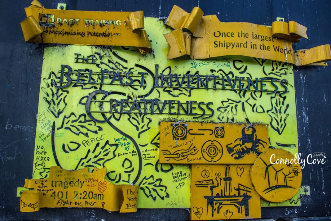
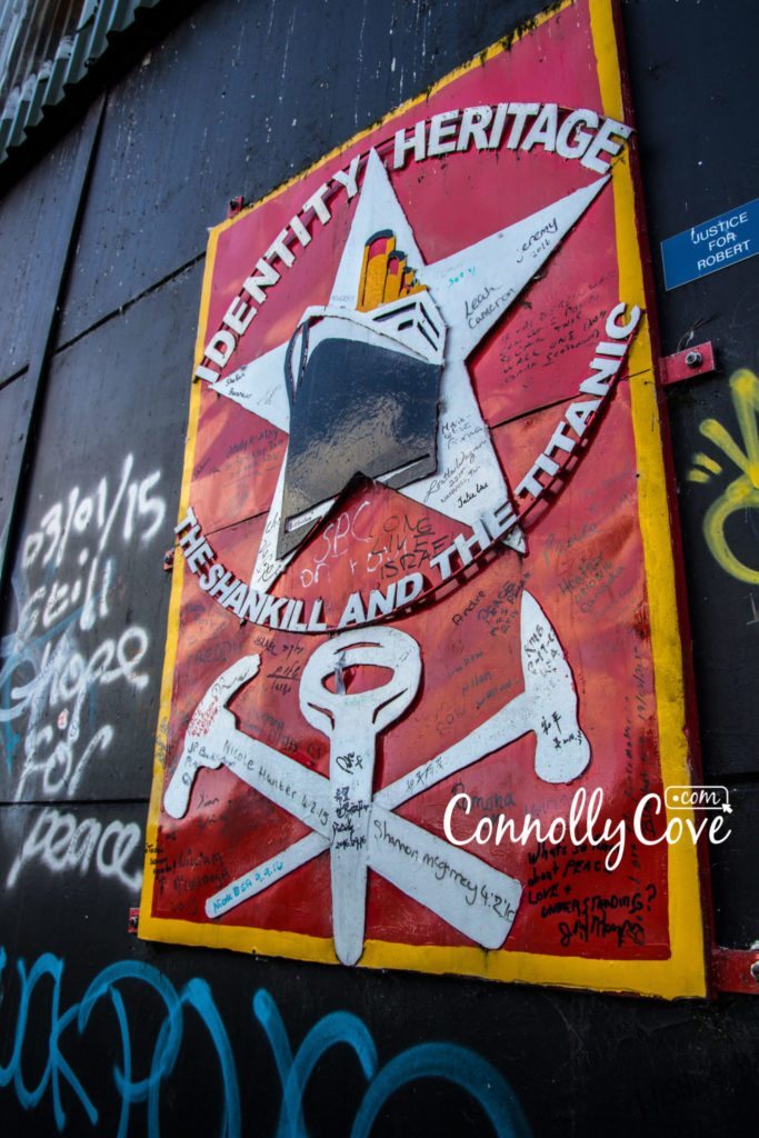
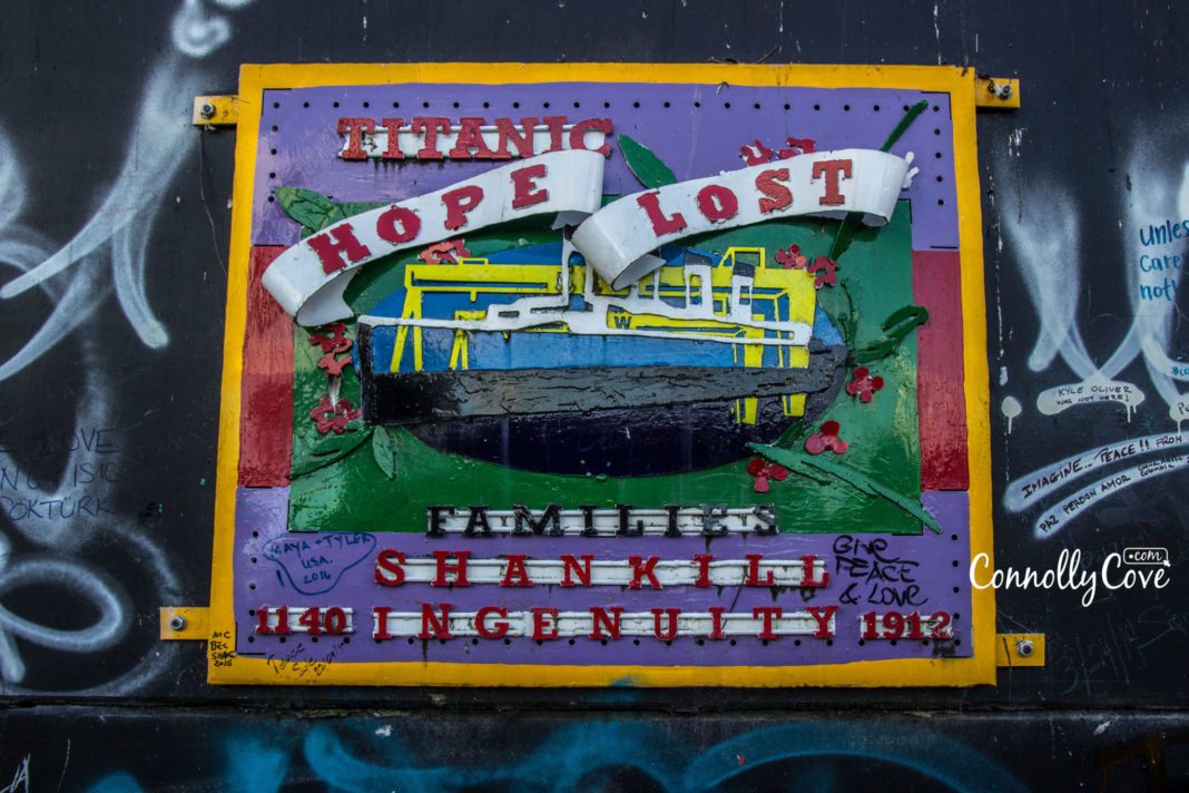
Peace Wall Belfast Messages:
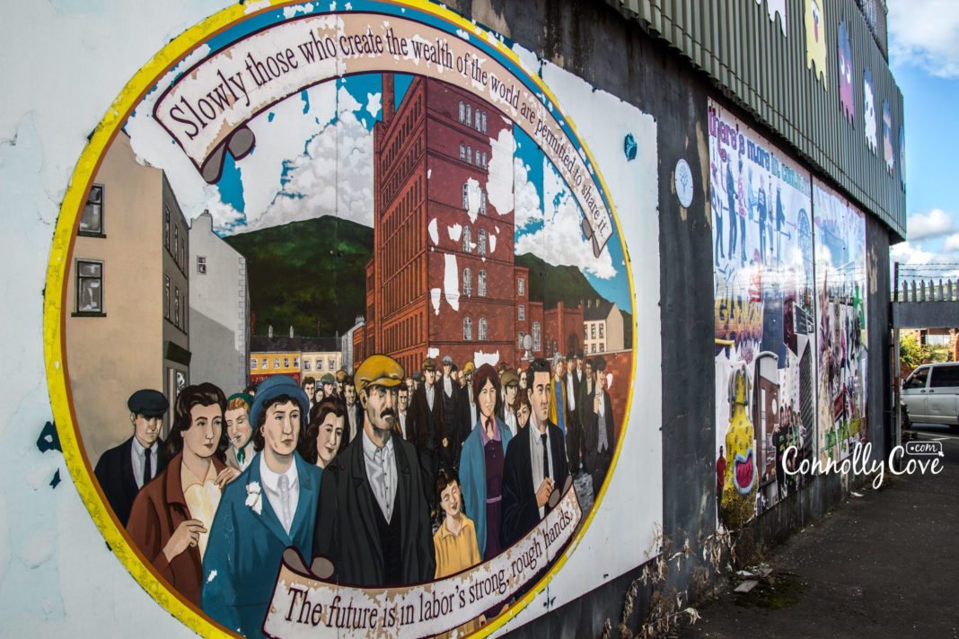
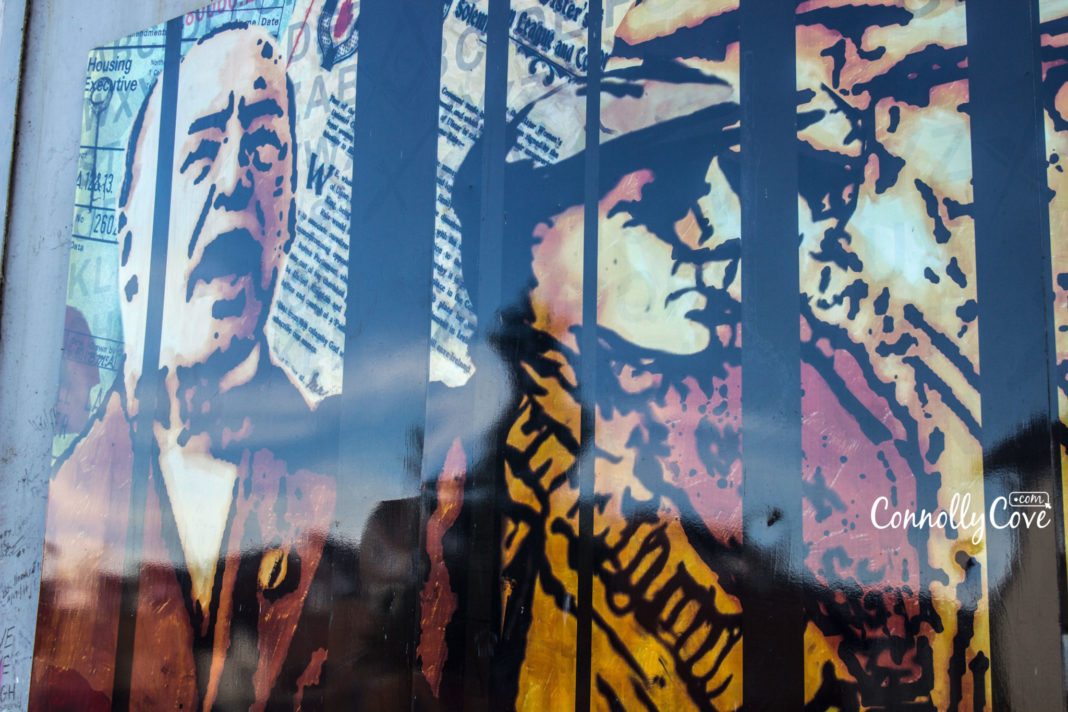
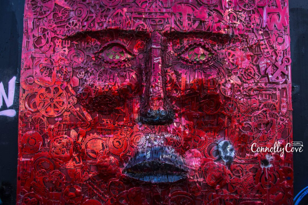
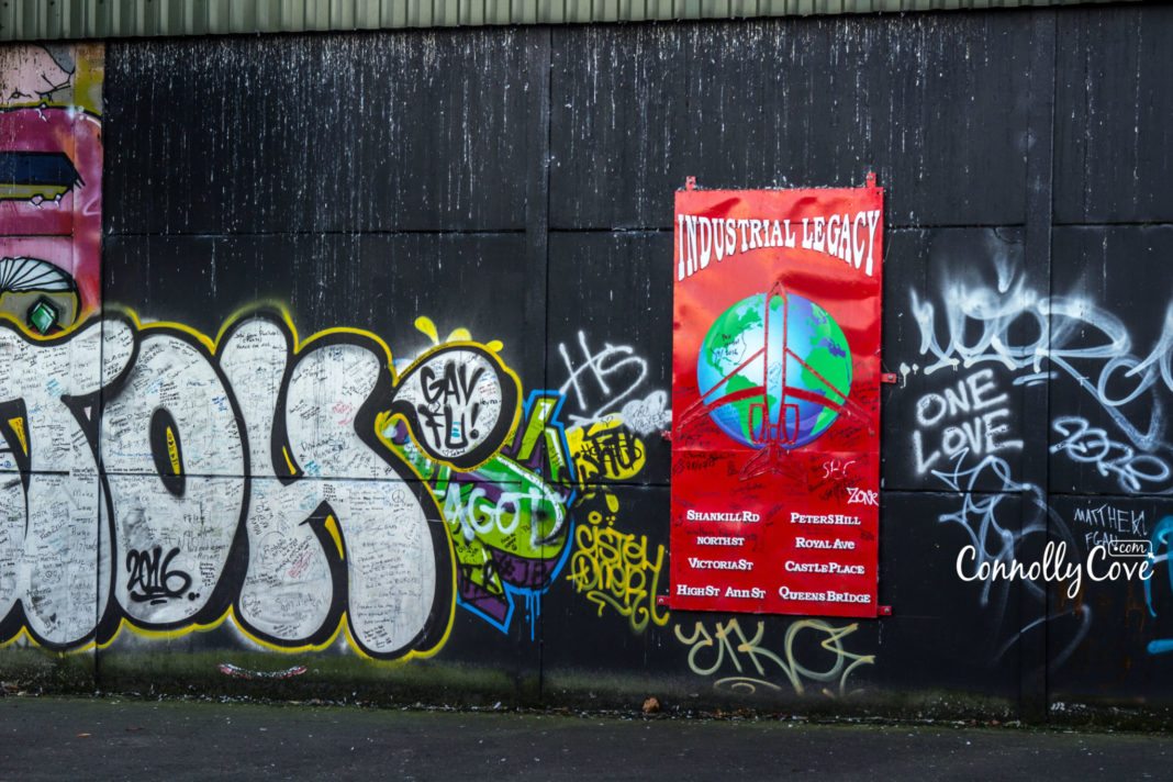
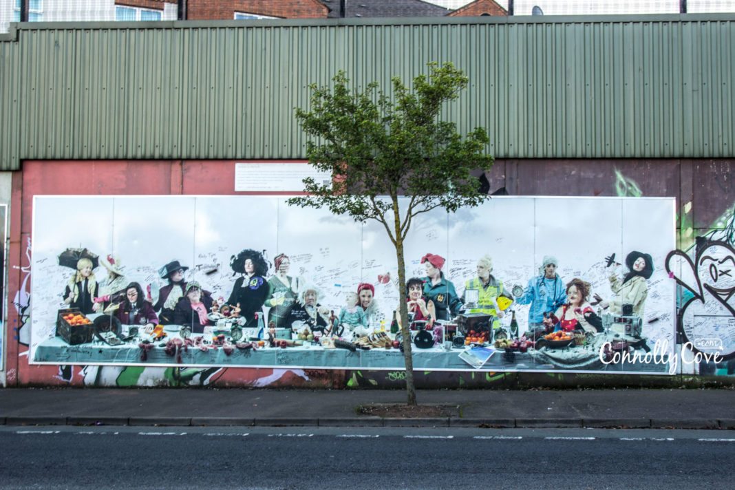
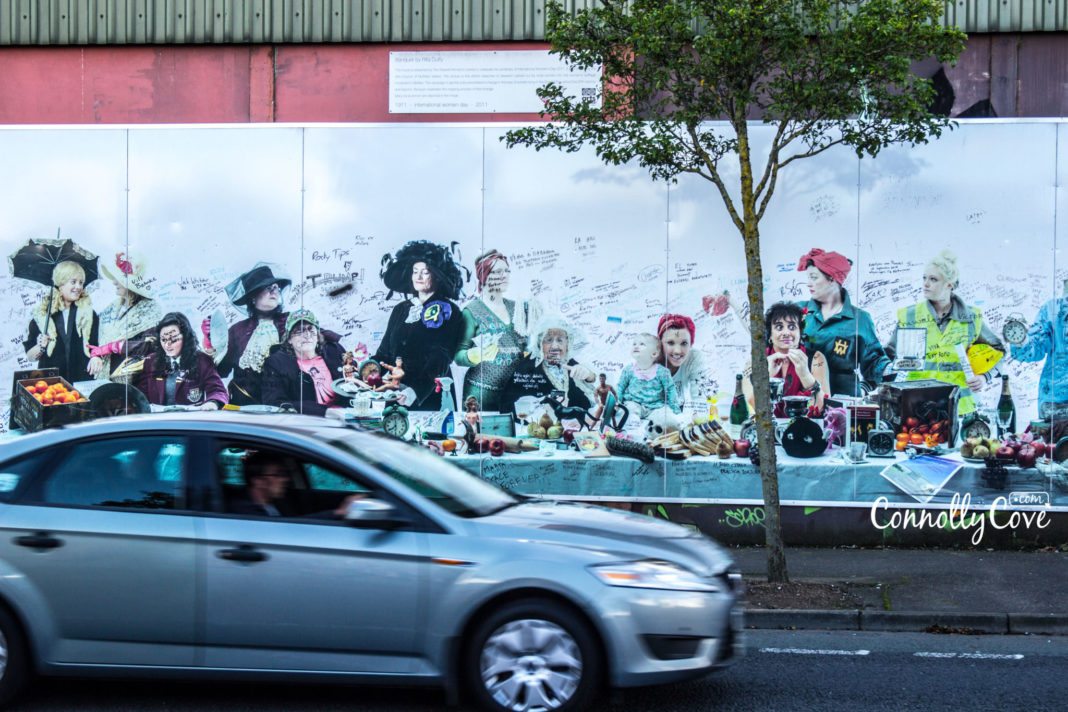
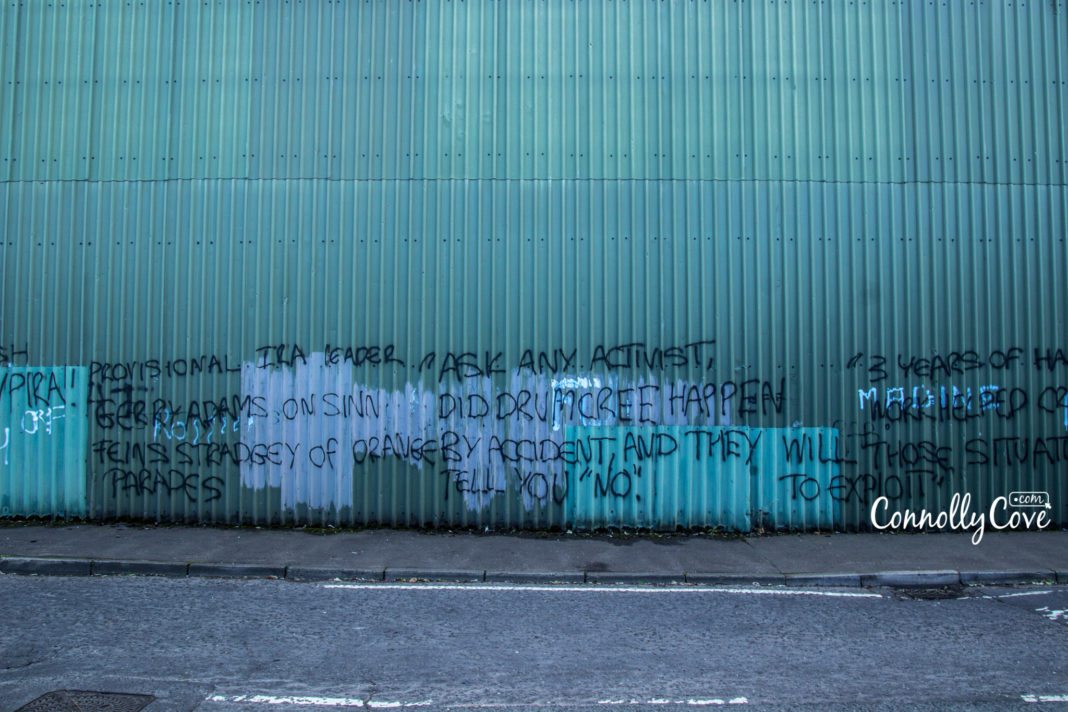
One of the most tragic yet intriguing things about the peace walls is that they attract tourists from all over the world. When they do come to visit, they leave their own messages on the wall for Belfast people. The messages written on the peace wall are positive, simply people trying to inspire others, to inspire peace and hope in a city that has seen much tragedy.
We took a trip to the Peace Walls in Belfast and found hundreds of beautiful messages that people had left. The messages are about change, coming together and looking to the future. We thought we would share some of our favourite ones as the walls get painted again every couple of months. Meaning we lost all these wonderful messages, so we were sure to take some photos and remember them forever. Check the photos out below:
Have you ever visited the Belfast Peace Wall – or any other ones around Northern Ireland? What do you think of Northern Ireland’s amazing artists? We love our murals! And make sure you leave a message on the wall to inspire others!
P.s: Don’t forget to check out some other popular tourist attractions while in Northern Ireland, such as Peace Bridge Derry | Botanic Gardens | Bushmills | Brown’s Bay | Norman Castle, Conagher Forest.

Key Insights: Global Medical Tourism Statistics and Market Growth Analysis
Travel Statistics
26/04/2024
The Irish Mafia: A Closer Look at Organised Crime Syndicates
History and Heritage
26/04/2024

The Ultimate Guide to Eating Out in Ireland: Tips and Recommendations
Food and Cuisine
26/04/2024

Plan Your Perfect Trips to Northern Ireland: A Guide to the Best Tours and Vacation Packages!
Northern Ireland
26/04/2024
Ultimate 7-Day Scotland Driving Itinerary: Explore Edinburgh, Skye, and More!
Scotland
26/04/2024