
Peace Bridge – Derry/Londonderry
Updated On: April 07, 2024 by  Noha Nabil
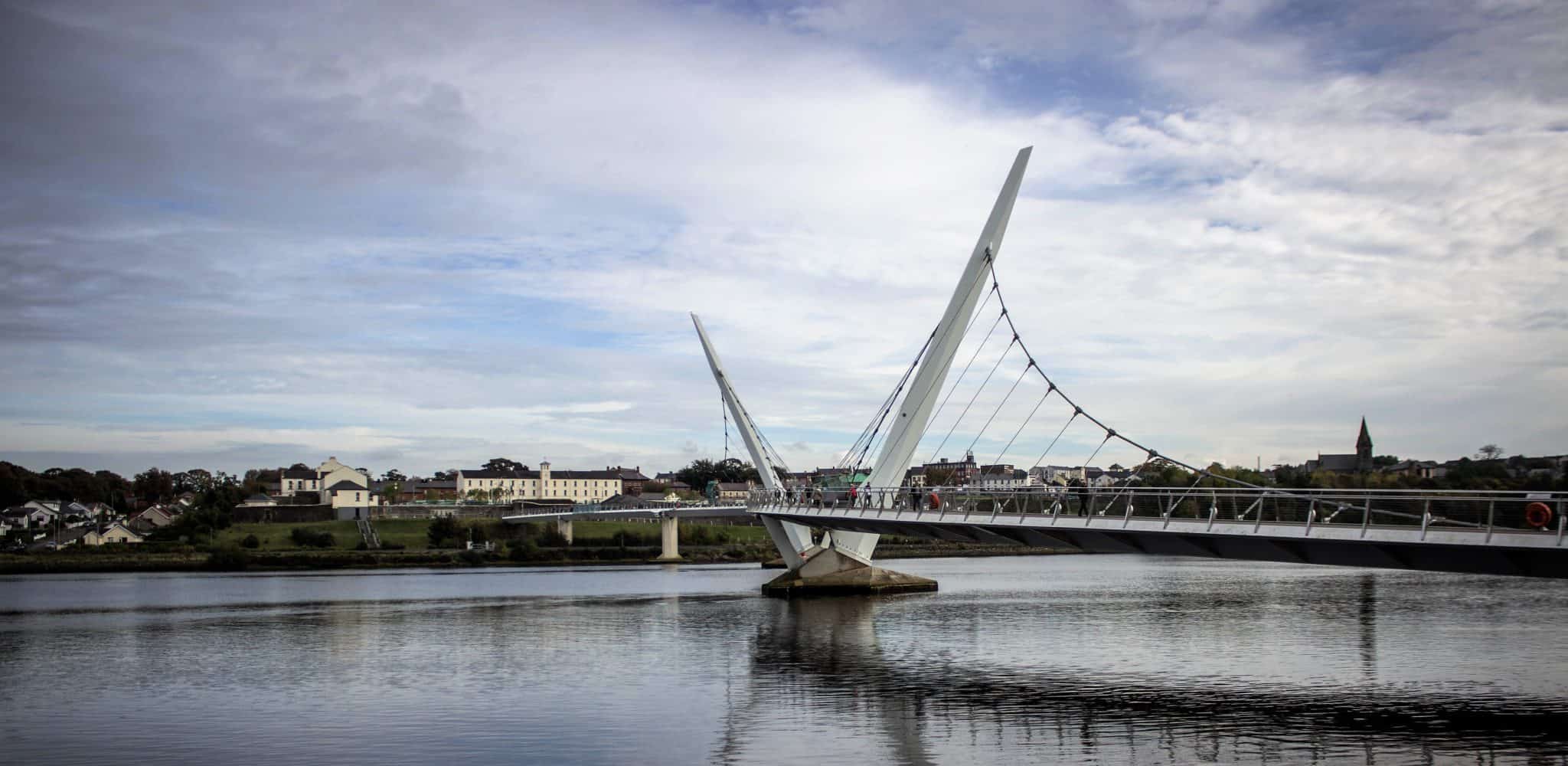
The Peace Bridge was opened in Derry/Londonderry over the River Foyle on the 25 of June 2011. It is called the peace bridge because it was thought to help improve the relationships of a once very divided community. The largely Unionist ‘Waterside’ and the largely Nationalist ‘City Side’ and the bridge join the two sides together over the river.
Description
Officially launched on 25 June 2011, Ilex built and managed the Peace Bridge as part of Derry~Londonderry’s regeneration programme. Funded by the European Union’s PEACE III Programme (Shared Space Initiative), the £14.5m Peace Bridge has become an iconic structure for the city, connecting the two sides of the River Foyle.
Three years since its launch, the bridge has been embraced by citizens and radically changed how people perceive the city. With over three million crossings to date, the Peace Bridge has become a focal point in city activities and events, including the New Year celebrations and launch of City of Culture year, the gateway and backdrop to Radio 1’s Big Weekend, the stage for Lumière installations and several charity events such as Brides across the Bridge.
Officially launched on 25 June 2011, the Peace Bridge was constructed as part of Londonderry’s regeneration program. The project was co-funded by several entities, including the Department for Social Development (NI), the Department of the Environment, Community and Local Government and the European Union’s PEACE III Programme, with a total budget of £14.5m. It has now become an iconic structure for the city as it connects both sides of the River Foyle.
The Peace Bridge has become a central hub for the city’s activities and events, including the New Year celebrations, the City of Culture year launch, and the gateway and backdrop to Radio 1’s Big Weekend.
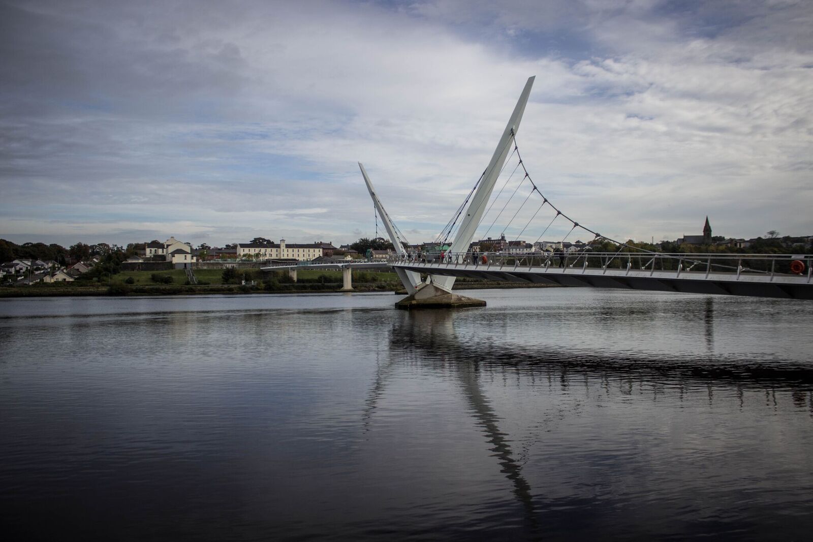
The Peace Bridge is a cycle and footbridge bridge across the River Foyle in Derry, Northern Ireland. It is the newest of the three bridges in the city. AECOM and Wilkinson Eyre Architects designed the 235-meter bridge.
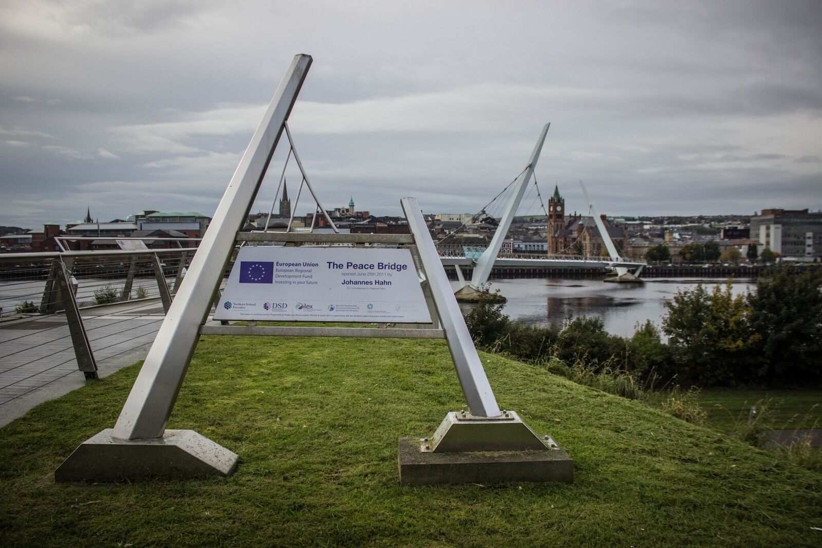
The bridge was inaugurated by EU Commissioner for Regional Policy, Johannes Hahn; the First and Deputy First Ministers, Peter Robinson and Martin McGuinness; and the Irish Taoiseach, Enda Kenny. The primary purpose behind the project was to improve relations between the largely unionist ‘Waterside’ and the predominantly nationalist ‘Cityside’ by improving access across these areas. The bridge is described as a “structural handshake”.
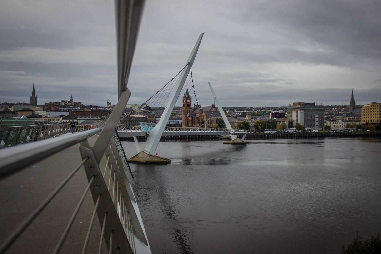
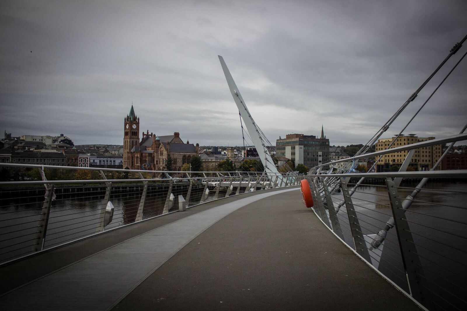
Designed for pedestrians and cyclists, the bridge stretches from Guildhall Square on the west bank to Ebrington on the east bank.
At first, sectarian tension prevented many from crossing to the other side of the city, as many Catholics and Protestants lived largely separate lives. That is why the bridge was initially built to improve both parties’ relations and promote peaceful coexistence. Chief Superintendent Stephen Martin said, “I was here in the 1980s as a police officer for six years – it is a fundamentally different place now. It is a place of hope, increasing prosperity, and where the people of the city want peace.”
The Derry Peace Bridge has been crossed by over 3 million people so far, and many locals use it daily as it represents the triumph of the local people against adversity.
Interesting Facts about the Peace Bridge
- The Peace Bridge is designed to withstand impact from vessels up to approximately 30 tons moving at up to 5 knots.
- It weighs a total of 1,000 tons.
- The bridge’s design was inspired by the sculpture “Hands Across the Divide” by Maurice Harron, which can be found near the bridge.
- The design life of the bridge is 120 years.
- The bridge has won the Structural Steel Design Awards 2012
“The bridge is a self-anchored suspension bridge for pedestrians and cyclists. The bridge deck is divided into two curved halves, each supported by the suspension system from a single inclined steel pylon. At the centre of the river, the structural systems overlap to form a ‘structural handshake’. The 312m long bridge has six spans, three of which are supported by the cables. The main river span is 96m, with a minimum clearance of 4.3m for navigation.”
- The construction of the Peace Bridge was a joint European effort, as the glass panels were imported from Portugal, the steel from Wales, and the CCTV from Dublin.
- The Peace Bridge has won many awards since it was inaugurated, including:
- Achieving Excellence Partnering Award, Construction Employers Federation
- Global BIM Award, Tekla Corporation
- Overall Planning Award, Irish Planning Institute
- Place Making, Irish Planning Institute
- Waterways Trust Renaissance Awards, Waterways Trust
- Arthur G Hayden Medal, International Bridge Conference Award
- Structural Steel Design Award
- ICE NI Sustainability Award
- Civic Trust Award
- RTPI/PSPB NI Sustainable Planning Awards
- Royal Institute of Chartered Surveyors (RICS) NI Awards
The Design
The Peace Bridge is a beautiful and elegant piece of architecture that was designed by Wilkinson Eyre Architects in London. It is designed as two identical halves, each suspended from a single, inclined steel pylon, which overlaps at the centre of the river to form a ‘structural handshake.’ A powerful metaphor for reconciliation and hope, drawing on inspiration from the sculpture “Hands Across the Divide” by Maurice Harron, which can be found nearby. The bridge celebrates how far the city has come, and the symbol of hope has become a massive part of Derry/Londonderry. It attracts many visitors, locals and tourists who tell a story of triumph over adversity.
Peace Bridge Facts;
- It is the only self-anchored suspension bridge on this island.
- It was designed to withstand 120 years last.
- The bridge rises 7.5m from the city side to the Waterside.
- The Peace Bridge has won five awards since it was opened, including the ‘Overall Planning Award’ and ‘Place Making Award’ (Irish Planning Institute, Dublin)
- A 3D model used to complete the structure is on display in the reception area of the North West Regional College.
Have you taken a trip to visit the Peace Bridge yet? What did you think of the design?
Also, if you would like to learn more about Derry/Londonderry and what it offers, click here.
Challenges and Opportunities
Despite its many successes, the Peace Bridge is not without its challenges. Like any infrastructure project, it requires ongoing maintenance and investment to ensure its continued viability and safety. Moreover, it must contend with the broader socio-economic and political realities of Northern Ireland, where sectarian divisions still linger and peace remains a fragile and precious commodity.
Nevertheless, the Peace Bridge also presents opportunities for further growth and development. As Derry/Londonderry continues to evolve and embrace its identity as a city of peace and reconciliation, the bridge can catalyze positive change. Whether through cultural events, educational initiatives, or community outreach programs, much can be done to harness the bridge’s potential and promote a more inclusive and harmonious society.
Places to Visit near the Peace Bridge
-
Ebrington Square
Ebrington Square is a public space and tourist attraction in Derry, Northern Ireland, an Army Barracks transformed into a public space for various open-air events, art exhibitions and music spectacles.
-
The Tower Museum
The Tower Museum is a museum on local history in Derry, County Londonderry, Northern Ireland. It showcases Derry’s history and has an exhibit on a local shipwreck of La Trinidad Valancera, which sank off Inishowen in 1588. The museum first opened in 1992 and has won several awards.
-
St Columb’s Park
St Columb’s Park is a public park on Limavady Road. It was previously an estate that belonged to the Hill family. The vast grounds include a large house which was called ‘Chatham’. In 1845, the estate was bought by the Londonderry Corporation, which transformed it into a public park.
The house was formerly used as a Nurse’s home for some time before it became the St Columb’s Park House Activity and Reconciliation Center.
-
Guildhall
The Guildhall is one of Derry’s most outstanding landmarks and has been so since the 1800s. An iconic building that has seen many events and history in the making, Guildhall stands in the city’s centre today as a must-see spot for visitors in Derry-Londonderry.
The Guildhall includes a large hall where many social and political events have been held over the years, including Halloween carnivals, the switch-on of Christmas lights, and the Christmas European Market. The square in front of the Guildhall is the principal city square in Derry-Londonderry, making it a focal location in the city, as shopping, cultural, and tourist areas surround it.
Conclusion
the Peace Bridge in Derry/Londonderry is a powerful symbol of hope, resilience, and unity. From its elegant design to its profound symbolism, the bridge embodies the aspirations of a community striving to overcome its troubled past and embrace a brighter future. As Northern Ireland continues its journey towards peace and reconciliation, the Peace Bridge serves as a reminder of what is possible when people come together to pursue a common goal. Bridging divides and fostering connections is a testament to the past and a beacon of hope for future generations.
Have you ever visited the Peace Bridge in Derry/Londonderry? Let us know your thoughts in the comments below.
More Interesting Blogs: Bishops Gate – Derry | Bogside Murals/Derry Murals | Derry Girls – TV Show | Lisa McGee – Writer from Derry | Things to do in Derry
Irish Folklore: Mythical Monsters and Terrifying Creatures
Ireland
28/04/2024
Discover the Best Scenic Drives in Northern Ireland
Northern Ireland
28/04/2024
Exploring Ireland’s Ancient East
Ireland
28/04/2024
Viking History: Insight into the Age of Phantom Travellers
History and Heritage
28/04/2024
The Symbolism and Meaning of the Dara Knot
Culture Exploration
28/04/2024