Is Ireland an Island? Exploring the Geography and Borders of the Emerald Isle
Updated On: April 23, 2024 by  Panseih Gharib
Ireland conjures images of rolling green hills, dramatic cliffs, and a rich cultural heritage. But a simple question lingers: is Ireland an island? While seemingly straightforward, this query delves into the island’s complex political and geographical reality.
This article will navigate the intricacies of Ireland’s landmass and explore the fascinating interplay between geography and identity that defines this captivating corner of the world.
Geography and Borders of Ireland
Whether Ireland is an island might seem straightforward, but geography rarely adheres to tidy definitions. We must delve into Ireland’s unique physical landscape and complex political map to understand it.
A Land of Diversity
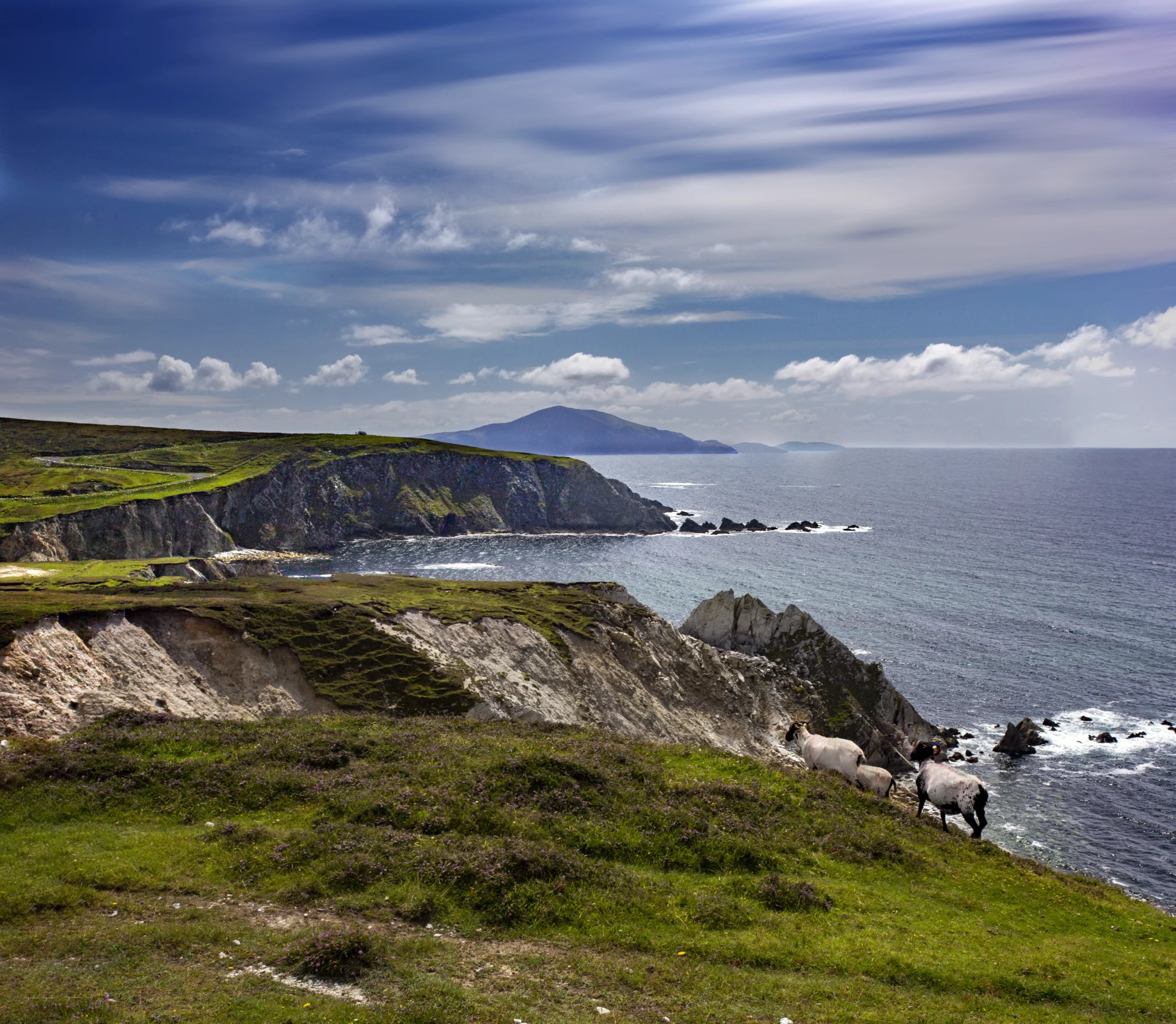
Ireland boasts a surprisingly diverse terrain for its relatively small size. Imagine a gently rolling central plain fringed by rugged coastal mountains that dip into dramatic cliffs along the west coast. The majestic Wicklow Mountains rise in the east, while the flat expanses of the Shannon River Basin snake across the island, culminating in Europe’s longest estuary. This interplay of mountains, plains, and coastlines creates a dynamic backdrop for the island’s rich biodiversity and agricultural bounty.
Is Ireland an Island?
Geologically, Ireland sits on the edge of the European continental shelf, separated from Great Britain by the Irish Sea, the North Channel, and St. George’s Channel. There are many beautiful and interesting islands off the coast of Ireland, both in the Republic of Ireland and in Northern Ireland. Here are a few of the most notable:
Islands in the Republic of Ireland
- Aran Islands: Located off the coast of County Galway. They are a group of three islands: Inishmore, Inishmaan, and Inisheer. They are known for their traditional Irish culture, Gaelic language, and stunning scenery.
- Achill Island: Ireland’s largest island off the mainland, Achill Island, is located off the coast of County Mayo. It is known for its dramatic cliffs, beautiful beaches, and rich archaeological heritage.
- Valentia Island: Located off the coast of County Kerry, Valentia Island is known for its dramatic cliffs, beautiful beaches, and historical sites, including the Telegraph Field, where the first transatlantic cable was laid.
- Skellig Islands: Located off the coast of County Kerry, the Skellig Islands are two remote and rugged islands known for their early Christian monastic settlements and stunning scenery. They were also featured in the Star Wars films.
- Saltee Islands: Located off the coast of County Wexford, the Saltee Islands are known for their birdlife, including puffins and gannets. They are also home to an important lighthouse.
Islands in Northern Ireland
- Rathlin Island: Located off the coast of County Antrim, Rathlin Island is known for its dramatic cliffs, seabird colonies, and historical sites, including Bruce’s Castle.
- Inishowen Peninsula: While technically a peninsula attached to the mainland, Inishowen offers many of the same characteristics as an island, with stunning scenery, a rich history, and a unique culture.
Political Division
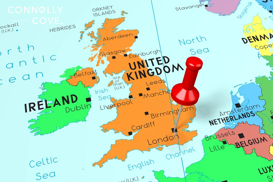
The Republic of Ireland encompasses roughly five-sixths of the landmass, while Northern Ireland constitutes the remaining portion as part of the United Kingdom. This 300-year-old political border, though invisible in many landscapes, is a stark reminder of the island’s complex history and ongoing identity debates.
The Republic of Ireland, also known simply as Ireland, is an independent country covering most of the island. It has its own government and capital city, Dublin. On the other hand, Northern Ireland is part of the United Kingdom and shares its borders with the Republic of Ireland. This division has significantly impacted both regions in terms of politics, culture, and identity.
Overview of the Republic of Ireland
The Republic of Ireland is a sovereign nation located in Western Europe. Occupying the more significant portion of the island of Ireland, it is separated from Great Britain by the Irish Sea and the Atlantic Ocean. The country has a diverse landscape, with a captivating coastline encompassing renowned regions such as Kerry, Donegal, Galway, and the enchanting Aran Islands and Achill Island. The population of Ireland is predominantly of Irish descent, historically making it a significant cultural hub for the Irish people.
Cultural and Historical Significance
Ireland is known for its rich cultural and historical heritage, prevalent throughout the country. The Irish language, also known as Gaelic, holds an influential place in the cultural identity of the Irish people. Ireland’s deep-rooted traditions and customs, along with its historical landmarks, reflect the enduring legacy of the country. From the bustling city of Dublin to the charming town of Cork and the scenic beauty of West Ireland, Ireland’s cultural and historical significance is woven into the fabric of its society.
Ancient Ireland
Ireland’s pre-Christian past left an enduring legacy. Megalithic tombs like Newgrange stand as testaments to a sophisticated society, while intricate Celtic mythology, featuring heroes like Cú Chulainn, continues to capture imaginations. The Gaelic language, though facing challenges, preserves this heritage, connecting modern Ireland to its ancient roots.
The Fight for Independence
Centuries of English rule inflicted deep wounds. Land confiscations, religious persecution, and famines like the Great Famine shaped a national narrative of struggle and resilience. The fight for independence, marked by figures like Daniel O’Connell and Michael Collins, culminated in the establishment of the Republic in 1949. This complex history continues to evoke strong emotions and inform contemporary debates on identity and politics.
A Literary Powerhouse
Despite challenges, Ireland nurtured a vibrant literary tradition. Giants like James Joyce, William Butler Yeats, and Seamus Heaney explored themes of identity, exile, and social change, capturing the world’s attention with their lyrical prose and poignant poetry. This rich literary heritage continues to inspire new generations of writers and artists, solidifying Ireland’s place on the global cultural map.
Folklore and Music
Irish storytelling traditions thrive in pubs and festivals, where tales of fairies, leprechauns, and mythical heroes keep folklore alive. With its evocative melodies and lively rhythms, traditional music enjoys immense popularity, echoing in pubs, concert halls, and international stages. These expressions serve as powerful symbols of cultural identity and community spirit.
A Nation in Transition
Today, the Republic of Ireland grapples with balancing tradition and modernity. While embracing globalization and economic progress, it strives to preserve its unique cultural heritage. Issues like language revival, gender equality, and religious change spark ongoing conversations about the nation’s evolving identity.
Economic Importance

The Republic of Ireland’s economic status presents a complex picture, marked by impressive performance in some sectors and ongoing challenges in others. Here’s a breakdown of key aspects:
High-Tech Hub
- Knowledge Economy: Ireland has transitioned from an agricultural-based economy to a knowledge-driven one, specializing in high-tech sectors like pharmaceuticals, life sciences, financial services, and information technology.
- Foreign Direct Investment (FDI): The country attracts significant foreign investment, particularly from multinational corporations looking for a European base with a skilled workforce and favourable tax policies.
- GDP and GNI: Measured by GDP per capita, Ireland ranks near the top of the OECD and EU, indicating a high standard of living. However, GNI per capita, which excludes foreign profits, paints a slightly different picture, highlighting the impact of multinationals.
Emerging Challenges
- Housing Crisis: Soaring housing costs and limited supply pose a significant challenge for affordability and social mobility.
- Income Inequality: Despite overall economic growth, income inequality remains a concern, with some groups struggling to share in the prosperity.
- Brexit: The UK’s exit from the EU created trade uncertainties for Ireland, a highly open economy heavily reliant on European trade.
Future Outlook
- Economic Slowdown: While Ireland weathered the COVID-19 pandemic well, its growth is expected to moderate shortly.
- Investment in infrastructure: The government plans to invest in infrastructure, housing, and climate change initiatives, potentially spurring future growth.
- Uncertainty Persists: Global factors like inflation and geopolitical tensions add further uncertainty to the economic outlook.
Visiting the Emerald Isle
In most cases, you can visit both the Republic of Ireland and Northern Ireland with the same visa, but it depends on your nationality and the type of visa you have.
Places to Visit in the Republic of Ireland
- County Kerry: Excel with iconic sites like the Ring of Kerry, a scenic driving route offering breathtaking ocean views and charming villages. Explore the majestic cliffs of Slea Head, hike through Killarney National Park, or visit the ancient ruins of Muckross Abbey.
- Dublin: Ireland’s lively capital offers a vibrant history, culture, and entertainment mix. Visit the iconic Trinity College and Book of Kells, explore the Guinness Storehouse and Kilmainham Gaol, or stroll through the bustling streets of Temple Bar.
- Connemara: This enchanting region in western Ireland is a haven for nature lovers. Hike through the Connemara National Park, explore the Kylemore Abbey and its Victorian walled gardens, or discover the traditional Irish culture in the charming villages.
- Galway City: Nestled on the west coast, Galway is known for its vibrant arts scene, lively pubs with traditional music, and charming streets with colourful shops. Explore the Galway Cathedral, stroll along the Spanish Arch, or take a boat trip to the Aran Islands.
- Cork City: Ireland’s second-largest city. Explore the English Market, one of the oldest covered markets in Europe, visit the Blarney Castle and kiss the Blarney Stone for eloquence, or enjoy the lively pub scene in the historic city centre.
Places to Visit in Northern Ireland
- Belfast: Northern Ireland’s capital that offers a blend of Victorian architecture, modern attractions, and a rich maritime history. Explore the Titanic Belfast museum, visit the historic Crumlin Road Gaol, or take a “Game of Thrones” tour of iconic filming locations.
- Giant’s Causeway: This UNESCO World Heritage Site is a geological wonder featuring over 40,000 hexagonal basalt columns formed by volcanic activity. Hike along the dramatic coastline, explore the nearby Dunluce Castle ruins, and marvel at the unique natural beauty.
- Derry: This historic walled city boasts impressive fortifications, a vibrant cultural scene, and a welcoming atmosphere. Explore the Derry Walls, visit the Guildhall, or enjoy the lively pubs and restaurants in the city centre.
- Mourne Mountains: This mountain range offers stunning scenery, charming villages, and various outdoor activities. Hike through the Silent Valley, explore the Mourne Wall, or visit the Tollymore Forest Park for scenic walks and waterfalls.
- Portrush: This seaside town is a popular resort destination, offering beautiful beaches, a charming harbour, and several golf courses. Enjoy water sports, explore the nearby Dunseverick Castle, or walk along the scenic coastal path.
Whether seeking serene retreats or adventures etched in rugged beauty, Ireland’s islands offer something for every soul. So, set sail beyond the mainland and let the whispers of the Emerald Isles guide you on a journey of discovery. Remember, the true magic of Ireland lies not just in its vast landscapes but also in the hidden gems scattered across its shimmering seas, each waiting to be unearthed.
FAQ
Is Ireland an Island?
Yes, Ireland is an island in Europe located west of Great Britain.
When did Ireland become a republic?
Ireland became a republic on April 18, 1949, and ceased to be a part of the British Commonwealth.
What is the relationship between Ireland and the United Kingdom?
Ireland and the United Kingdom of Great Britain have a complex history, with Ireland gaining independence from the UK and becoming the Irish Free State in 1922.
Has Ireland joined the European Union?
Yes, Ireland joined the European Union (EU) on January 1, 1973, and has been an active member since then.
Is the island of Ireland part of a larger country?
No, Ireland is divided into the Republic of Ireland, which occupies most of the island, and Northern Ireland, which is part of the United Kingdom.
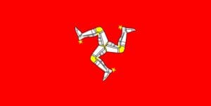
Exploring the Isle of Man’s Rich History and Culture
Ireland
29/04/2024
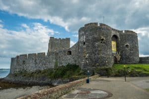
Exploring The Town of Carrickfergus
County Antrim
29/04/2024
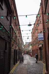
Commercial Court: The Dazzling Lights of Belfast
Northern Ireland
29/04/2024

How to Make a Killy Kiss Cocktail By Killyhevlin Hotel
Northern Ireland
28/04/2024
Middle East Travel Statistics from 2019 to Now
Middle East
28/04/2024