

Discover the Majestic Mountains in Wales
Updated On: April 20, 2024 by  Raghda Elsabbagh
Ever had that niggling feeling that you’re circling the same old routine, yearning for a dose of fresh air and outdoor frolics to breathe life back into your soul? Don’t worry, you’re in good company.
This blog post is designed to be your guidebook, revealing the hidden gems tucked away amidst the majestic mountains in Wales—an idyllic haven for hiking enthusiasts like us. Wales, a land of rugged beauty and ancient tales, is home to some of the most stunning mountain landscapes in the United Kingdom. Eager for some awe-inspiring vistas? Let’s lace up those boots and get cracking!
Table of Contents
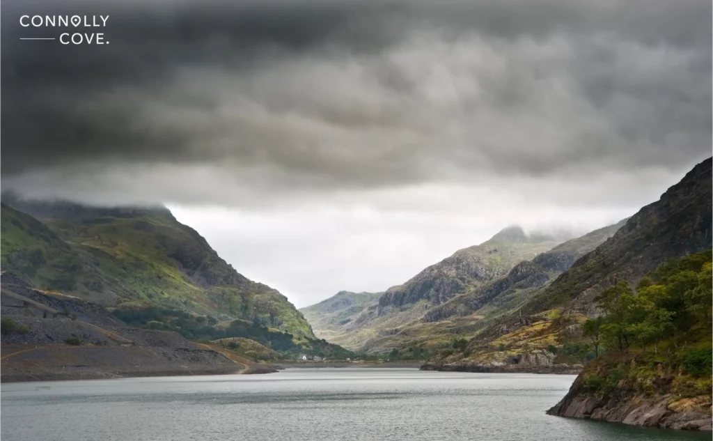
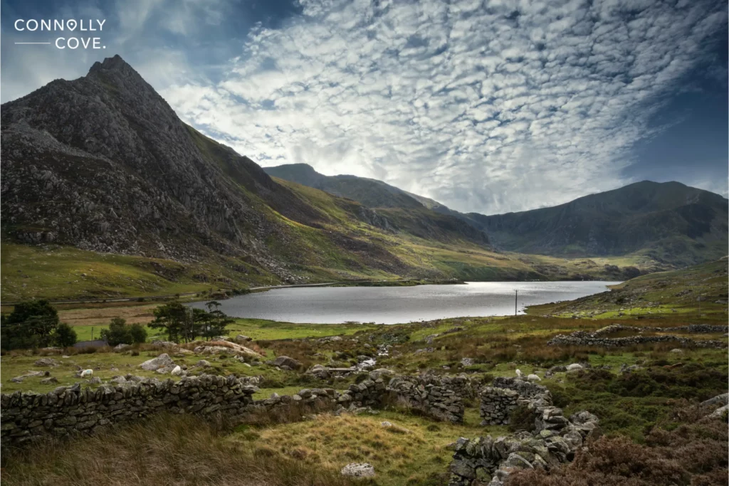
Snowdonia National Park
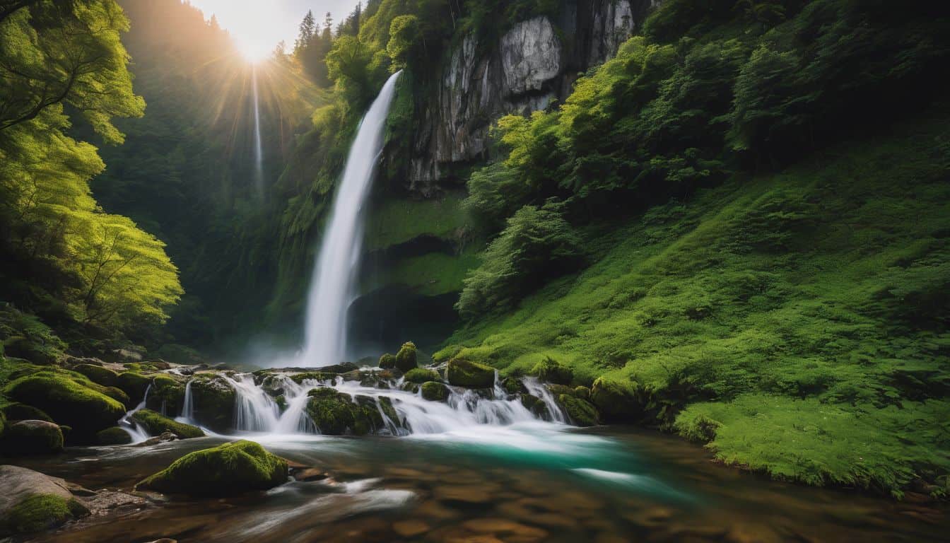
Tucked in the heart of Wales, Snowdonia National Park, established in 1951, is a testament to the raw, untamed beauty of the Welsh landscape. The park spans 2130 square kilometres and has a diverse range of landscapes, from craggy mountain peaks and deep river valleys to dense forests and picturesque coastal areas. Hidden within its folds are ancient woodlands, cascading waterfalls, and enchanting glacial lakes that add to the park’s mystique.
Its rich tapestry of habitats harbours an astonishing array of flora and fauna, making it a haven for biodiversity. Snowdonia is a playground for outdoor enthusiasts, offering many activities such as hiking, rock climbing, mountain biking, and water sports. The network of trails, including the renowned Snowdon Horseshoe, caters to all skill levels, providing a chance to immerse oneself in the park’s natural splendour.
Beyond its natural allure, Snowdonia is steeped in Welsh culture and history. The region is dotted with quaint villages, historic castles, and ancient ruins, offering a glimpse into the rich past of Wales. The Welsh language, traditions, and folklore permeate the park, creating a unique and immersive experience. Every trip to Wales should include time at this fantastic park!
The park has some of the most prominent mountains that grace the Welsh terrain, each with its own unique charm, history, and allure. Here are some of them:
Mount Snowdon: The Crown Jewel of Wales
Our adventure begins with Snowdon, the undisputed monarch of the Welsh mountains. At the heart of Snowdonia National Park, Mount Snowdon reigns supreme as the highest mountain in Wales, standing proudly at 1,085 metres (3,560 feet). The mountain’s geological history, shaped by ancient tectonic forces and glacial activity, contributes to its breathtakingly diverse landscapes, from sharp ridges to glacially carved valleys.
Mount Snowdon offers an array of outdoor adventures, attracting hikers, climbers, and nature enthusiasts worldwide. Summiting Mount Snowdon is a must-do for any climber seeking extreme weather conditions and stunning vistas. The ascent unveils panoramic vistas of Snowdonia’s diverse landscapes, leaving you with a sense of accomplishment and awe. Other neighbouring peaks include Crib Goch and Y Lliwedd, which offer thrilling ridge walks.
Snowdon is not only the highest peak in Wales but also an emblem of Welsh mythology. Legend has it that the giant Rhitta Gawr is buried beneath Snowdon’s rocks, adding a mythical touch to this majestic peak.
The ancient route of the Snowdon Mountain Railway offers an alternative perspective, allowing visitors to ascend to the summit with ease while relishing the scenic journey.
Cader Idris: The Seat of the Giant
Venturing southward of Snowdonia National Park, we encounter the mystical Cader Idris. Also known as Cadair Idris or the Chair of Idris, this majestic mountain beckons adventurers with its rugged peaks, serene lakes, and the mystical allure of Welsh folklore.
Cader Idris, at 893 metres (2,930 feet), is not the highest peak in Snowdonia, but it is undoubtedly one of the most captivating mountains in Wales. Its distinctive horseshoe-shaped ridge, crowned by three prominent peaks—Pen y Gadair, Cyfrwy, and Mynydd Moel—paints a dramatic silhouette against the Welsh sky. The mountain’s geology reveals its ancient origins, shaped by glacial and volcanic activity over millennia.
The mountain is steeped in Welsh mythology, with legends intertwining the name “Cader Idris” with the giant Idris Gawr. According to one legend, Idris Gawr used the mountain as his throne, and, as the story goes, those who spend the night on Cader Idris will awaken either a poet or a madman.
The trails leading to Cader Idris offer a blend of challenge and awe-inspiring scenery, attracting hikers of different skill levels. The Pony Path, the most popular route, provides a gradual ascent, while the more challenging Fox’s Path offers a steeper and rockier climb. The Minffordd Path is another popular choice, offering stunning views of Llyn Cau.
Llyn Cau is a glacial lake surrounded by steep cliffs. The lake, reflecting the changing hues of the sky and mountains, adds to the picturesque beauty of the Cader Idris experience. Many hikers take a moment to rest by its shores, absorbing the tranquillity that defines this secluded mountain retreat. Regardless of the chosen path, the summit rewards hikers with breathtaking panoramic views of Snowdonia and beyond.
The Glyderau Range: A Playground for Rock Enthusiasts
In the heart of the rugged embrace of Snowdonia National Park, the Glyderau mountain range boasts a collection of rugged peaks. This corner of Snowdonia offers a mesmerising tapestry of rocky crags, unique formations, and challenging ascents.
The Glyderau, comprising several peaks, including Tryfan, Glyder Fawr, and Glyder Fach, form a striking and distinctive mountain range. “Glyder” is derived from the Welsh word “Cludair”, meaning a heap of stones. As part of the Snowdonia massif, these rocky giants provide a captivating contrast to the nearby peaks, offering a unique playground for those seeking a more challenging and varied mountain experience.
The Glyderau are renowned for their unique rock formations, sculpted by centuries of weathering and geological processes. Among the notable formations is Castell y Gwynt (Castle of the Winds), a spectacular jagged outcrop resembling a fortress perched on the mountainside.
Glyder Fawr
The ascent of Glyder Fawr, the highest peak in the Glyderau range at 1,001 metres (3,284 feet), is a thrilling endeavour. Hikers and climbers navigate rocky ridges and boulder-strewn paths to reach the summit, where panoramic views unfold, revealing the surrounding mountains and valleys in all their glory.
Tryfan
Tryfan, standing at 917 metres (3,010 feet), is perhaps one of Snowdonia’s most iconic and recognisable peaks. Tryfan’s rugged rock faces and challenging scrambles attract photographers, rock climbers, mountaineers, and scramblers seeking a thrilling adventure.
The classic North Ridge route, featuring the famous twin monoliths of Adam and Eve standing atop its summit, offers an exhilarating ascent for those with a taste for vertical challenges. Legend has it that Tryfan was placed in its location by the giant Idwal, creating a landscape rich in myth and folklore.
Moelwynion: A Majestic Range in the Heart of Snowdonia
Nestled in Snowdonia National Park, the Moelwynion mountain range, also known as the Moelwyns, is in northwestern Wales between the towns of Blaenau Ffestiniog and Beddgelert. The Moelwynion is a lesser-known gem presenting a rugged and majestic landscape with peaks like Moelwyn Mawr and Moelwyn Bach.
These mountains offer diverse outdoor activities, from gentle walks to challenging scrambles and rock climbing, attracting adventurers seeking both natural beauty and adventure. Moelwynion range consists of several cairned summits that can be explored through various hiking trails. As you hike through this majestic landscape, you’ll encounter open moorland, lush upland areas, stunning lakes, and picturesque valleys.
The Moelwynion has a rich history of slate quarrying; remnants of the industry can still be seen on the slopes. Abandoned quarries and structures tell the tale of a once-thriving industry that shaped the landscape and communities.
Carneddau: Majestic Peaks in Northern Wales
Stretching across the northern reaches of Snowdonia, the Carneddau is a sprawling mountain range encompassing a series of prominent peaks, including Carnedd Llewelyn, Carnedd Dafydd, and Pen yr Ole Wen. This mountain range creates a natural barrier between the coast and the highlands, presenting a varied and captivating terrain.
The Carneddau offer an extensive network of hiking trails, catering to all levels of expertise. The ascent of Carnedd Llewelyn, in particular, is a rewarding challenge for hikers, revealing expansive vistas of the Welsh highlands.
The vast uplands of the Carneddau provide opportunities for wilderness exploration. Hikers can traverse expansive plateaus, navigate rocky ridges and deep valleys, and discover the remote beauty of this less-trodden region of Snowdonia. Exploring the Carneddau mountains will leave you awe-inspired by the natural beauty that Wales has to offer.
The Brecon Beacons National Park
In South Wales, the Brecon Beacons National Park is a must-visit destination for outdoor enthusiasts who want to soak up the natural beauty of Wales. You’ll be captivated by its lush and scenic landscapes. If you’re a history buff, you’ll be intrigued as you uncover the rich heritage of this area, with ancient Roman ruins and medieval castles dotted throughout the park.
The park is also home to a range of picturesque mountains, offering diverse landscapes and outdoor adventures, from hiking trails that lead to cairned summits to open moorland waiting to be explored. Some of the prominent mountains in the Brecon Beacons National Park include:
Pen y Fan: Brecon Beacons Beauty
Nestled within the scenic Brecon Beacons, Pen y Fan reigns as the highest peak in South Wales, standing at 886 metres (2,907 feet). Its distinctive red sandstone peaks and rolling hills make it a favourite among hikers, offering an array of trails suitable for all levels. The summit of Pen y Fan is part of the central Brecon Beacons ridge, offering a relatively accessible ascent.
Cribyn
Often climbed with Pen y Fan, Cribyn is the second-highest peak in South Wales, standing at 795 metres (2,608 feet). The ridge walk connecting Pen y Fan and Cribyn provides a challenging yet rewarding experience.
Fan y Big
Located just south of Cribyn, Fan y Big is known for its distinctive flat summit, offering breathtaking views of the surrounding landscape. If you’re seeking an extra adventure, the “Diving Board,” a protruding rock on the edge of Fan y Big’s summit, is a unique and thrilling spot.
Corn Du
Positioned alongside Pen y Fan and Cribyn, Corn Du is part of the trio of peaks that make up the central ridge of the Brecon Beacons. It is often traversed as part of a circular route that includes Pen y Fan and Cribyn.
Waun Rydd
Positioned north of Pen y Fan, Waun Rydd is a less frequented peak. Still, it provides a quieter and more serene hiking experience. This summit offers jaw-dropping views of the surrounding valleys and hills.
Sugar Loaf (Pen y Fal)
Although not part of the central Brecon Beacons range, the Sugar Loaf is a distinctive peak located southeast of the main park area. Standing at 596 metres (1,955 feet), Sugar Loaf offers stunning views of the Usk Valley and the Black Mountains.
The Black Mountains
Stretching across the border between England and the eastern edge of Wales, the Black Mountains showcase a different facet of Welsh beauty. Situated within the Brecon Beacons National Park, the Black Mountains present a distinctive silhouette against the horizon. Despite their name, these mountains are not black but are characterised by slopes covered in dark heather, creating a captivating contrast with the lush greenery that carpets the valleys below.
While not as towering as some of Wales’ other peaks, the Black Mountains boast several notable summits, including Waun Fach, the highest point in the range at 811 metres (2,661 feet), Pen Allt-mawr, and Pen Cerrig-calch.
The Black Mountains are steeped in history, with evidence of human activity dating back thousands of years. Bronze Age burial mounds and Iron Age hillforts dot the landscape, providing glimpses into the lives of ancient communities who once called these mountains home.
The Black Mountains are also traversed by the famous Offa’s Dyke Path. This long-distance trail follows the ancient earthwork that Offa, the King of Mercia, constructed in the 8th century.
With its network of hiking trails, biking routes, and bridleways, the Black Mountains provide an ideal terrain for hikers, cyclists, and horse riders, catering to various skill levels. As you hike along its trails, explore the rocky ridge walks, or meander through the tranquil lush valleys, you’ll soak up panoramic views. Black Mountain is also home to unique wildlife and plant species, adding to the charm of your hiking experience.
The Cambrian Mountains
Tucked away in the heart of Wales, the Cambrian Mountains form a vast and rugged expanse of wilderness that often escapes the spotlight, overshadowed by the more famous mountain ranges in the country. This hidden gem, often referred to as the “Green Desert of Wales,” boasts a unique charm, rich biodiversity, and a sense of solitude that beckons those seeking an authentic and untouched landscape.
The Cambrian Mountains cover a large portion of mid-Wales, spanning approximately 4,000 square kilometres (1,500 square miles). While not as lofty as some of Wales’ other mountain ranges, the Cambrian Mountains feature several notable peaks, including Plynlimon, the highest point in the range, standing at 752 metres (2,467 feet). Other peaks like Drygarn Fawr and Esgair Mwyn contribute to the region’s varied topography.
Rolling hills, deep valleys, and expansive moorlands characterise this extensive upland area. The landscape is largely wild and unspoiled; you’ll be awestruck by the untouched beauty of these mountains. Numerous rivers, including the Wye, Severn, and Teifi, originate in the Cambrian Mountains. These waterways carve through the landscape, creating picturesque valleys and supporting various aquatic life. Llyn Brianne, a reservoir in the hills, adds to the region’s scenic beauty.
Outdoor Activities in the Cambrian Mountains
The Cambrian Mountains offer an escape from the city’s hustle and bustle with their tranquil open moorland and lush upland scenery. History buffs will appreciate the ancient sites scattered throughout this area, such as Roman roads and medieval castles.
The Cambrian Mountains offer an extensive network of trails and footpaths, allowing hikers and walkers to explore the vast and tranquil landscapes. The Glyndŵr’s Way National Trail traverses this wilderness, providing a scenic route through its diverse landscapes.
With minimal light pollution, the Cambrian Mountains are renowned for their dark skies. Stargazers flock to this region for an unparalleled celestial spectacle, where constellations and the Milky Way shine brightly against the night canvas.
If you want to spend the night and you’re seeking a luxurious experience, there are boutique accommodations nestled in quaint villages nearby.
The Berwyn Range
In northeast Wales, the Berwyn Range presents a serene and lesser-known mountain landscape characterised by rolling hills, heather-clad moorlands, and a sense of solitude. The Berwyns possess a quiet charm, offering hikers and nature enthusiasts an opportunity to explore off-the-beaten-path trails and discover the unspoiled beauty of the Welsh countryside.
Peaks like Cadair Berwyn and Moel Sych provide panoramic views of the surrounding valleys. The range’s remote character offers a peaceful escape, making the Berwyns a hidden gem for those seeking a tranquil and authentic mountain experience in Wales.
Conquer the Mountains in Wales!
In conclusion, Wales is a true hiker’s paradise with majestic mountains and stunning natural beauty. From the towering peaks of Snowdonia National Park to the rugged landscapes of the Cambrian Mountains and Brecon Beacons National Park, there are endless outdoor adventure and exploration opportunities.
Whether you’re a seasoned rock climber or an adventurer seeking breathtaking views, Wales invites you to explore its rugged wonders and immerse yourself in the timeless beauty of its rocky peaks. So put on your hiking boots and get ready to experience the breathtaking scenery and exhilarating trails that await in this remarkable destination. Remember to pack your hiking gear and capture the beauty of these majestic mountains in Wales on your camera.

Top Places to Visit on a Day Trip to Alexandria
Egypt
09/05/2024

Kilmainham Gaol; Former Prison Turned Tourist Attraction
County Dublin- Dublin
09/05/2024

25 of the Best Irish Comedians: The Irish Humour
Ireland
09/05/2024
Royal County Down Golf Club: One of the Oldest Irish Courses
Northern Ireland
09/05/2024
The Dingle Peninsula: A Beautiful Part of Ireland
Ireland
08/05/2024