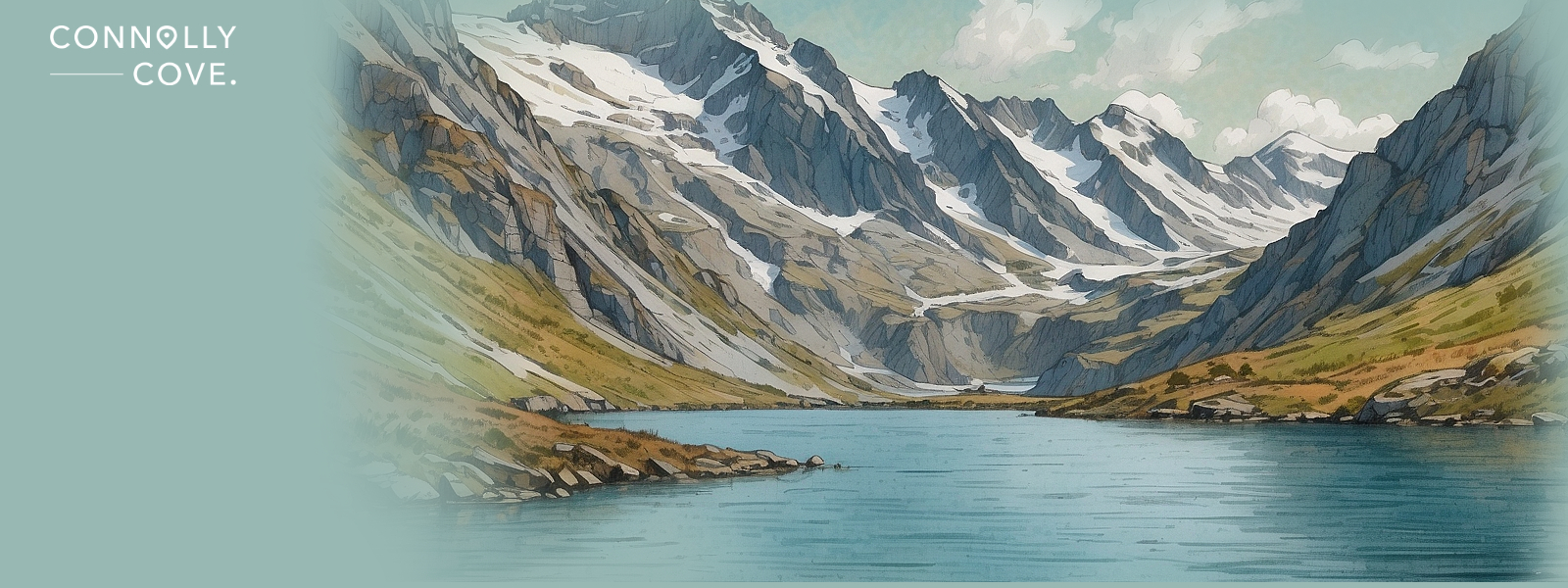
Lake Tseuzier – Valais, Switzerland
Updated On: April 24, 2024 by  Maha Yassin
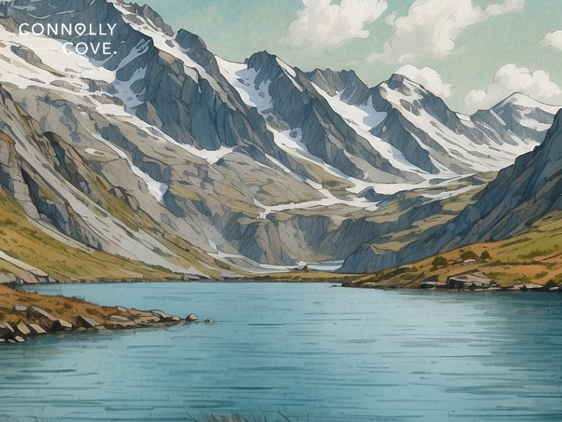
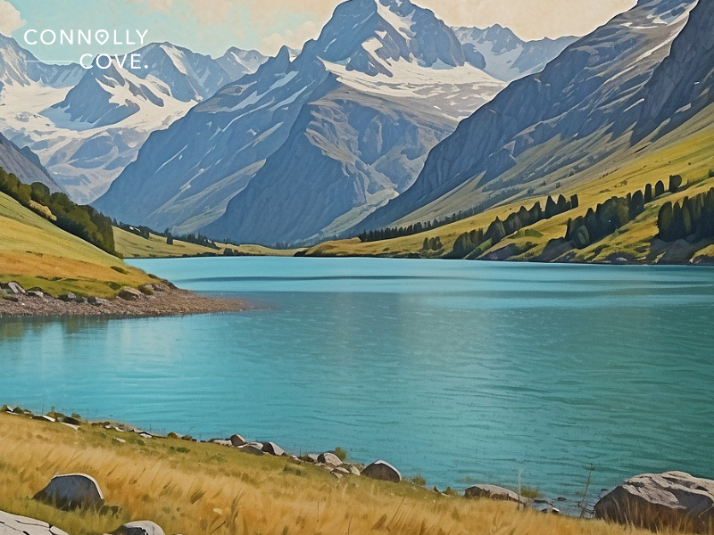
Beneath the watchful gaze of towering Alpine peaks, a jewel of azure tranquillity nestles amidst the rugged folds of the Valais Alps. Lake Tseuzier, a secret whispered by glaciers and echoed by windswept pines, beckons the adventurous soul with a symphony of untouched beauty and pristine nature.
Far from the clamour of tourist hordes, Lake Tseuzier promises a symphony of experiences – a haven for hikers who crave alpine thrills, a canvas for photographers chasing ethereal light, and a sanctuary for those seeking comfort in nature. Forget the overcrowded shores of its more famous cousins; Lake Tseuzier invites you to dive into a hidden wonderland, where every sunrise paints the mountains in fiery hues and every starlit night whispers tales of ancient glaciers.
So, if you’re looking for an adventure of a lifetime or a place where you can be one with nature, this travel guide is for you. We’ll learn everything about planning the perfect trip to Lake Tseuzier!
The Allure of Lake Tseuzier
Lake Tseuzier isn’t your average postcard-perfect Alpine lake. It’s a living tableau of vibrant contrasts, where emerald waters mirror the jagged crests of snow-capped giants. Imagine sunlight carving through mist-shrouded mornings, casting long shadows on mirror-like surfaces. As the day unfolds, the vibrant turquoise deepens, reflecting the azure canvas above. Come sunset, molten gold dances on the ripples, setting the peaks ablaze in a fiery farewell. This chameleon lake captivates every hour, whispering secrets in the rustle of pines and the gentle lapping of waves.
Unlike its crowded counterparts, Lake Tseuzier retains an air of serendipitous discovery. Its tranquil shores beckon those seeking an escape from the tourist trail, where silence reigns, and nature whispers its tales. Here, you won’t find souvenir shops or bustling crowds, just the gentle rhythm of mountain life and the company of soaring eagles and curious marmots. This is a sanctuary for the soul, where every breath inhales crisp mountain air and exhales worries, leaving only the echo of your footsteps on solitary trails.
Adventure Beckons in Every Season at Lake Tseuzier
Lake Tseuzier isn’t a mere backdrop; it’s an active participant in your alpine adventure. Spring paints the meadows with wildflowers, inviting invigorating hikes on sun-dappled trails. Summer’s warmth beckons kayakers to slice through the glassy surface while paddleboarders chase the sun’s reflection. Autumn transforms the landscape into a vibrant tapestry, ideal for strolls and cosy evenings with crackling fireplaces. And when winter cloaks the mountains in white, Lake Tseuzier becomes a playground for cross-country skiers and snowshoers, leaving their ephemeral tracks on virgin snow.
Lake Tseuzier is more than just a pretty face; it’s a playground for the adventurous soul, a canvas for unforgettable memories, and a sanctuary for those who crave the embrace of nature. Buckle up because we’re about to dive deep into the adventures waiting to be experienced in this Alpine paradise:
Hike Through Time and Terrain
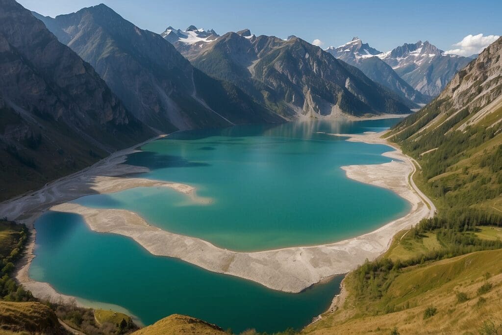
- Traverse the Past: Lace up your boots and embark on the ancient Haut de Cry trail (pictured below), where history whispers from every rock face. Imagine yourself as a shepherd or a smuggler, following the footsteps of those who came before you. Witness breathtaking panoramas and rare alpine flora as you wind along the eastern shore, soaking in the timeless beauty.
- Challenge the Heights: For the adrenaline junkies, the Grande Dixence Dam hike is a must. Feel the earth tremble beneath your feet as glacial waters thunder in the depths, and marvel at the world’s highest gravity dam, a testament to human ingenuity against the backdrop of towering peaks.
Paddle into Serendipity
- Kayak Through Glacial Echoes: Glide across the mirror-like surface in a kayak, the cool spray on your face a refreshing baptism in nature’s embrace. Listen to the whispers of ancient glaciers hidden beneath the turquoise depths and spot playful marmots sunning themselves on rocky outcrops.
- Starry Night Dreams: For an experience that will stay etched in your memory forever, try nighttime kayaking under a blanket of stars. Witness the Milky Way reflected like diamonds on the water and feel the universe’s magic while floating in serene silence.
Scale the Mountain Walls
- Conquer the Aiguilles Rouges: Experienced climbers, prepare for a vertical challenge! The granite face of the Aiguilles Rouges awaits a series of needle-like peaks that pierce the sky. Feel the thrill of the ascent, the wind whipping through your hair as you conquer each rocky step. The reward? Panoramic views that will leave you speechless.
- Thrills on the Via Ferrata: The Grand Dévouement via Ferrata is for those who crave controlled adrenaline. Secured by ladders and cables, traverse exposed rock faces, cross dizzying bridges, and conquer your fear of heights, all while rewarded with breathtaking views that will make your heartbeat.
Seek Hidden Gems
- Uncover the Gorges de la Dixence: Venture off the beaten path and discover a dramatic canyon carved by glacial meltwater. Feel the spray of waterfalls as you descend into this emerald moss-covered wonderland, where sunlight filters through the canopy like liquid gold.
- Explore the Secrets of Fort l’Allondon: Step back at the abandoned Fort l’Allondon, a World War I military outpost that stands sentinel over Lake Tseuzier. Explore the eerie tunnels and bunkers, imagining the soldiers who once guarded these walls, and feel the weight of history in this silent testament to the past.
Embrace the Winter Wonderland
- Glide Through Snowy Serenity: Lake Tseuzier transforms into a cross-country skier’s paradise when the mountains wear winter coats. Glide through frosted forests on silent trails; the only sounds are your breath and the crunch of snow under your skis. Breathe in the crisp air, soak in the panoramic vistas, and lose yourself in the tranquillity of nature’s winter embrace.
- Carve Your Tracks: For those seeking more excitement, hit the slopes near Grimentz, a charming village with rustic chalets and après-ski vibes. Feel the adrenaline rush as you carve down the snow-covered slopes and end the day with a warm drink and laughter in a cosy mountain lodge.
The adventures at Lake Tseuzier are as diverse as the seasons themselves. Whether you’re a seasoned hiker, a winter sports enthusiast, a history buff or a nature lover, there’s something here to ignite your spirit and leave you with memories that will last a lifetime. So, pack your sense of adventure and get ready to be swept away by the magic of this hidden gem in the heart of the Swiss Alps.
Planning Your Unforgettable Escape to Lake Tseuzier
Picture all the above experiences: the cool Alpine air kisses your cheeks as you hike around a mirror-like lake, turquoise waters reflecting the majestic peaks that cradle it. Sunbeams dance on glistening waterfalls, and playful marmots peek from rocky outcrops. This isn’t a dream; it’s your reality waiting at Lake Tseuzier, a hidden gem in the Swiss Alps’s heart.
To make your Lake Tseuzier adventure truly unforgettable, we’ll dive into the nitty-gritty of planning your escape:
Finding Your Perfect Season
Lake Tseuzier unveils its unique charm throughout the year, each season offering a symphony of experiences. Choose your soundtrack:
- Summer Symphony (June-August): Hike beneath a cerulean sky, kayak on glassy waters, and picnic on sun-drenched meadows. Imagine lazy swims at Lake Tseuzier’s shore and refreshing ice cream at a charming village cafe.
- Autumn Tapestry (September-November): Witness the mountains burst into a fiery blaze of foliage. Cosy up on a hike and breathe in the crisp air punctuated by the aroma of freshly baked bread from a nearby chalet. Don’t miss the local harvest festivals, bursting with fresh produce and lively music.
- Winter Wonderland (December-March): Transform into a snow princess! Glide through frosted forests on cross-country skis, carve fresh tracks on the slopes near Grimentz, and snuggle up in a rustic chalet with a crackling fireplace and a steaming mug of hot chocolate.
- Spring Awakening (April-May): Witness nature’s rebirth as wildflowers paint the meadows in vibrant hues. Breathe in the fresh mountain air as waterfalls cascade with meltwater, creating a symphony of sound and light.
Getting There and Around
They say it’s always about the journey, not the destination. Even though we can assure you that the destination is a gem, reaching it is half the fun! Choose your adventure:
- Train and Bus: Embark on a scenic journey from Swiss cities like Geneva or Lausanne. Lean back and admire the changing landscapes before transferring to a picturesque bus ride that winds through charming villages and verdant valleys until you reach the lakeshore.
- Car Rental: For independent exploration, rent a car and enjoy the winding mountain roads at your own pace. Stop at quaint villages for coffee breaks and impromptu photo ops, soaking in the breathtaking scenery.
- Organised Tours: Let someone else handle the logistics with guided tours showcasing the region’s best. Discover hidden gems and local secrets you might miss, gaining insights from knowledgeable guides.
Finding Your Home Away from Home
Lake Tseuzier cradles a spectrum of accommodations, each promising a unique escape tailored to your desires. Choose your haven:
Lakeside Hotels
- Grand Hôtel du Lac: Imagine waking up to shimmering turquoise waters reflected on your balcony at this iconic lakeside landmark. Indulge in luxurious spa treatments after a day of exploration, and savour gourmet meals on the panoramic terrace as the sun paints the sky in fiery hues.
- Hostellerie des Sources: Embrace rustic charm with a modern twist at this family-run gem. Warm your toes by the crackling fireplace in the lobby, savour regional delicacies in the cosy restaurant, and soak in the panoramic views from your balcony adorned with colourful geraniums.
Cosy Mountain Huts
- Cabane de Tracuit: Experience the magic of a traditional alpine refuge perched high above Lake Tseuzier. Hike through verdant meadows to reach this haven, where crackling fires welcome you to shared meals and stories with fellow adventurers. Stargaze from your dorm room window or balcony, enveloped by the silence of the mountains.
- Cabane de Moiry: Nestled near the mighty Grande Dixence Dam, this rustic hut offers a taste of history alongside breathtaking views. Imagine stepping back in time with wooden interiors and hearty meals, then waking up to a panorama of snow-capped peaks as the sun paints them with golden light.
Vacation Rentals
- Chalet Le Grenier: Picture a charming self-catered chalet nestled in a quiet village near Lake Tseuzier. Gather your loved ones around the fireplace, prepare meals with fresh local ingredients in the fully-equipped kitchen, and enjoy evenings playing board games on the balcony under the starry sky.
- Apartment Les Marmottes: This lake-view apartment is your haven for modern comfort with a touch of Alpine charm. Imagine waking up to the sunrises over the water, enjoying leisurely breakfasts on the balcony, and exploring the region at your own pace with the freedom of a vacation rental.
Remember, booking your accommodation well in advance, especially during peak season, is highly recommended. Secure your dream sanctuary before someone else does!
Beyond Lake Tseuzier: Unveiling the Treasures of the Region
Lake Tseuzier isn’t just a breathtaking destination; it’s a gateway to a treasure of hidden gems in the Valais Alps. Venture beyond the lakeshore and discover the rich tapestry of nearby valleys, quaint towns, and cultural attractions that will add another layer of enchantment to your Swiss adventure.
Valleys Whispering Ancient Tales
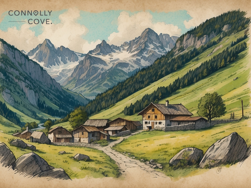
- Val d’Anniviers: Embark on a journey through time in this secluded valley adorned with charming villages perched on sun-drenched slopes. Hike through meadows bursting with wildflowers, visit traditional cheesemakers, and discover the secrets of ancient irrigation canals dug centuries ago.
- Val de Bagnes: This dramatic valley bears the scars of a devastating rockfall in 1946, creating a striking contrast between the lush green slopes and the barren rock face. Explore the “Village Englouti,” a museum housed in a church steeple that miraculously survived the disaster, and learn about the valley’s resilience.
- Val des Dix: Hike alongside the shimmering blue waters of the Lac des Dix, the largest man-made lake in Switzerland. Marvel at the engineering marvel of the Grande Dixence Dam, or take a thrilling mountain bike ride down the winding road that snakes along the valley floor.
Towns Breathing Alpine Charm
- Grimentz: This picture-perfect village, with its wooden chalets, cobbled streets, and colourful flower boxes, is a fairytale. Spend a morning wandering through the bustling market, indulge in a cheese fondue in a cosy restaurant, and soak in the stunning views from the church belfry.
- Euseigne: Discover the hidden gem of Euseigne, known for its historic castle and quaint cobbled streets. Explore the museum within the castle walls, taste local wines in a charming cafe, and wander through the flower-filled village square, feeling like you’ve stepped back in time.
- Sion: For a touch of urban vibrancy, visit the capital of Valais. Explore the medieval castle overlooking the city, discover Roman ruins in the Old Town, and wander through art galleries and museums. Immerse yourself in the lively atmosphere of the market square and enjoy a leisurely dinner on a restaurant terrace, soaking in the sights and sounds of city life.
Cultural Delights
- Festivals and Traditions: Be part of the local culture by attending one of the many festivals throughout the year. Witness the vibrant costumes and cheese-rolling competition at the Fête de l’Alpage, celebrate the harvest season with traditional music and dance at the Fête des Vendanges, or experience the magic of Christmas markets in charming village squares.
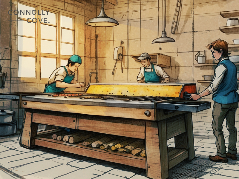
- Cheese Paradise: For cheese lovers, a trip to Valais wouldn’t be complete without delving into Raclette and other local delicacies. Visit a cheesemaker to learn about the traditional production process, indulge in a fondue feast in a rustic mountain hut, or stock up on local cheeses to take home as souvenirs.

- Wine and Chocolate Delights: Wine connoisseurs can embark on a tasting tour through the vineyards of Valais. At the same time, chocoholics can indulge in artisanal chocolates made with local milk and fresh ingredients. These culinary experiences offer a delicious way to discover the region’s rich flavours and traditions.
Lake Tseuzier isn’t just a destination; it’s a symphony of experiences waiting to be orchestrated. Whether you’re a seasoned adventurer seeking thrills or a nature lover yearning for solace, this hidden gem whispers promises that resonate in the soul. Imagine hiking through alpine meadows, kayaking on a mirror-like surface, or carving fresh tracks on virgin snow under the watchful gaze of towering peaks.
Beyond the lake’s embrace, a tapestry of vibrant valleys, charming towns, and cultural delights awaits. Explore ancient castles, savour local delicacies, and immerse yourself in the rhythm of festivals and traditions. Each step you take unfolds a new chapter in your Swiss adventure, leaving you captivated by the beauty and authenticity of this region.
So, pack your sense of wonder, lace up your boots, and embark on your symphony at Lake Tseuzier. Breathe in the crisp mountain air, feel the sun on your face, and allow the magic of this Alpine paradise to sweep you away. Remember, the most breathtaking landscapes are often etched within our hearts, and Lake Tseuzier promises memories that will resonate long after your journey back to reality.
FAQs
What’s the food scene like around Lake Tseuzier?
Local specialities like Raclette and cheese fondue reign supreme. Sample fresh-baked bread and indulge in hearty mountain meals at cosy village restaurants. Don’t miss the local wines and artisanal chocolates for gourmet souvenirs.
Are there any family-friendly activities?
Lake Tseuzier is a haven for families! Enjoy easy hikes around the lake, paddle in pedal boats, or build sandcastles on the shore. Take a scenic train ride through the mountains or explore the charming villages by bike. Furthermore, many hotels and huts offer kid-friendly amenities; some even have playgrounds and dedicated children’s menus.
Is Lake Tseuzier accessible for people with disabilities?
The lake is accessible by wheelchair via the main road and some specific paths around the water. Certain hotels and restaurants are wheelchair-friendly, and some boat tours offer adapted options. Contact local tourism offices or accommodation providers beforehand for specific accessibility information and assistance.
Are there any unique souvenirs I can buy at Lake Tseuzier?
Beyond cheese and chocolate, consider handcrafted wood carvings, traditional cowbells, or colourful woven blankets as unique souvenirs. Also, local artists often sell their work at markets or galleries, offering a piece of the region’s creative spirit to take home.
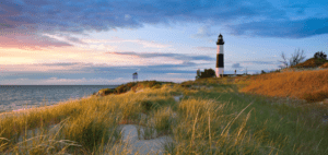
An Overview of Michigan Tourism Statistics: Visitor Spending, Growth, and Industry Impact
United States
28/04/2024

Top Things To Do in Hamburg: A Hamburger’s Guide!
Germany
27/04/2024
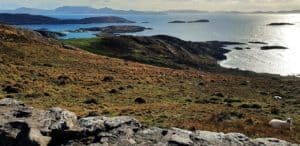
Take a Look at the Astounding Scenery of County Kerry
County Kerry
27/04/2024
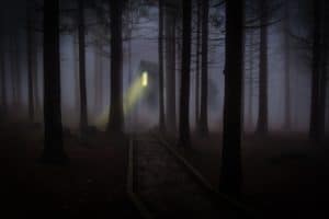
Famous Haunted Houses in Egypt: Spooky Stories for Halloween
Destinations
27/04/2024

St. Paul’s Cathedral – London Attractions
England
27/04/2024