
Take a Look at the Astounding Scenery of County Kerry
Updated On: November 07, 2023 by  ConnollyCove
County Kerry is renowned over the world for its beautiful scenery, including Ireland’s highest mountain, the astounding lakes, its beautiful sandy beaches, cliffs and rocky headlands. And, subsequently, these mountains, lakes, and coasts have been the picture-postcard image of Ireland overseas. And while visitors may argue about their favourite towns, everyone genuflects to the perfection that is the Kerry landscape. It’s just drop-dead gorgeous. With this coastline carved over millennia by a wild ocean, Kerry is the proud owner of Ireland’s 10 highest peaks and a vast national park containing the country’s oldest oak forests.
A paradise for hikers and climbers, Kerry also boasts a plethora of welcoming towns, B&Bs and cosy pubs in which to rest mountain-weary feet. There’s so much to do for the whole family, making it the perfect break this summer season to relax and have a wholesome family time.
The Heart of Kerry
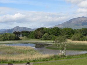
Where to begin? Killarney National Park, that’s where. Sprawling over 10,236 hectares, the sublime Killarney National Park is an idyllic place to explore. The park is home to famed locations such as Muckross House and Gardens, the Lakes of Killarney, Inisfallen island, Killarney House and Knockreer, with the former still standing with all its furnishings intact.
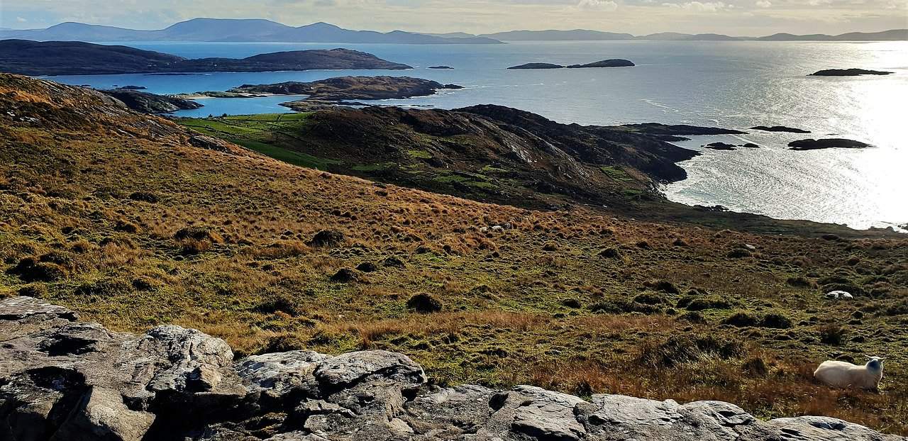
Overlooking Lough Leane, Ladies View provides one of the most spectacular displays of Kerry’s landscape. The natural beauty of Torc Waterfall, Innisfallen Island and the dramatic MacGillycuddy’s Reeks mountain range are a breath of fresh air for the soul. And then there’s the famous Ring of Kerry touring route. That showcases some of the most spectacular sights and quirkiest towns and villages that Kerry has to offer. Kerry (Irish: Ciarraí) is considered in the province of Munster, southwestern Ireland.
History
The name Kerry is derived from Ciar (son of Fergus, king of Ulster, and, according to the Ulster cycle, the legendary queen Medb), whose descendants occupied this part of Munster. Kerry was divided in 1127 between the O’Brien kingdom of Thomond, or North Munster, and the MacCarthy kingdom of Desmond, or South Munster. But in the 14th century, the northern part of the county fell under the rule of the Anglo-Irish Earl of Desmond, a branch of the FitzGerald dynasty.
In addition, Kerry had the highest annual rate of emigration from Ireland in the twenty years up to 1911. According to the 1841 census, the population of the county was as high as 295,000. By 1911, the census was recording a decline to just 160,000 people. Even since the previous census had been taken in 1901, the population had fallen by more than 6,000. And it would continue to fall for much of the twentieth century. Many of those who left ended up in Kerry enclave in the cities of England and America.
More so, after the Irish defeat of the Nine Years War, much of the native-owned land in Kerry was confiscated. And given to English settlers or people known as ‘planters’. Additionally, in the wake of the Great Irish Famine of 1845 (which continued till 1949), thousands of people died or migrated to seek better chances of life across the Atlantic, and Kerry remained a soil of e until recent times.
Finally, like the rest of the West of Ireland, Kerry had gone through a lot and gradually recovered very slowly through the rest of the 20th century, but it eventually became the prime tourist destination in Ireland.
Kerry’s Nature
Killarney National Park and Killarney Lakes
Killarney National Park is a unique and special place in Ireland. Situated in south-west Ireland, close to the most westerly point in Europe. The National Park covers over a whopping 25,000 acres of mountain range, moorland, woodland, waterways, parks and gardens.
Enclosed in the National Park, the insanely famous Lakes of Killarney offer the most spectacular views of Killarney’s breathtaking scenery. Killarney Lakes consists of three you Lakes: Lough Leane, Muckross Lake, and Upper Lake. Which are all part of Killarney National Park and are surrounded by rugged slopes of the Macgillycuddy’s Reeks. They are studded with islands and on the shores, like some of Killarney’s most stunning historic landmarks; Ross Castle, and Muckross House & Abbey.
Moreover, there is a point that encapsulates these three lakes known as the Meeting of the Waters. As the name implies, the Meeting of the Waters is where Killarney’s famous lakes converge. The Upper Lake, Middle Lake (Muckross Lake) and Lower Lake (Lough Leane) all come together at this beautiful spot. It is a little haven of tranquillity and can only be reached by foot or bicycle.
Torc Waterfall
Nestled at the base of Torc Mountain, Torc Waterfall is located approximately 7km on the Muckross Road. Standing at approximately 20 meters high, the waterfall is astounding, rugged and at its most wild after a heavy rain downpour.
Torc Mountain
Torc Waterfall is at the base of Torc Mountain off the main Ring of Kerry Road. Even though the summit is 525m, this walk is very popular as it is accessible to almost anyone due to the clear paths and wooden sleepers on the mountain. Torc Mountain gets its name from the Irish word torc meaning boar and is steeped in Irish Mythology. It is said that an enchanted boar was killed there by the legendary hero. Fionn mac Cumhaill (Finn McCool), the mythical hunter-warrior of Irish mythology. who led the Fianna warriors in the 3rd century. Finn McCool also occurs in the mythologies of Scotland and the Isle of Man.
Ross Castle
Ross Castle is located just outside the town of Killarney on the Ross Road. It is very well signposted and easy to find. Ross Castle was built in the 15th century and is typical of its style, with square bartizans on diagonally opposite corners and a thick end wall containing a tier of chambers and winding stairs.
The foundations of the castle were once surrounded by a fortified bawn with towers defending its curtain walls; two of the towers still remain today. Sometime after 1688, the castle was used as a barracks; the bawn was subsequently removed as additions were made to the south side of the castle prior to the 19th century. Ross Castle is open to the public during the summer months.
The Wild Atlantic Way
The Wild Atlantic Way stretches 1600 miles (2600 km) in length and is one of the longest defined coastal routes in the world. It winds its way all along the Irish west coast from the Inishowen Peninsula in the north down through County Kerry to the picturesque town of Kinsale, County Cork, in the south. This route from start to finish unfolds the wonders of nature, the power of the ocean and its imprint on the west coast of Ireland, and the stunning countryside in all its diversity.
Whether you want to dive into those invigorating sea swells, indulge in gastronomic gems or simply embrace those scenic vistas at a pace all your own; the route encompasses seven counties and never fails to create countless memories.
Top Places to Visit
Molly Gallivan’s Cottage & Traditional Farm
Molly Gallivan’s 200-year-old cottage and farm is a family run business. Situated halfway between Kenmare and Glengarriff on the Beara peninsula. In the picturesque County Kerry, South West of Ireland. At Molly Gallivan’s you will experience the simple country lifestyle in rural Ireland before the days of electricity and modern conveniences.
More so, the house is over 200 years old and was originally a single story thatched cottage. Part of which still remains, it was extended, raised and slated in the early 1900s. There has been little change since then. The house as it is today was home to one of Molly’s descendants until 1997. The large open hearth, where the fire rarely if ever went out, was the only energy source providing hot water, heat and cooking facilities.
The visitor will also visit the ghostly ruins of a family dwelling from the era of the Great Famine. As well as Neolithic stone row that forms part of a very rare ancient sun calendar.
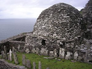
Skellig Michael
Skellig Michael is home to a 6th-century monastic settlement. This complex is perched on the steep sides of the larger of the two Skellig Islands. Some 12 km off the coast of County Kerry. It illustrates the very spartan existence of the first Irish Christians. Since the extreme remoteness of Skellig Michael has until recently discouraged visitors, the site is exceptionally well preserved.
More so, these Skellig islands are world-famous, each in its own right. Skellig Michael is known throughout the world of archaeology. As the site of a well-preserved monastic outpost of the Early Christian period. Now designated a UNESCO World Heritage Site; Small Skellig is equally renowned in matters of ornithology as the home of some 27,000 pairs of gannets. The second largest colony of such seabirds in the world.
The isolated UNESCO Site was featured extensively in the 2017’s galactic blockbuster Star Wars. The Last Jedi, which gave more exposure for it to welcome a greater number of visitors monthly.
Great Blasket Island
The Dingle Peninsula in County Kerry, Ireland, is a landscape of spare and emotive beauty. It is a rugged place of stone-walled fields climbing mountainsides to the limits of tillable land. Where the Atlantic Ocean meets bold headlands with an almost unimaginable energy and intensity. Three miles off the western end of the Dingle Peninsula lies an archipelago of islands called the Blasket Islands.
The Blasket Islands are a group of islands off the coast of Kerry. These islands are The Great Blasket Island (An Blascaod Mór), Beginish (Beiginis), Inishnabro (Inis na Bró), Inishvickillane (Inis Mhic Uileáin), Inishtooskert (Inis Tuaisceart), and Tearaght Island (An Tiaracht). The Great Blasket Island, at the most westerly point in Europe, is separated from the mainland by the Blasket Sound and is the largest of the islands. Inishtooskert, Inishnabro, Inishvickillane and Tearaght Island are located to the west and southwest of the Great Blasket and rise steeply from the sea.
Furthermore, The Islands are now uninhabited, but there were residents living and working on Great Blasket until the middle of the 20th century.
Caherdaniel
Surrounded by the rugged shores of Derrynane Bay and gently rolling mountains, the charming village of Caherdaniel (Dónalls Stone Forth), is located on the Southern coast of the Iveragh peninsula, on the N70. Caherdaniel with its stone fort nearby is one of the oldest villages in Ireland. And it is right in the heart of the Kerry Way. As well as the Home of the ancient poets and writers, now a mix of old and new. Full of character and atmosphere, the pretty village is home to the great ‘Liberator’ Daniel O’Connell, Derrynane House and National Park is a visit not to be missed.
So, if you were wondering why this county is known around Ireland as “The Kingdom”, maybe now anyone would understand. Kerry is a land of pure majestic beauty.
Have you ever visited Kerry before, or any plan to do so in the future? We would love to here for you.
Also, don’t forget to check out some of our other blogs that might interest you: Connemara-Galway| Glens of Antrim| Killkenny| County Monaghan| Kildare|Downpatrick Town| Bundoran- Donegal|
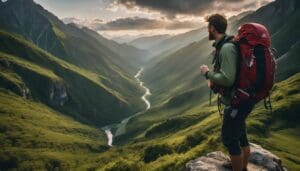
A Walk in Ireland Guide: Best Trails, Routes, and Tips
Ireland
26/04/2024
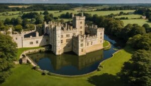
An Ultimate Guide to 6 of the Finest Castle Tours in England
England
26/04/2024
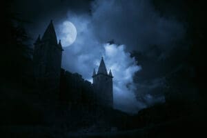
Unveiling the Most Terrifying Haunted Tours in Scotland
Scotland
25/04/2024

7 Top Amusement Parks in England for an Unforgettable Adventure
England
25/04/2024
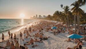
Miami Tourism Statistics: A Comprehensive Overview of Visitor Numbers and Revenue
Travel Statistics
25/04/2024