


The Joy of Walking in Northern Ireland: A Guide to Breathtaking Trails & Scenic Paths
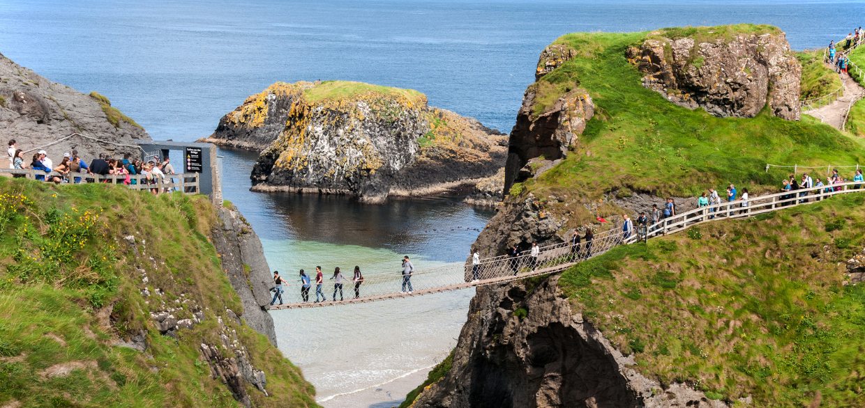
Updated On: April 28, 2024 by  Maha Yassin
Strap on your boots, breathe in the crisp air, and prepare to be enveloped by the magic of Northern Ireland. Winding coastal paths, rugged mountain hikes, and tranquil forest trails weave through this land, offering breathtaking scenery and rich history at every step. Whether you’re a seasoned adventurer seeking epic summits or a casual explorer yearning for scenic strolls, walking in Northern Ireland promises an unforgettable journey.
So, lace up your boots, embrace the spirit of adventure, and embark on an experience of walking in Northern Ireland. This article will guide you, highlighting the most breathtaking trails, enchanting forests, and captivating urban walks. We’ll also delve into the vibrant #WalkNI community, where you can connect with fellow explorers, share your adventures, and discover hidden gems.
Let the journey begin!
Embrace the Rugged Coast of Northern Ireland
The salty whisper of the Irish Sea mingles with the whispers of ancient myths along the stunning coastline of Northern Ireland. Here, where land meets the sea in a dramatic display of raw beauty, your walking adventure takes on a legendary dimension.
Giant’s Causeway and Causeway Coast Path
Step onto the legendary Giant’s Causeway, where 40,000 basalt columns, like stepping stones of giants, create a mesmerising landscape for your walk in Northern Ireland. Feel the spray of the Atlantic on your face as you explore the hexagonal columns, each a testament to ancient volcanic activity. Continue your journey along the Causeway Coast Path, a 31-mile scenic route hugging the coastline. Gaze in awe at dramatic cliffs like Fair Head, carved by millennia of wind and waves. Discover hidden coves like Portballintrae, where colourful fishing boats bob on turquoise waters. Breathe in the salty air and listen to the whispers of Celtic myths as you walk in the footsteps of giants.
Murlough Bay
Escape the crowds and find serenity at Murlough Bay, a haven for nature lovers and walkers in Northern Ireland. Stroll along the golden expanse of Whiterocks Beach, feeling the soft sand between your toes. Watch playful grey seals bask on the shore, their barks echoing across the bay. Listen to the calls of nesting seabirds as you wander through the dune grasslands, a haven for rare wildflowers and buzzing with insect life. Climb Torr Head a dramatic promontory offering panoramic views of the coastline and the distant Scottish hills. Discover a hidden gem – the Mussenden Temple, a miniature Roman temple perched on a clifftop, inviting you to step back in time.
Strangford Lough
Embark on a journey through a maritime wonderland at Strangford Lough, the largest sea inlet in Britain and Ireland. Lace-up your boots and walk in Northern Ireland along the scenic shores dotted with charming villages like Portaferry and Killinick. Explore historical gems like Audley’s Castle, its ancient walls whispering tales of knights and battles. Spot diverse birdlife at RSPB Strangford Lough, a haven for migrating ducks, geese, and even otters. Hike through Scrabo Hill Country Park, where rolling hills offer breathtaking views of the lough and the Mourne Mountains beyond. Immerse yourself in the unique ecosystem of Strangford Lough, a haven for marine life and a paradise for walkers in Northern Ireland.
Conquer Majestic Mountains of Northern Ireland
Challenge yourself on the windswept peaks of the Mourne Mountains, where walking in Northern Ireland becomes a test of both body and spirit. Conquer Slieve Donard, the highest peak in the land, or explore hidden gems like Bloody Bridge and Hares Gap, where waterfalls tumble down rugged slopes.
Mourne Mountains
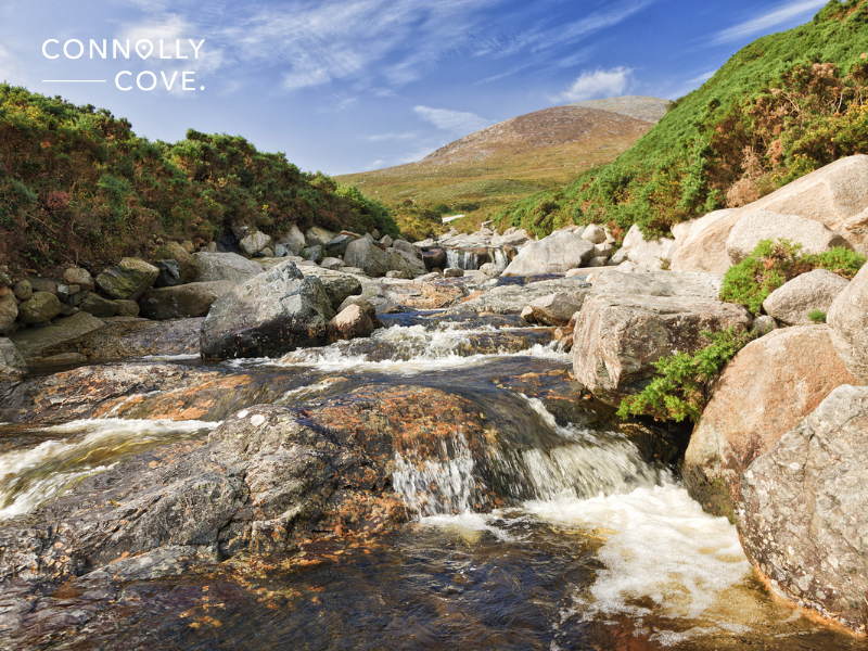
Ascend to a realm of granite giants in the Mourne Mountains, where walking in Northern Ireland becomes a physical and emotional challenge. Slieve Donard, the highest peak, beckons with breathtaking panoramas, its granite slopes testing your endurance. Explore lesser-known gems like Bloody Bridge, where waterfalls tumble through rugged valleys, or Hares Gap, where hidden lakes reflect the sky. Be mesmerised by the Silent Valley Reservoir, a haven of tranquillity, and discover historical landmarks like Tollymore Forest Park, its ancient trees whispering tales of times gone by. Whether you conquer the peaks or wander through hidden valleys, the Mourne Mountains promise an unforgettable walking adventure in Northern Ireland.
Sperrins Mountains
Step into a wild embrace in the Sperrins Mountains, where rolling hills, heather-clad slopes, and hidden waterfalls create a tapestry of natural beauty. Follow the majestic Ulster Way on a multi-day adventure, traversing diverse landscapes and charming villages. Or, choose shorter trails like Gortin Glen Forest Park, where cascading waterfalls serenade your steps and lush greenery soothes your soul. Climb Mount Errigal, the highest peak in Derry, for panoramic views stretching towards the Donegal coast. Spot elusive wildlife like red grouse and golden eagles, and breathe in the refreshing air of this unspoiled wilderness. The Sperrins Mountains offer a great experience walking in Northern Ireland and a chance to reconnect with nature and experience the raw beauty of the land.
Antrim Hills
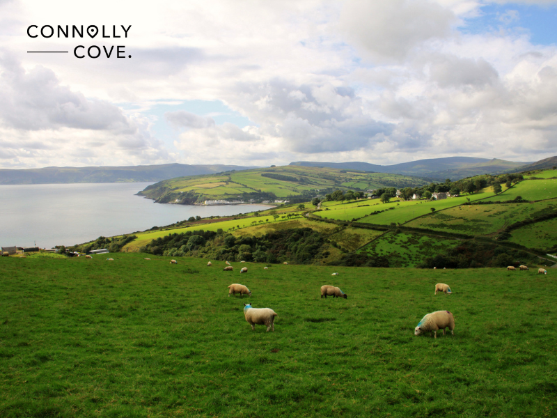
Discover a diverse playground in the Antrim Hills, where ancient forests meet rugged glens and tranquil lakes. Climb Divis and Black Mountain for a bird’s-eye view of Belfast, feeling the wind whip through your hair as you admire the cityscape. Wander through the enchanting Glenariff Forest Park, a haven of cascading waterfalls and lush greenery, home to the famous “Dark Hedges,” a mystical avenue of beech trees. Explore the Antrim Hills Way, a long-distance trail taking you through farmland, forests, and charming villages. Whether you seek gentle strolls or challenging hikes, the Antrim Hills is a great place for walking in Northern Ireland and offers a perfect blend of natural beauty and historical intrigue.
Find Tranquility in Verdant Forests: Where Nature Embraces You
Escape the hustle and bustle and step into a world of soothing greens and calming silence in the verdant forests of Northern Ireland. Breathe in the refreshing aroma of ancient trees at Tollymore Forest Park, follow the enchanting Shimna River, and discover hidden waterfalls like the Silent Pool, where walking in Northern Ireland becomes a journey of inner peace.
Tollymore Forest Park
Step into a fairytale world at Tollymore Forest Park, where walking in Northern Ireland becomes a journey through ancient wonders. Breathe in the earthy aroma of moss-covered trees as you wander along winding paths beside the meandering Shimna River. Discover hidden waterfalls like the Silent Pool, its crystal-clear waters reflecting the towering trees in perfect stillness. Follow the Glen River Walk, where sunlight filters through the leaves, creating a dappled magic on the forest floor. Explore the fairy bridge, supposedly crossed by mythical creatures, and let your imagination soar. Tollymore Forest Park, with its rich history and enchanting beauty, offers walkers in Northern Ireland a chance to escape the everyday and reconnect with nature’s magic.
Gortin Glen Forest Park
Escape the hustle and bustle and find serenity at Gortin Glen Forest Park, a haven for walkers in Northern Ireland seeking peace and tranquillity. Cascading waterfalls, like the spectacular Fairy Falls, serenade your steps as you wander through lush greenery. Follow the waymarked trails, each offering its unique charm. The Slieve Gortin Trail takes you up a gentle incline for panoramic views of the Sperrins Mountains. The Waterfall Walk leads you past cascading waters and hidden nooks, perfect for quiet contemplation. Spot playful red squirrels darting through the trees, listen to the melody of birdsong, and let the fresh air invigorate your senses. Gortin Glen Forest Park offers walkers in Northern Ireland a rejuvenating escape into the heart of nature.
Castlewellan Forest Park
Experience a blend of historical charm and natural beauty at Castlewellan Forest Park, a delightful destination for walkers in Northern Ireland. Explore the majestic Castlewellan Castle, its gothic architecture standing proudly amidst the trees. Follow the Lakeside Trail, a gentle path circling the tranquil Annel Lough, perfect for families and strolls. Discover the Tollymore Trail, leading you through ancient woodlands and past hidden waterfalls, echoing the adventures of Tollymore Forest Park. For a challenge, conquer the Sheriffs Mountain Trail, rewarded with breathtaking panoramas of the surrounding countryside. Whether you seek a gentle stroll with the family or a more adventurous hike, Castlewellan Forest Park offers walkers in Northern Ireland a diverse and charming escape.
Discover Urban Gems: Where Cityscapes Meet Nature’s Embrace
Walking in Northern Ireland isn’t just about remote landscapes; it’s about discovering the hidden gems within vibrant cities. Stroll along the scenic River Lagan in Belfast Waterfront, marvelling at the modern skyline and historical landmarks like Titanic Belfast. Or, step back in time on the historic city walls of Derry-Londonderry, a UNESCO World Heritage Site, and witness stunning panoramic views.
Belfast Waterfront

Immerse yourself in the vibrant energy of Belfast while enjoying a scenic walk along the Belfast Waterfront in Northern Ireland. Stroll along the River Lagan, watching colourful boat bob on the water and marvelling at the iconic cityscape reflected on the surface. Breathe in the fresh sea air as you walk past Titanic Belfast, a majestic museum honouring the legendary ship and its tragic journey. Explore the Titanic Quarter, a buzzing hub of modern architecture and historical significance. Stop for a coffee at a waterfront cafe, soaking in the lively atmosphere and enjoying panoramic views. Whether you’re a history buff, an architecture enthusiast, or simply seeking a refreshing walk, Belfast Waterfront offers walkers in Northern Ireland a unique blend of urban energy and natural beauty.
Derry-Londonderry Walls
Step back and embark on a historical walk in Northern Ireland along the Derry-Londonderry Walls, a UNESCO World Heritage Site. Walk atop the ancient city walls, their stones whispering tales of centuries past. Explore the vibrant Bogside neighbourhood, its murals showcasing its rich cultural and political history. Learn about the Siege of Derry at the Siege Museum, and imagine the resilience of the city’s people. Enjoy breathtaking panoramic views of the River Foyle and the surrounding landscape. From bustling markets to peaceful gardens, Derry-Londonderry Walls offer walkers in Northern Ireland a captivating journey through history, culture, and stunning scenery.
Divis and Black Mountain
Escape the urban buzz and experience the beauty of nature just minutes from the city centre with a walk in Northern Ireland on Divis and Black Mountain. Hike through rolling hills and Heather moorland, feeling the refreshing wind blow through your hair. Climb to the summit of Divis for panoramic views of Belfast city sprawling below, a breathtaking contrast to the wild landscape around you. Watch paragliders soar through the sky, adding a touch of adrenaline to your experience. Explore the Belfast Castle, perched on the slopes of Cave Hill, offering historical intrigue and picturesque gardens. Whether you seek a challenging hike or a stroll with stunning views, Divis and Black Mountain provide walkers in Northern Ireland with a quick escape to nature’s embrace right at the city’s doorstep.
#WalkNI: Connecting with Nature and Fellow Explorers
Walking in Northern Ireland isn’t just a solo journey; it’s a chance to connect with a vibrant community of passionate explorers. That’s where #WalkNI comes in, serving as a beacon for anyone seeking to discover the magic of this land on foot.
More than just a hashtag, #WalkNI is a movement. It’s where you’ll find:
- Inspiring stories and photos: Immerse yourself in stunning landscapes and captivating adventures shared by fellow walkers worldwide. Discover hidden trails, learn about local gems, and be inspired to plan your journey.
- A platform for sharing your experiences: Share your #WalkNI moments, whether breathtaking panoramas, heartwarming encounters, or funny trail mix fails. Inspire others, document your memories, and connect with fellow adventurers.
- Local insights and advice: Ask questions, get recommendations, and find helpful tips from experienced walkers and local experts. The #WalkNI community is always happy to help you plan your perfect adventure.
- Challenges and events: Join organised walks, participate in photo contests, and challenge yourself with themed hiking initiatives. #WalkNI fosters a sense of camaraderie and encourages you to explore new paths and push your limits.
Whether you’re a seasoned hiker or a casual stroller, #WalkNI welcomes you with open arms. Join the conversation, share your passion for walking in Northern Ireland, and be part of something bigger than yourself. Remember, every step you take contributes to the #WalkNI tapestry, weaving a story of exploration, adventure, and connection with nature.
So, lace up your boots, grab your phone, and don’t forget to use #WalkNI! Let’s explore the beauty of Northern Ireland together, one step at a time.
Planning Your Unforgettable Steps: Tips for Walking in Northern Ireland
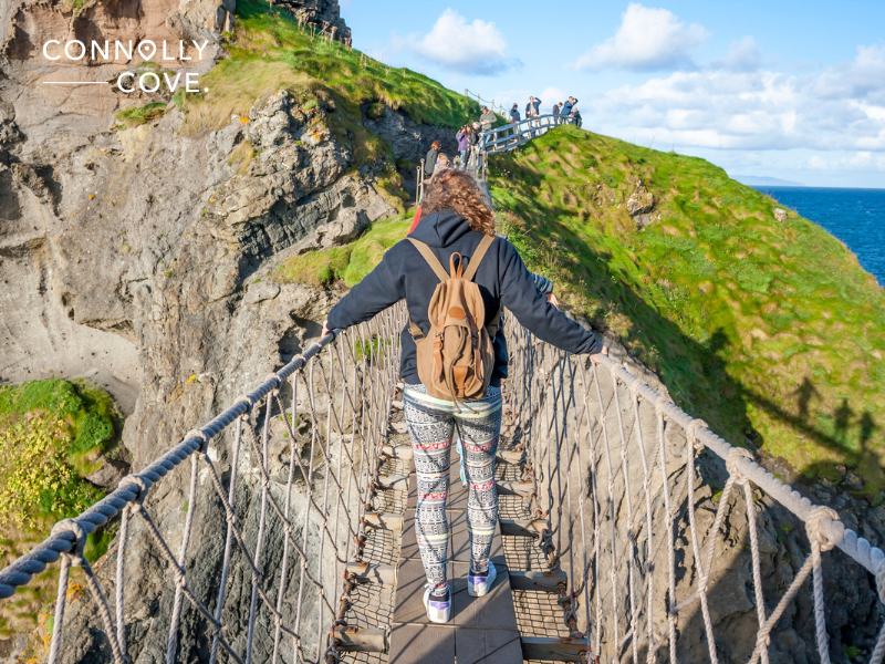
Are you excited to embark on your walking adventure in Northern Ireland? With so many diverse trails and landscapes to choose from, planning can feel overwhelming. But fear not! Here are some handy tips to ensure your Northern Irish steps are filled with joy and discovery:
Find Your Perfect Path
Consider your experience level, desired walking distance, and preferred terrain. Websites like WalkNI.com offer detailed trail descriptions, difficulty ratings, and maps. Filter by region, length, and amenities to find your ideal route.
Check the Weather and Be Prepared
The weather in Northern Ireland can be unpredictable, changing quickly, even within a day. Always check the forecast before you set off and dress accordingly. Pack layers, waterproof gear, sturdy walking boots, and sun protection.
Pack Smart, Pack Light
Pack only essentials like water, snacks, a first-aid kit, a map, and a compass. Remember, a lighter is better for a more enjoyable walk. Consider using reusable containers and minimising single-use plastic to leave no trace.
Respect the Environment and Leave No Trace
Northern Ireland’s beauty is precious. Always stick to designated paths, minimise your impact on wildlife, and dispose of waste responsibly. Follow the Leave No Trace principles to ensure the trails remain beautiful for everyone.
Share Your Adventure and Be Safe
Let someone know your planned route and estimated return time. Download offline maps and consider carrying a personal locator beacon for remote areas. Don’t hesitate to turn back if weather conditions worsen or you feel unsafe.
Embrace the Journey, Not Just the Destination
Savour the sights, sounds, and smells of the landscapes around you. Take breaks to admire the scenery, breathe fresh air, and engage with your surroundings. Walking in Northern Ireland is a journey of discovery, not just a race to the finish line.
Connect with Fellow Walkers
Join the #WalkNI community online and connect with other enthusiasts. Share experiences, seek advice, and find inspiration for your next adventure.
Support Local Businesses
Enjoy a well-deserved treat at a local cafe or pub after your walk. Purchase souvenirs from artisan shops and support the communities that maintain these beautiful trails.
Remember, Every Step Counts
Whether you conquer a mountain peak or explore a city park, every step contributes to your health, happiness, and connection with Northern Ireland. Enjoy the journey, embrace the unexpected, and create lasting memories on your #WalkNI adventure!
By following these tips and using the resources available, you’ll be well on your way to planning an unforgettable and rewarding walking adventure in Northern Ireland. Now, lace up your boots, grab your backpack, and start creating your own story on the paths of this magical land!
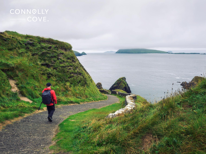
Remember, walking in Northern Ireland is more than just a physical activity; it’s a journey of self-discovery, a chance to reconnect with nature’s magic, and an opportunity to create lasting memories. Join the #WalkNI community, share your experiences, and inspire others to explore the hidden gems of this captivating land.
Don’t let this be the end of your story. Pack your bags, chart your course, and embark on your unforgettable adventure walking in Northern Ireland. Every step you take unveils a new chapter, and every chapter writes a recent story in the timeless narrative of this enchanting land. Start walking, exploring, and creating your Northern Irish adventure. The path awaits!
Discover the Best Scenic Drives in Northern Ireland
Northern Ireland
28/04/2024

Exploring Ireland’s Ancient East
Ireland
28/04/2024

Viking History: Insight into the Age of Phantom Travellers
History and Heritage
28/04/2024
The Symbolism and Meaning of the Dara Knot
Culture Exploration
28/04/2024
An Overview of Michigan Tourism Statistics: Visitor Spending, Growth, and Industry Impact
United States
28/04/2024