

Article Summary
What this article covers: A practical guide to The Wicklow Mountains, covering the folklore attached to the range, the main walking routes, the Military Road drive, transport from Dublin, and the weather and ground conditions visitors need to plan for.
Who this is for: Travellers planning a day trip from Dublin, walkers choosing a route in Wicklow Mountains National Park, and anyone interested in the Irish legends tied to these hills.
Key takeaway: The Wicklow Mountains sit close enough to Dublin for a half-day visit but behave like genuine upland terrain, so the difference between a good day and a bad one usually comes down to route choice, arrival time and what you packed.
Expert insight: “The mist in Wicklow is not scenery, it’s a planning problem. We’ve stood at the top of the Spinc boardwalk on a July morning and watched the Upper Lake disappear in about four minutes. That’s the day you learn why the old stories in these hills are all about people getting lost.” , Ciaran Connolly, Founder of ConnollyCove
Quick facts:
- Lugnaquilla, at 925 metres, is the highest summit in The Wicklow Mountains and the highest mountain in Ireland outside County Kerry
- Wicklow Mountains National Park is the largest of Ireland’s national parks, covering more than 20,000 hectares of upland, blanket bog and woodland
- Powerscourt Waterfall, on the northern edge of the range, drops 121 metres and is the tallest waterfall in Ireland
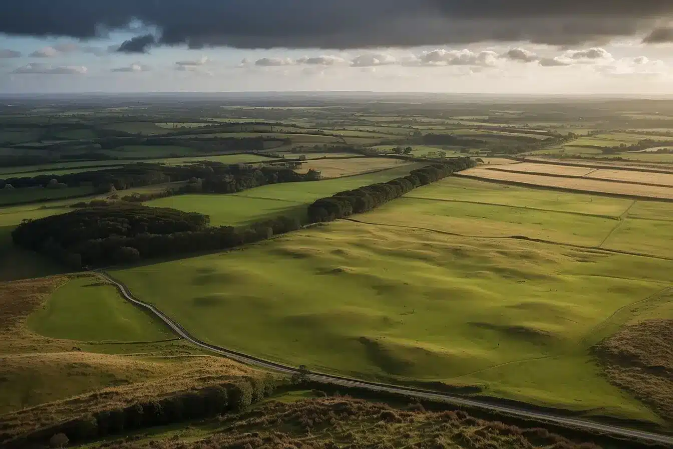
Less than an hour south of Dublin, the suburbs stop and the ground starts climbing. The Wicklow Mountains are the largest continuous upland area in Ireland, a granite spine running through County Wicklow and spilling into Dublin, Wexford and Carlow. Most visitors meet the range at Glendalough, where a sixth-century monastic settlement sits between two glacial lakes, and go home thinking that is all of it. West of there the ground opens into pathless blanket bog and quiet valleys that see a fraction of the footfall.
This guide covers both sides of that split: the folklore behind the range, the main walking routes with honest difficulty ratings, the Military Road drive, and the detail tourism summaries leave out. Where the car parks fill. How the weather turns. What to do when the cloud comes down. ConnollyCove covers Irish heritage and travel destinations from an Ireland-based perspective, and Wicklow is one of the places where the mythology and the map line up most closely.
Table of Contents
Where The Wicklow Mountains Sit and How They Formed
The Wicklow Mountains are a granite batholith, a mass of molten rock that cooled deep underground around 400 million years ago and was later exposed by erosion. That explains most of what you see: rounded summits rather than jagged peaks, wide boggy plateaus, and granite boulders across the hillsides. Ice Age glaciers then carved the U-shaped valleys, including Glendalough and Glenmalure, and left ribbon lakes in their floors.
The Four Areas Travellers Actually Use
The range is not a single destination, and treating it as one is the most common planning mistake. North Wicklow, reached through Enniskerry, holds the northern access to the Wicklow Way along Djouce Mountain and the formal gardens at Powerscourt House and Estate. The central uplands are crossed by the Military Road and contain Sally Gap and Lough Tay. The Glendalough valley, entered through Laragh, is where the marked trails and almost all the crowds are. West and south Wicklow, around Blessington, Hollywood and the Glen of Imaal, is the quietest sector and holds Lugnaquilla, along with the Palladian Russborough House near Blessington.
Why the Geology Matters on Foot
Because the granite is ancient and heavily weathered, the high ground carries blanket peat rather than bare rock. Peat holds water, so the plateaus stay saturated most of the year, even after a dry fortnight. Routes that look flat on a map can be slow, wet walking, which is the biggest practical difference between hiking here and hiking in the Reeks or the Mournes.
Legends and Folklore in The Wicklow Mountains
The stories attached to The Wicklow Mountains are mostly stories about weather, disappearance and the boundary between the visible world and something else. That is not a coincidence. Country that produces sudden cloud, standing water and featureless bog generates a folklore of people going missing, and Irish tradition supplied the cast to explain it. The National Folklore Collection at University College Dublin holds Schools’ Collection material from Wicklow parishes recording these beliefs as they were told locally in the 1930s.
Fionn mac Cumhaill and the Fianna
Fionn mac Cumhaill and his warrior band, the Fianna, appear across Irish topographic legend, and the Wicklow uplands are among the areas linked to their hunting grounds in the Fenian Cycle. The pattern is consistent: the Fianna move through high, wild country outside settled society, and Wicklow was close to the medieval power centres of the east coast yet physically difficult to control. Our guide to the Tuatha Dé Danann and the gods of Irish mythology covers the earlier cycle behind these tales.
The Aos Sí, the Púca and the Fairy Hills
Belief in the Aos Sí, the fairy people, was recorded across County Wicklow as elsewhere in Ireland, and it attached to specific features: certain hills, certain thorn trees, certain crossings. The púca, a shape-shifter appearing as a black horse or goat, turns up as a night traveller’s problem. Hawthorns standing alone in fields were left untouched because of what was believed to live under them, and that practice survives in places. We cover the wider tradition in our guide to fairy trees and the beliefs attached to them, and the full cast appears in our reference on legendary creatures from Celtic mythology.
Saint Kevin and the Glendalough Stories
Saint Kevin, who founded the monastic settlement at Glendalough in the sixth century, has a body of legend around him that is local rather than borrowed. The best known has him praying with his arm outstretched until a blackbird nested in his palm, and staying still until the chicks fledged. Another places him in a cave in the cliff above the Upper Lake, reachable only by boat, now called St Kevin’s Bed.
What the Folklore Gets Wrong
A claim circulates that The Wicklow Mountains were formed by a hag dropping stones from her apron, and that the god Lugh is buried in them. The apron motif is a genuine and widespread Irish folk explanation for upland terrain, attached to the Cailleach figure in several counties. The Lugh burial claim is not something we can source to a recorded Wicklow tradition, so we have left it out rather than repeat it.
Glendalough: The Valley at the Heart of The Wicklow Mountains
Glendalough is the busiest place in The Wicklow Mountains and still worth the visit, provided you time it properly. The valley holds the monastic city founded by Saint Kevin, including a round tower of roughly 30 metres, a roofless cathedral, and the stone oratory known as St Kevin’s Kitchen. Two lakes sit above the ruins in a glacial trench with near-vertical southern walls.
What to See on the Valley Floor
The monastic site is free and open access. The Office of Public Works runs a visitor centre nearby, and the National Parks and Wildlife Service has a separate information point at the Upper Lake. Walking from the Lower Lake to the Upper Lake takes about 20 minutes on a flat, surfaced path suitable for wheelchairs and buggies. Our fuller guide to visiting Glendalough covers the buildings in detail.
Why the Upper Lake Car Park Is the Problem
The Upper Lake car park is paid, finite and fills early. On summer weekends and bank holidays it can hit capacity well before mid-morning, after which cars are turned away and the overflow goes into Laragh village, adding a 20 to 30 minute walk each way. Arriving before 9am or after 4pm in high season avoids most of this. Check current charges and hours with the National Parks and Wildlife Service before you travel.
Walking Routes Across The Wicklow Mountains
Route choice in The Wicklow Mountains should be driven by ground conditions rather than photographs, because the terrain ranges from surfaced lakeside path to saturated pathless peat within a few kilometres. The table below compares the routes most visitors consider. Distances and times are approximate and assume a steady pace with short stops.
| Route | Distance | Ascent | Time | Ground | Grade |
|---|---|---|---|---|---|
| Glendalough lakeside path | 3 km | Negligible | 45 min | Surfaced, level | Easy |
| Miners’ Road Walk | 5 km | Minimal | 1.5 hrs | Gravel track | Easy |
| The Spinc (White Route) | 9.5 km | 380 m | 3 to 3.5 hrs | Boardwalk, timber steps | Moderate |
| Djouce via Ballinastoe | 10 km | 410 m | 3 hrs | Forest path, exposed summit | Moderate |
| Lough Ouler and Tonelagee | 7.5 km | 450 m | 3.5 to 4 hrs | Rough trod, wet peat | Strenuous |
| Lugnaquilla via Glen of Imaal | 13.5 km | 780 m | 5 to 6 hrs | Pathless plateau, boulders | Demanding |
Easy Walks Suitable for Families
The lakeside path at Glendalough is the obvious starting point and the only route in the valley that works with a buggy. The Miners’ Road Walk continues along the northern shore of the Upper Lake to a ruined nineteenth-century lead mining village, on firm gravel with almost no climb. Both work in poor weather, because neither takes you onto exposed ground.
Half-Day Routes With a Payoff
The Spinc is the signature walk of The Wicklow Mountains. From the Upper Lake car park it climbs steeply beside Poulanass Waterfall on timber steps, then breaks onto a boardwalk built from railway sleepers that runs for over a kilometre along the lip of the valley, several hundred metres above the water. Walk it clockwise so you ascend the steps and descend the gentler mining track. In frost the sleepers are slippery despite the wire mesh, and the crest offers no shelter from wind.
Djouce gives a comparable view for similar effort with far fewer people on it, and on a clear day you can see across Dublin Bay. The final approach is exposed and the cairn is a poor place to sit in strong wind.
Serious Upland Routes
Lugnaquilla is a different proposition. The summit plateau is broad, featureless and prone to sudden cloud, and the standard routes from the Glen of Imaal cross ground where paths fade out entirely. Two things matter. You need to navigate with map and compass rather than rely on a phone. And the Glen of Imaal contains an active Defence Forces artillery range, with access restricted during live firing and signalled by red flags and published notices. Check before you set out. Mountaineering Ireland publishes guidance on hillwalking safety and access in Irish uplands.
Driving the Military Road and Sally Gap
The Military Road is the best single introduction to The Wicklow Mountains if you have a car and limited time. Construction began in 1800, after the 1798 rebellion, when the British administration wanted access into an upland area that rebels including Michael Dwyer had used as a base. The road runs from Rathfarnham on Dublin’s southern edge to Aghavannagh, and the middle section is now the R115.
What You Pass
North to south, the route climbs out of Dublin past Glencree, crosses open bog to the Sally Gap crossroads, then runs above Lough Tay. The lake is dark peat-stained water with a pale sand beach at one end, which is where the Guinness Lake nickname came from, and it stood in as Kattegat in the television series Vikings. We cover the sites in our guide to Vikings filming locations across Ireland. South of there the road drops past Glenmacnass Waterfall into Laragh, the usual base for exploring the rest of County Wicklow.
Road Etiquette That Actually Matters
The R115 is narrow, unfenced and used by sheep. There are marked pull-ins at the main viewpoints, and stopping anywhere else creates a real hazard on blind bends. Lough Tay sits on private land, so the view is from the roadside area rather than the shore. In winter the high section over Sally Gap is among the first roads in Leinster to close in snow and ice, and it is not a gritting priority.
Visiting The Wicklow Mountains Without a Car
You can reach The Wicklow Mountains from Dublin on public transport, but the options are narrow and the timetables decide your day rather than the other way round. Glendalough is the only part of the range with a direct scheduled service from the city.
Services From Dublin
St Kevin’s Bus runs a direct service between Dublin city centre and Glendalough, and it is the standard car-free route to the valley. Transport for Ireland Local Link operates rural routes connecting Laragh and surrounding villages. For the northern end, the DART to Bray or Greystones puts you within reach of coastal walks and, with a local bus connection, Enniskerry for Powerscourt. Timetables change seasonally and some rural services run on limited days, so confirm current times with the operator before committing to a plan.
Building a Realistic Car-Free Day
Work backwards from the last bus. A Glendalough day on scheduled services gives five to six hours in the valley, enough for the Spinc plus the monastic site, or the lakeside walks at a slower pace. It is not enough for west Wicklow, which has no practical public transport to the trailheads.
Weather, Safety and Ground Conditions
Weather is the main risk in The Wicklow Mountains, and it gets underestimated because the range is close to a capital city and the summits are under 1,000 metres. Cloud base can drop below 500 metres within minutes, and the high plateaus offer no walls and very few features to navigate by once visibility goes.
What the Bog Does to Your Timings
Blanket peat absorbs and holds water, and after sustained rain the ground between Tonelagee and Lugnaquilla becomes a network of peat hags and saturated channels. Expect your pace to drop to two kilometres an hour or less on this terrain. Waterproof boots matter more than stiff boots here, and gaiters are not excessive.
Navigation and Emergencies
Carry Ordnance Survey Ireland Discovery Series Sheet 56, which covers the range, plus a compass, and know how to use both. Phone batteries fail in cold and coverage across the central bog is patchy. In an emergency dial 999 or 112 and ask for Mountain Rescue; the Dublin Wicklow Mountain Rescue Team covers this area. Tell someone your route and return time before you leave, and check the forecast with Met Éireann on the morning of your walk, not the night before.
When to Visit and How to Avoid the Crowds
May to September gives the most reliable weather and longest daylight in The Wicklow Mountains, but it also concentrates visitors into Glendalough. Late April and late September are the better trade-off for most walkers: quieter trails, good light, and ground that has had a chance to drain.
Season by Season
Spring gives the best combination of drainage and daylight. Summer is busiest and also midge season, worst near standing water at dawn and dusk on still days. Late August and early September bring the heather into bloom across the high bog. Winter is quiet and often clear, but December gives barely seven usable hours of light and the high roads can close without much warning.
Going Somewhere Other Than Glendalough
The simplest way to avoid the crowds is to base yourself west instead of east. Blessington, on the reservoir lakes, reaches the western foothills and the Glen of Imaal without touching Glendalough traffic. Glenmalure, to the south, is a deep quiet valley with a hostel and access to Lugnaquilla’s eastern side. Both see a fraction of the visitors and both are the same drive from Dublin.
Planning Your Visit
The Wicklow Mountains reward planning more than most Irish destinations, because the gap between the easy valley walks and the serious upland routes is wider than the map suggests. Pick your route for the conditions on the day rather than the one you settled on last week, arrive early if Glendalough is on your list, and carry more layers than you think you need.
ConnollyCove publishes travel guides and cultural coverage from Ireland and beyond. For more on the folklore behind these hills, read our guide to Irish folklore and legendary creatures, or watch our video guides to Irish heritage sites on the ConnollyCove YouTube channel.
FAQs
How old are The Wicklow Mountains?
The granite cooled underground around 400 million years ago, during the Caledonian mountain-building period. The shape you see today was carved far more recently by Ice Age glaciers.
What is the highest mountain in Wicklow?
Lugnaquilla, at 925 metres. It is also the highest mountain in Ireland outside County Kerry.
How far are The Wicklow Mountains from Dublin?
Glendalough is roughly 50 kilometres from Dublin city centre, about an hour and 15 minutes by car. The northern edge near Enniskerry is closer, at around 30 minutes.
Can you visit The Wicklow Mountains without a car?
Yes, but only Glendalough has a direct scheduled bus from Dublin. The rest of the range, particularly west Wicklow, is difficult to reach on public transport.
What is the best walk in The Wicklow Mountains for a first visit?
The Spinc at Glendalough, a 9.5 kilometre loop taking about three hours. For something easier, the lakeside path to the Upper Lake takes 45 minutes on level ground.
Do you need hiking experience for the Wicklow trails?
Not for the Glendalough valley walks, which are waymarked and surfaced. Anything above the boardwalks, and Lugnaquilla in particular, needs map and compass skills.
Is Wicklow Mountains National Park free to enter?
Yes, park access is free. Car parking at Glendalough Upper Lake is charged, and the OPW visitor centre has a separate admission fee.
What legends are connected to The Wicklow Mountains?
Saint Kevin’s Glendalough stories are the best documented, including the blackbird nesting in his hand. Fianna hunting legends and belief in the Aos Sí and the púca also attach to the range.