
Discovering the Counties and Provinces of Ireland
Updated On: April 15, 2024 by  Panseih Gharib
Have you ever felt your head spinning when planning a journey through the four eclectic provinces of Ireland? Indeed, it’s quite a task. The regions – Connacht, Leinster, Munster and Ulster – each hold their unique charm steeped in ancient lore and vibrant culture – it can be rather challenging to know where to begin.
Fear not! This article will become your guidebook as we navigate these captivating Irish provinces together. We’ll delve into their must-visit attractions and distinct personalities.
Are you ready for an adventure packed with enchanting discoveries? Let’s unravel the charm of Ireland’s provinces hand in hand!
Key Takeaways
- Ireland has four provinces: Connacht, Leinster, Munster, and Ulster.
- Each region has its unique attractions and characteristics.
- Connacht offers stunning landscapes in places like Connemara.
- Leinster is home to historical landmarks in Dublin and natural beauty in Wicklow.
- Munster enchants visitors with picturesque countryside and historic sites such as Blarney Castle.
- Ulster showcases a rich cultural heritage with ancient ruins and breathtaking landscapes.
Overview of the Four Irish Provinces
The four provinces of Ireland are Connacht, Leinster, Munster, and Ulster. They have a rich and complex history dating back to ancient times. Each province has its unique culture and identity, shaped by centuries of Gaelic kingdoms, Viking raids, Norman invasions, and English rule. Today, they mainly serve as cultural and historical divisions, each with distinct traditions, dialects, and folklore.
Connacht: Where Nature and History Converge
Connacht is an Irish province located in the west. It has a breathtaking, untamed beauty and a rich cultural tapestry. From Connemara’s rugged peaks to the Aran Islands’s ancient allure, every corner of this Irish province promises an unforgettable experience.
Connemara: A Landscape Painted by Nature
Connemara National Park, a crown jewel of Connacht, unveils a breathtaking panorama of emerald valleys, shimmering lakes, and windswept Atlantic coastlines. Hike through the heather-cloaked Diamond Hill, where panoramic views unfold beneath your feet. Take a boat trip on the glassy expanse of Kylemore Lough, framed by the majestic Twelve Bens mountain range.
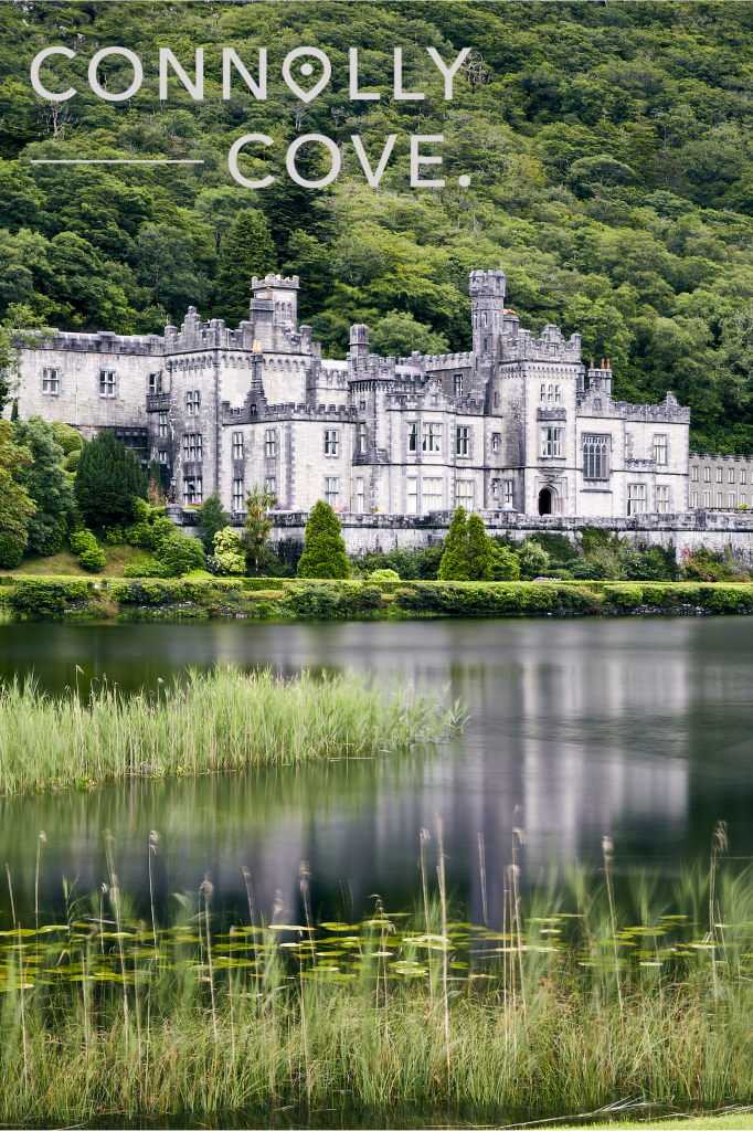
Kylemore Abbey: A Victorian Fairytale
Step into a bygone era at Kylemore Abbey, a Victorian gem nestled amidst Connemara’s splendour. Explore the lavishly decorated rooms of the former residence, now a Benedictine monastery, and wander through the Victorian Walled Garden, a riot of colourful blooms.
The Aran Islands: Where Time Stands Still
Venture offshore to the Aran Islands, where Gaelic whispers on the wind and ancient traditions hold sway. Explore the timeworn ruins of Dun Aonghasa, a prehistoric fort perched precariously on the cliff edge, or cycle along the windswept paths, savouring the salty air and breathtaking seascapes.
Galway City: A Cultural Buzz
Galway City, Connacht’s vibrant heart, pulsates with a bohemian spirit. Stroll through the cobbled streets of Eyre Square, embrace the lively atmosphere of the traditional pubs, and lose yourself in the melody of buskers strumming their guitars. Immerse yourself in the city’s rich artistic heritage at the Galway Arts Centre or the Galway Museum, home to fascinating exhibits on local history and culture.
Beyond the Beaten Path
Connacht is one of the Irish provinces that offers an array of hidden gems for those seeking an off-the-grid adventure. Hike the scenic trails of Westport House Demesne, kayak through the emerald waters of Killary Fjord, or delve into the mystical aura of Lough Key Forest Park.
A Warm Welcome Awaits
Connacht’s charm extends beyond its stunning landscapes and historical treasures. The warmth of its people, renowned for their hospitality and storytelling, ensures that every visitor feels like a part of the community. So, swap stories with the locals, and let the Irish province spirit weave its magic on your soul.
Leinster: An Irish ProvinceTapestry of Cityscapes and Emerald Escapes
Leinster, nestled in the eastern embrace of Ireland, is a province that hums with vibrant energy. From the bustling Dublin streets to the serene landscapes of Wicklow, this Irish province offers a kaleidoscope of experiences for every traveller.
Leinster’s charm extends beyond its iconic landmarks and breathtaking landscapes. It’s a land where history whispers in ancient ruins, tradition thrives in lively pubs, and nature’s beauty inspires awe in every corner. So, pack your bags, unleash your inner explorer, and let Leinster weave its magic on your Irish province adventure!
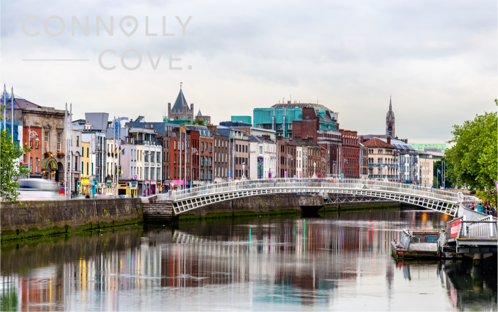
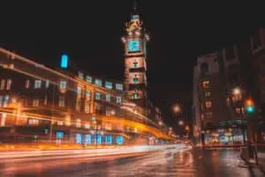
Dublin: A City Steeped in History and Charm
Step into the hallowed halls of Trinity College, home to the renowned Book of Kells, an illuminated manuscript dating back to the 8th century. Explore the cobbled squares and admire the imposing Georgian architecture that defines this historic university.
Wander through the cobbled streets, discover quirky shops, and lose yourself in the melody of traditional Irish music.
Wicklow: A Haven of Nature and Tranquility
Put on your boots and embark on the Wicklow Way, a 127-km scenic trail that winds through rolling hills, lush valleys, and charming villages. Hike past ancient ruins, witness cascading waterfalls, and breathe in the fresh air of Wicklow’s stunning countryside.
In addition, discover the monastic ruins of Glendalough, nestled amidst the Wicklow Mountains. Explore the 6th-century Round Tower, wander through the peaceful graveyard, and soak in the spiritual atmosphere of this ancient site.
Another destination is to Seek refuge in the luxurious haven of Powerscourt Estate & Spa. Immerse yourself in the grandeur of this Palladian mansion, stroll through the landscaped gardens, and relax in the opulent spa overlooking the breathtaking Wicklow scenery.
Remember to taste the local cuisine. Enjoy an exquisite dining experience at Leinster’s Michelin-starred restaurants. Sample the innovative tasting menu at Chapter One in Dublin or savour the seasonal French cuisine at Champagne in Kilkenny.
Munster
Munster is one of the southern provinces of Ireland where history whispers from imposing castles and vibrant music spills from cosy pubs. From the rugged Kerry coastline to the fertile plains of Tipperary, Munster allows you to experience one of the provinces of Ireland in various ways.
Kerry: A Rugged Landscape with Enchanting Charms
Take a scenic drive along the legendary Ring of Kerry, a 200-km coastal route that showcases breathtaking sea views, windswept cliffs, and charming villages. Stop at the Skellig Experience Centre to learn about the monastic life on the remote Skellig Michael islands, or hike through the Killarney National Park, home to cascading waterfalls and ancient lakes.
Kiss the legendary Blarney Stone, perched atop Blarney Castle, and reputed to grant the gift of eloquence. Explore the medieval fortress, wander through the manicured gardens, and enjoy the views of the countryside.
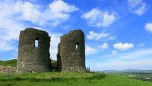
Tipperary: History Carved in Stone and Song
Journey through time at the Rock of Cashel, a dramatic limestone outcrop crowned by a magnificent ensemble of medieval buildings. Explore the 12th-century Cormac’s Chapel, marvel at the Round Tower, and soak in the panoramic views of the Golden Vale below.
Step back into the 13th century at Cahir Castle, one of the best-preserved medieval castles in Ireland. Tour the fortified towers, discover secret passages, and learn about the turbulent history of this imposing landmark.
Discover the untouched beauty of the Glen of Aherlow, a picturesque valley known for its rolling hills, lush meadows, and cascading waterfalls. Hike through the woodlands, enjoy a picnic by the River Suir, or take a horse-drawn carriage ride for a truly authentic experience.
Beyond the Emerald Hills: A Culinary and Cultural Immersion
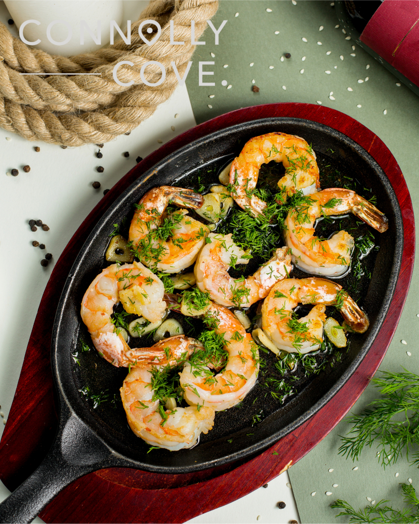
Immerse yourself in the heart of Irish culture at a traditional music session in a cosy pub. From Michelin-starred restaurants in Cork to charming cafes in Kilkenny, Munster’s culinary scene caters to every palate. Sample fresh seafood by the coast, savour hearty stews in a country pub or indulge in a slice of decadent Limerick cheesecake.
Ulster: Unveiling Beauty and History, North and South
Ulster is an Irish province with diverse landscapes, a rich history, and a vibrant culture. Ulster is Divided between Northern Ireland and the Republic of Ireland. It presents a unique blend of experiences to all visitors.
Northern Delights: A Journey Through Time and Nature
Pulse with the energy of Belfast, Northern Ireland’s vibrant capital. Explore the imposing Titanic Quarter, delve into the maritime history at the HMS Caroline, and climb the dome of City Hall for panoramic city views.
Step into a mythical landscape at the Giant’s Causeway, a UNESCO World Heritage Site. Marvel at the hexagonal basalt columns formed by ancient volcanic eruptions, walk along the dramatic cliffs, and let the legend of Finn McCool and the giants come alive.
You can also Hike through the breathtaking Mourne Mountains, a hiker’s paradise with granite peaks, glacial valleys, and hidden waterfalls. Climb Slieve Donard, the highest peak, or drive along the Mourne Coastal Route for stunning sea views.
Southern Sojourn: Exploring History and Enchantment
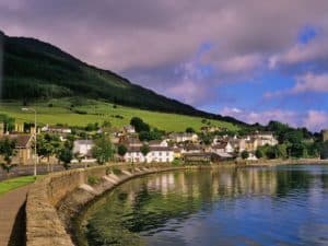
Discover the wild beauty of County Donegal, known for its rugged coastline, sandy beaches, and charming villages. Hike along the Slieve League cliffs, kayak through the sheltered Lough Swilly, or visit Glenveagh National Park for a serene wilderness experience.
Stand in awe of the dramatic Dunluce Castle, perched precariously on a cliff edge. Explore the crumbling ruins, imagine life in medieval times, and soak in the panoramic views of the Atlantic Ocean.
Walk along the historic Derry Walls, a 17th-century fortification surrounding the city of Derry. Discover the Siege Museum, explore the vibrant street art scene, and enjoy traditional music in lively pubs.
Beyond the Landscapes: A Cultural Kaleidoscope
Ulster’s culinary scene caters to every palate, from fresh seafood to hearty stews in a country pub. Sample the famous black pudding of Armagh, indulge in melt-in-your-mouth Ulster Fry, or try a slice of Barmbrack, a fruit-studded sweet bread traditionally eaten on Halloween.
In conclusion, exploring the four provinces of Ireland, Connacht, Leinster, Munster, and Ulster, offers a fascinating journey through Ireland’s rich history and diverse landscapes. From the stunning scenery of Connemara in Connacht to the bustling cities of Dublin in Leinster and Cork in Munster, each Irish province has unique highlights.
FAQs
What is the modern official status of traditional Irish counties like Kerry, Kildare and Laois?
Traditional Irish counties like Kerry, Kildare and Laois no longer hold an official administrative role. However, they continue to be a source of pride and cultural significance for many Irish people. They represent a rich history and heritage woven into the fabric of Irish life.
How many counties are there in Ireland?
There are 32 counties in Ireland, which include well-known counties like Meath, Carlow, Longford, Wexford, Louth, Offaly, and Westmeath.
What is the difference between the Republic of Ireland and Northern Ireland?
The Republic of Ireland and Northern Ireland are two separate entities. The Republic of Ireland is independent, while Northern Ireland is part of the United Kingdom.
Can you explain the origins and history of the counties and provinces of Ireland?
The counties and provinces of Ireland have origins that date back centuries. They were initially founded by various groups, including the Vikings, Normans, Gaels, and Anglo-Normans, leading to the rich and diverse history of the regions.
What are the most visited tourist attractions in the counties and provinces of Ireland?
The counties and provinces of Ireland contain many fine examples of medieval architecture, ancient castles, and stunning landscapes. Visitors can also explore several different cultures, be it Ulster Scots, Gaels, or Anglo-Normans, making it a fascinating destination for tourists

Exploring Aillwee Caves in County Clare, Ireland
County Clare
01/05/2024
Visiting Glasgow | Ultimate Travel Guide
Scotland
01/05/2024
Discovering Ireland | Explore County Tyrone
County Tyrone
01/05/2024
10 Charming Irish Towns You Must Visit
Ireland
01/05/2024

The Art of Solomon’s Knot: Complete Guide
Culture Exploration
01/05/2024