Article Summary
What this article covers: Connemara, Galway, is a wild, Irish-speaking district on Ireland’s west coast, and this guide covers what to see, how to get there, and when to go.
Who this is for: Travellers planning a trip to Galway or the west of Ireland who want a clear, practical introduction to Connemara before they set off.
Key takeaway: Connemara isn’t a county on any map; it’s a cultural district west of Lough Corrib where the mountains, the Irish language, and the Atlantic all meet, and it rewards more than a rushed afternoon.
Expert insight: “The first time you drive past Oughterard, the stone walls change and so does the light. That’s when you know you’ve left Galway City behind and arrived somewhere the Irish language never stopped being spoken.” — Ciaran Connolly, Founder of ConnollyCove
Quick Facts
- Connemara sits in western County Galway, bordered by Lough Corrib, Killary Harbour, and the Atlantic Ocean
- The region splits naturally into mountainous North Connemara (the Twelve Bens) and the low-lying, Irish-speaking South Connemara
- Killary Harbour, on Connemara’s northern edge, is Ireland’s only true fjord
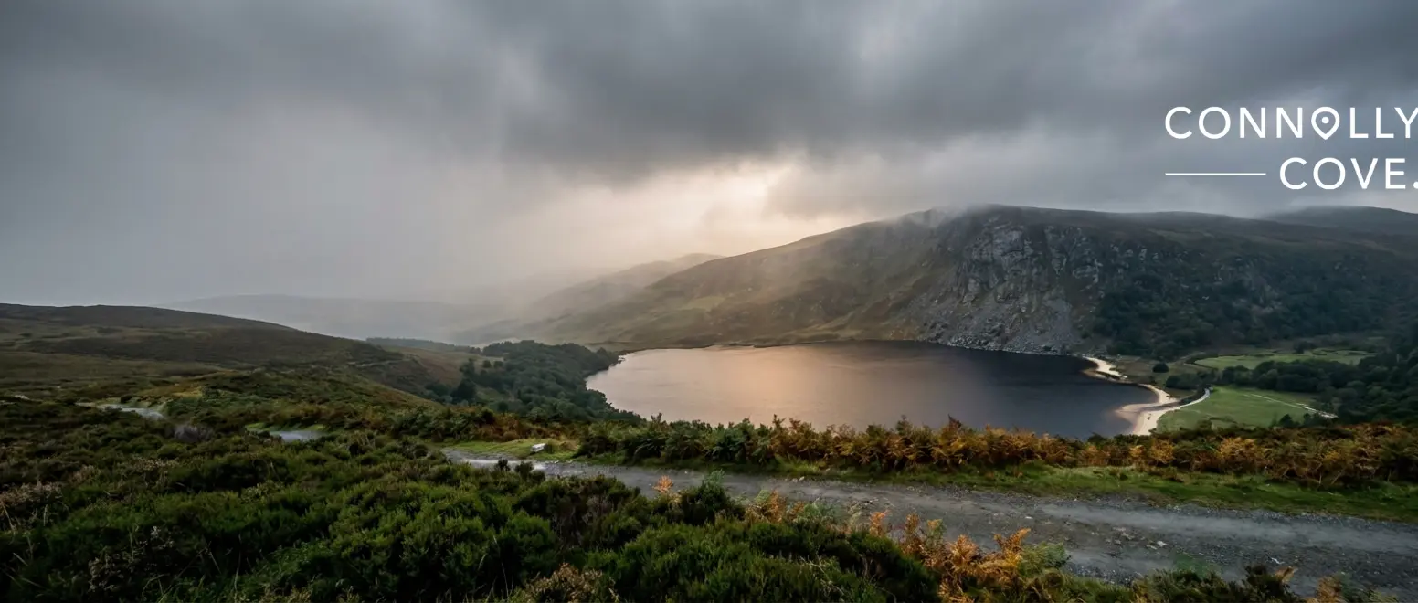
Connemara, Galway, is one of those places that resists a short visit. Tucked into the western edge of County Galway, it isn’t an official county or a single town; it’s a cultural district stretching from the shores of Lough Corrib out to the Atlantic, taking in mountains, bogland, and some of the last places in Ireland where Irish is still the language you hear in the shop queue.
We’d stayed in Clifden, the district’s unofficial capital, and spent our days driving out from there rather than trying to see everything in one push. That turned out to be the right call. Connemara doesn’t give up its character from a moving car window; it takes a slower pace, a few stops, and a willingness to get out and walk.
Table of Contents
What and Where Is Connemara, Galway?
Connemara begins roughly where the limestone of east Galway gives way to granite and bog, west of Lough Corrib. It has no fixed administrative boundary; instead, it’s defined by geography and culture, running from the Corrib out to the Atlantic coast and north to Killary Harbour, which marks the border with County Mayo.
The name comes from Conmhaicne Mara, an early medieval tribal name meaning roughly “the sea-descendants of Conmhac.” Locals and visitors both tend to just call it Connemara, and you’ll see the Irish form, Conamara, on road signs throughout the region. If you’re coming from exploring Galway City first, the shift is noticeable within half an hour’s drive: the buildings thin out, the walls turn to stacked stone, and the land opens up.
Two Different Landscapes
Connemara splits fairly cleanly into two halves, and knowing which one you’re in helps you plan. North Connemara is mountain country: the Twelve Bens (also called the Twelve Pins) dominate the skyline, and Killary Harbour cuts a genuine fjord into the coast near Leenane. This is where Kylemore Abbey sits, and where most of the postcard mountain photography comes from.
South Connemara is different again: low granite hills, blanket bog, and a coastline of coral-sand beaches and tidal islands. It’s also the stronghold of the Gaeltacht, the Irish-speaking region, with villages like Carraroe and Spiddal where Irish is still a working, everyday language rather than a subject taught in school.
Top Things to See and Do
Kylemore Abbey. The Benedictine abbey and its restored Victorian walled garden sit on the shore of a lake beneath the Twelve Bens. We spent a full morning there and still felt rushed; Kylemore Abbey and its walled garden deserve more time than most itineraries allow.
Clifden and the Sky Road. Clifden works as a base for the whole region, and a closer look at Clifden is worth reading before you go. The Sky Road loop out of town gives some of the best coastal views in Connemara, especially in late afternoon light.
Connemara National Park. Based around Diamond Hill near Letterfrack, the park is walking terrain only; there’s no road through it, so plan a couple of hours on foot rather than a drive-by stop.
Killary Harbour. Ireland’s only fjord, framed by mountains on both the Galway and Mayo sides. A short boat trip or a stop at one of the viewing points along the road gives a proper sense of scale.
Dog’s Bay and Roundstone. The white sand here is made almost entirely of tiny shell fragments rather than quartz, which is part of why it stays so pale. Roundstone village nearby is a good stop for food and a look at the harbour.
Getting to Connemara from Galway City
Most visitors base themselves in Galway City and drive out, and there are two realistic routes. The N59 runs inland through Oughterard and Maam Cross and is the faster option, taking around an hour to Clifden. The coastal route via the R336 and the Wild Atlantic Way is slower but takes in more of the coastline, particularly around Spiddal and Costelloe.
If you don’t have a car, Bus Éireann runs a route from Galway to Clifden via Oughterard and Maam Cross, and several operators run guided day tours from Galway City. Without your own transport, a guided tour is genuinely the easier way to see more than one part of the region in a single day.
Language, Heritage, and the Gaeltacht
South Connemara is one of the largest Gaeltacht regions left in Ireland, meaning Irish is the community language rather than a heritage curiosity. Road signs switch to Irish-only in places, so a village marked “An Spidéal” on a signpost is Spiddal on an English-language map.
“You don’t need fluent Irish to notice the difference. Standing in a shop in Carraroe and hearing Irish spoken as the ordinary, ordinary language of the day changes how the whole region feels,” says Ciaran Connolly, Founder of ConnollyCove.
Beyond the language, Connemara has its own folklore and cultural threads worth exploring, including how Irish folklore kept the language alive through centuries when it had no official status. The region also gave its name to Connemara’s distinctive green marble, quarried locally for centuries, and to the Connemara scenes filmed for The Quiet Man, still a pilgrimage stop for film fans.
The Connemara pony is another enduring local emblem, a hardy breed shaped by these bogs and hills over centuries. Local legend links its sturdy build to Spanish Armada horses that came ashore near Roundstone in 1588, interbreeding with native stock. You can still see ponies working smallholdings across South Connemara today.
Practical Tips for Your Visit
When to go. May, June, September, and October offer the best balance of daylight and quieter roads. July and August bring the longest days but the heaviest traffic on single-lane routes.
Weather. Rain is common year-round on this stretch of coast, so plan at least one indoor option (Kylemore’s interior rooms, for example) alongside outdoor plans.
Where to base yourself. Clifden suits most first-time visitors: central, well-served, and close to both North and South Connemara. Roundstone or Letterfrack suit travellers focused on hiking or the coast specifically.
A day isn’t really enough. Connemara rewards two to three days if you want to see both the mountain north and the Gaeltacht south without rushing between them.
Planning Your Visit
Connemara, Galway rewards travellers who give it more than a passing glance from a tour-bus window. Between the Twelve Bens, Killary Harbour, and the Gaeltacht villages of the south, there’s enough here for several days of exploring rather than one rushed loop.
For more of the west of Ireland, explore ConnollyCove’s guides to the Aran Islands and the Cliffs of Moher, both visible from parts of the Connemara coast on a clear day, or browse our Celtic mythology guide for the stories behind this landscape.
FAQs
A few questions come up again and again when people plan a trip to Connemara, Galway.
Can you drive through Connemara National Park?
No. The park itself has no vehicle roads; it’s a walking area accessed on foot from the Letterfrack visitor centre. Public roads like the N59 skirt its edges, but the interior is pedestrian-only.
What does “Connemara” mean?
It comes from Conmhaicne Mara, an early Irish tribal name meaning roughly “descendants of Conmhac of the sea.” The Irish spelling is Conamara.
How many days do you need in Connemara?
Two to three days let you cover both North Connemara’s mountains and South Connemara’s Gaeltacht coast without feeling rushed. A single day only allows a partial loop.
How do you get from Galway City to Connemara without a car?
Bus Éireann runs services to Clifden via Oughterard, and several companies operate guided day tours from Galway City for a hassle-free alternative.
Is Connemara part of County Galway?
Yes. Connemara isn’t a separate county; it’s the western district of County Galway, without an official administrative boundary of its own.
What is the best time of year to visit Connemara?
May, June, September, and October give the most reliable daylight and quieter roads. Summer is warmer but considerably busier on the narrow routes.