
Article summary
What this article covers: How Connemara’s landscape of quartzite peaks, blanket bog, fjord and tidal islands has shaped the place names, legends and customs of west County Galway.
Who this is for: Travellers planning a trip to the west of Ireland and readers interested in Irish folklore and the lore of places.
Key takeaway: In Connemara, the stories are attached to specific places, so reading the Irish names on the map is the quickest way to understand both the terrain and the lore behind it.
Expert insight: “Stand at Mám Éan on a clear day and you understand why the old story has Patrick stopping at the pass to bless the country below rather than walking on into it. The view across bog, lake and mountain still feels like the edge of somewhere.” (Ciaran Connolly, Founder of ConnollyCove)
Quick facts:
- Connemara takes its name from the Conmhaicne Mara, “the Conmhaicne of the sea”, an early tribal group in the far west of County Galway.
- The Irish name of the Twelve Bens, Na Beanna Beola, means “the peaks of Beola”, a giant and Fir Bolg chieftain in local tradition.
- Killary Harbour runs about 16 kilometres inland and forms part of the border between County Galway and County Mayo.
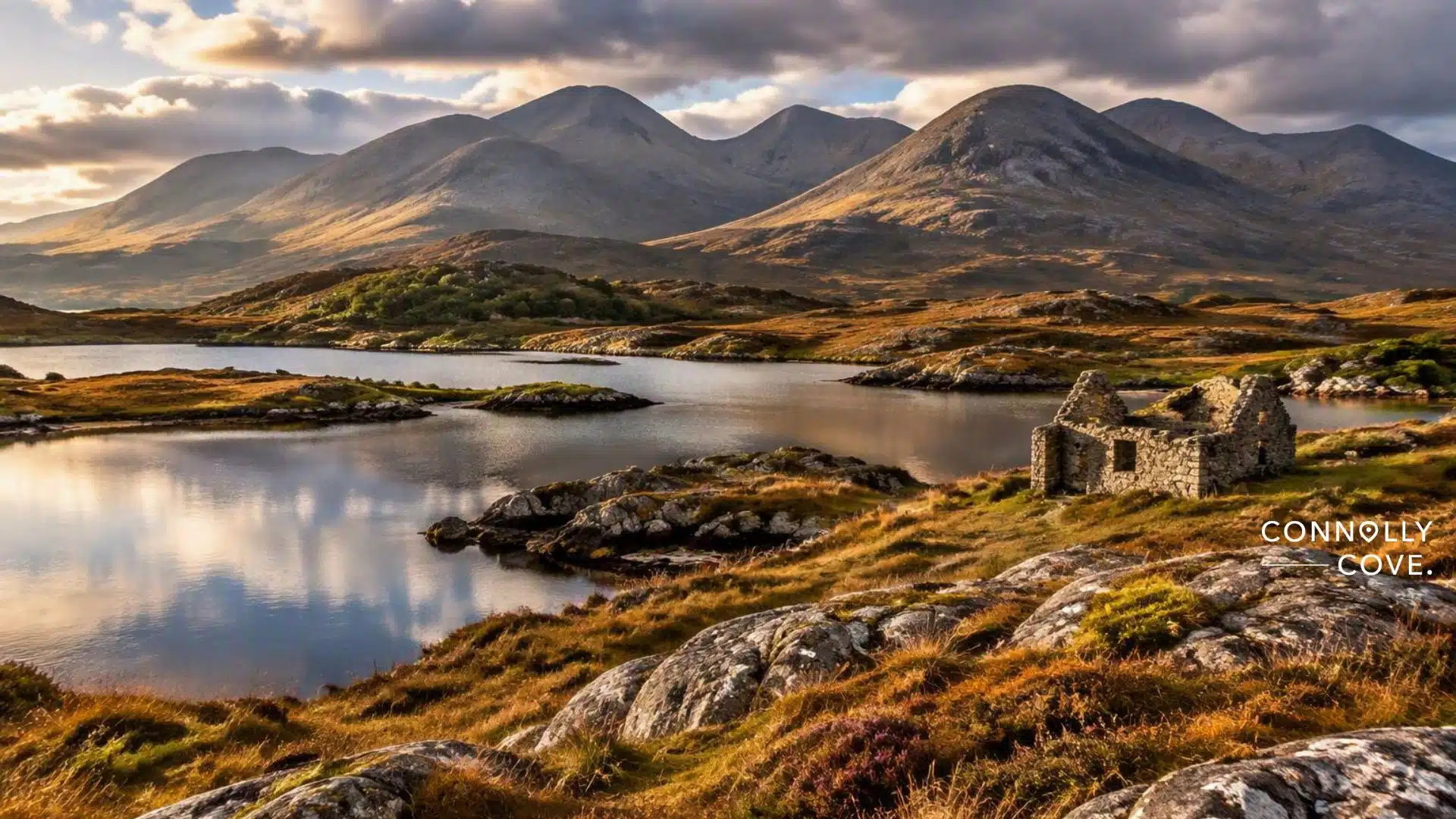
Connemara’s landscape reads like a book of stories in Irish. The quartzite peaks of the Twelve Bens, the brown bog around Clifden and the tidal sands at Omey all carry names and legends passed down for centuries, and ConnollyCove, the Ireland-based travel and culture platform founded by Ciaran Connolly, has followed many of those threads across west Galway.
The lore explains the place to visitors. A pass in the Maumturks became a pilgrimage site because of a story about St Patrick, and an island off Cleggan is named after a white cow that turned to stone. Readers who know the creatures of Celtic mythology will recognise several of them along this coast.
This guide moves from the history in Connemara’s name, through the mountains and bogs, to the lakes, the Atlantic edge and the living Gaeltacht, with practical visiting notes. A shorter overview of Connemara folklore sits alongside it.
Table of Contents
The History Written into Connemara’s Place Names
Irish place names in Connemara record who lived on the land, what they believed and what happened there, a tradition the Irish language calls dinnseanchas, the lore of places. Reading those names is the first step to understanding the Connemara landscape, and the sections below follow that thread from the region’s own name to the writers who mapped it.
Connemara Means the Conmhaicne of the Sea
The name Connemara comes from Conmhaicne Mara, “the Conmhaicne of the sea”, an early tribal group whose territory lay in the far west of County Galway. The Placenames Database of Ireland records that Conmhaicne means “hound descendants” and was the name of several tribes across the west, so the branch living by the Atlantic was distinguished by the sea itself.
Mara is the genitive form of muir, the Irish word for sea. Many travel guides repeat that Connemara means “inlets of the sea”, but the tribal origin is the explanation the state placenames service gives, and the Irish name, Conamara, is pronounced roughly “kun-uh-MAR-uh”.
The O’Kealys were among the chiefs of the Conmhaicne Mara, whose territory covered the barony of Ballynahinch and the parish of Inishbofin. Their way of holding land through kin and loyalty belonged to the wider system described in ConnollyCove’s guide to Gaelic Ireland.
The Twelve Bens Carry the Name of a Fir Bolg Giant
The Irish name for the Twelve Bens is Na Beanna Beola, “the peaks of Beola”, and it contains no number at all. Beola was remembered as a giant and a chieftain of the Fir Bolg, and his name survives in the village of Toombeola, Tuaim Beola, near Roundstone, where tuaim refers to a burial mound.
The Fir Bolg are one of the peoples in the medieval Irish origin legends, defeated in battle by the Tuatha Dé Danann and, in some versions, given Connacht as their share of the island. That link places the Connemara mountains inside the oldest layer of Irish myth.
The idea of exactly twelve peaks goes back at least to 1684, when the historian Roderic O’Flaherty wrote of the twelve high mountains of Bennabeola. Even he did not list them, and walkers still argue over which summits make up the twelve.
Grace O’Malley and Cromwell Left Their Mark on the Coast
The sixteenth-century sea captain Grace O’Malley, Gráinne Mhaol in Irish, is tied to this coast through marriage and through her fleet. Her first husband was Dónal an Chogaidh Ó Flaithbheartaigh, an O’Flaherty lord in Connemara, and island tradition credits her with fortifying Inishbofin alongside a pirate called Bosco. ConnollyCove’s profile of Grace O’Malley’s life at sea traces how she later dealt with Elizabeth I in 1593.
The following century brought harder change. Inishbofin surrendered to Cromwellian forces in 1653 and a star-shaped fort was built on the island during that decade, while land confiscations pushed many families onto poorer ground in the west. The history of Galway shows how the city and its western hinterland were shaped by these upheavals.
Writers and Mapmakers Recorded the Lore of Connacht
Scholars have written about Connemara for more than three centuries. Roderic O’Flaherty, a local landowner who lost much of his estate after the Cromwellian period, described the region in his “Chorographical Description of West or H-Iar Connaught”, which James Hardiman edited and published in 1846.
In the twentieth century, the cartographer and writer Tim Robinson spent decades walking the region, recording Irish place names across the Connemara landscape and the stories behind them on his maps and in his Connemara trilogy, which begins with “Connemara: Listening to the Wind”. The phrase “a savage beauty”, widely attributed to Oscar Wilde, appears in almost every modern description of the region, though its original source is hard to trace. That habit of reading lore from the map applies across the province, and the guide to mythical places in Connacht shows how neighbouring counties hold similar stories.
The Mountains and Bogs behind the Stories

Connemara’s mountains and bogs formed over an immense span of time. The rock of the Twelve Bens began as sea-floor sediment in the Precambrian and Cambrian periods, and the last Ice Age carved it into the outlines of the Connemara landscape that people later explained with giants, saints and spirits. This section looks at the rock itself, the pilgrim passes, the bog and the animals raised on this hard ground.
Hard Quartzite Gives the Bens Their Sharp Outline
The Twelve Bens are built mostly of quartzite, a sandstone that heat and pressure turned into one of the hardest rocks in Ireland. Because quartzite resists weathering, the peaks stand as bare grey ridges above softer ground, and glaciers sharpened them into the angular summits and scree slopes walkers see today.
Benbaun, An Bhinn Bhán or “the white peak”, is the highest at 729 metres and the highest point in County Galway. Other summits are also named for their look, for example Binn Bhreac, “the speckled peak”, and the walk up Diamond Hill inside Connemara National Park gives a gentler introduction to the range. A wider ConnollyCove guide to mountains across Ireland compares the Bens with the island’s other ranges.
Mountain Passes Became Places of Pilgrimage
Mám Éan, “the pass of the birds”, is one of the two main passes through the Maumturk Mountains and the old boundary between Connemara proper and Joyce Country. According to legend, St Patrick climbed to the pass on his way back from Croagh Patrick, blessed the land to the west and slept in a hollow now called Leaba Phádraig, Patrick’s Bed, without going any further into Connemara.
Many writers describe the site as older than the Patrick story, with a pattern day held there in the Lughnasa season that the English travel writer Henry Inglis described in 1834. The Church suppressed the gathering in the nineteenth century after faction fighting, and since its revival in the 1980s pilgrims have climbed on St Patrick’s Day, Good Friday and the first Sunday in August. Mám Éan sits among the holy places of the Republic of Ireland where older seasonal gatherings meet Christian devotion.
Blanket Bog Holds the Memory of the Land
Much of the lowland Connemara landscape is blanket bog, peat built up over thousands of years in a wet Atlantic climate, and it fills the ground between the mountains and the sea with brown and russet tones. Encyclopaedia Britannica describes the region as ice-scoured, rock-strewn country mostly covered with peat. Bog preserves what falls into it, and a common thread in Irish folklore treats it as uncertain ground where strange lights lead travellers astray.
The bog also holds modern history, because in June 1919 John Alcock and Arthur Whitten Brown ended the first non-stop transatlantic flight in Derrygimlagh Bog near Clifden, mistaking the flat green surface for a field, and their Vickers Vimy tipped nose first into the peat beside Marconi’s wireless station. A looped walk of about five kilometres now crosses the site, and the article on the cultural significance of peat bogs in Ireland explains how turf cutting shaped rural life in the west.
Connemara Ponies and Hill Lamb Live off the Same Hard Ground
The Connemara pony is the region’s best-known animal, a hardy breed suited to poor grazing and stony fields. A popular local tradition says the breed descends partly from horses that swam ashore from Spanish Armada ships wrecked in 1588, a story more often told than proven, and horses have long held a place among the animals of Celtic mythology and folklore.
The same mountain grazing produces Connemara Hill Lamb, which received Protected Geographical Indication status under European Union law in 1999. Visitors who want to taste the terrain can look for Connemara lamb and Killary mussels on local menus, where the cooking reflects the mix of hill pasture and sheltered seawater along the coast.
The Water Lore of Killary and the Lakes
Water defines the Connemara landscape as much as rock does, with a fjord on its northern edge and hundreds of lakes scattered across the bog. Those waters carry stories of famine roads, lake creatures and a Victorian romance, and each is tied to a place a visitor can reach by car or on foot.
Killary Harbour Cuts Deep between Two Counties
Killary Harbour, An Caoláire Rua in Irish, runs about 16 kilometres from the Atlantic to Aasleagh Falls and forms part of the border between County Galway and County Mayo. It is widely called Ireland’s only true fjord, although some sources also count Carlingford Lough and Lough Swilly, so the claim is best treated as a strong local tradition rather than settled geology.
Mweelrea, the highest mountain in Connacht at over 800 metres, rises on the Mayo side of the inlet, while the Maumturks and the Twelve Bens frame the Galway shore. A rough track along the southern side, known as the Green Road, was built as famine relief in the nineteenth century, and the piece on the Irish Famine in folk songs shows how that period entered local memory.
Lakes and Loughs Carry Their Own Creatures
In places the Connemara map shows almost as much water as land, and Irish tradition gives such waters inhabitants of their own. The dobhar-chú, the “water hound”, is a fierce otter-like creature best documented in Leitrim and Sligo, and it appears in the wider catalogue of mythical monsters in Irish folklore.
Connemara has its own modern chapter. In 2003, an artist reported seeing a dobhar-chú in Fahy Lake on Omey Island, a claim repeated in accounts of the island rather than confirmed. Stories like this continue a much older habit of reading meaning into still water, which ConnollyCove explores in the folklore of Irish rivers and lakes.
Kylemore Abbey Turned a Lakeside into a Love Story
Kylemore Abbey stands at the edge of a lough below a wooded hillside, and its story is the best-known romance in the region. The Manchester businessman and politician Mitchell Henry built the house, then called Kylemore Castle, between 1867 and 1871 for his wife Margaret, after the couple had fallen for the valley on their honeymoon.
After Margaret died in 1874, Henry built a small neo-Gothic church on the estate in her memory. In 1920, a community of Benedictine nuns who had left Ypres during the First World War made Kylemore their home, and the house and its Victorian walled garden now welcome visitors for much of the year. Kylemore is one of several west coast estates covered in ConnollyCove’s survey of the history of Irish castles.
Where Connemara’s Lore Meets the Ocean
Along its western edge, the Connemara landscape breaks into bays, tidal strands and islands, and this is where the region’s stories most often move between solid ground and open water. Early saints settled on its islands, and later sailors marked a phantom island on their charts somewhere beyond them to the west.
Omey Island Crosses between Land and Sea at Low Tide
Omey Island, Iomaidh Féichín or “Féichín’s bed”, lies off Claddaghduff north of Clifden and can be reached across a wide strand only around low tide. Posts in the sand mark the route, and anyone crossing should check a tide table first, because the island is cut off for several hours each day.
St Féichín is said to have founded a monastery here in the seventh century. The ruined church of Teampall Féichín lay buried in sand until 1981, when islanders led by the local curate dug it out, and a holy well above a rocky inlet still receives coins, ribbons and other small tokens from pilgrims. Omey belongs to the network of Irish monastic sites that shaped European learning, and the twice-daily crossing turns the meeting of earth and ocean into something visitors can walk.
Inishbofin Was Hidden by an Enchanted Mist
Inishbofin, Inis Bó Finne or “the island of the white cow”, lies a short ferry crossing from Cleggan. Its best-known legend tells of two fishermen lost in fog who landed on an enchanted island and lit a fire, which broke the spell and lifted the mist to show an old woman driving a white cow along the shore before she struck the animal, and it turned to stone.
Island tradition adds that the woman and the cow rise from Loch Bó Finne every seven years. Some say they appear only as a warning of disaster. St Colman founded a monastery on the island in the 660s, and the remains of later fortifications overlook the harbour. Inishbofin appears among ConnollyCove’s Irish islands worth visiting, since a single day there covers walking, early Christian history and lore.
Hy-Brasil Sat on Atlantic Charts for Centuries
Hy-Brasil, from the Irish Uí Bhreasail, is a phantom island that appeared on European sea charts west of Ireland from 1325, when the cartographer Angelino Dulcert marked an island called Bracile. Irish tradition held that it lay hidden in mist except for one day every seven years, when it could be seen but not reached.
The seven-year pattern links Hy-Brasil to the Inishbofin legend and to a wider belief in an Otherworld just beyond the western horizon, the subject of the guide to the fairy faith and belief in the Otherworld. Some writers connect the legend to Porcupine Bank, a raised area of seabed about 200 kilometres west of Ireland that was charted in 1862, though no island has ever been found there.
Merrows, Seals and Shipwrecks Fill the Coastal Tales
The merrow, murúch in Irish, is the sea maiden of Irish folklore, often described as wearing a red cap that lets her pass between the sea and dry land. Seals feature in closely related stories along the western seaboard, and the account of the legend of the selkies explains how seal people were said to marry into human families.
The sea has also taken lives here. In 1927, a storm drowned 45 fishermen from Cleggan, Inishbofin and neighbouring Mayo villages in what is remembered as the Cleggan Bay disaster. Visitors today are more likely to meet the living sea, since dolphins and seals can be seen around the bays, and the guide to dolphin and whale watching in Ireland covers where to look along the west coast.
Language and the Seasons Keep the Lore Alive

The stories of Connemara survive because people still tell them, sing them and use the Irish names that hold them. This final section covers the Gaeltacht, the storytelling and song traditions and the seasonal calendar, then turns to the practical side of planning a visit around weather and tides.
The Connemara Gaeltacht Keeps the Place Names Spoken
Large parts of Connemara form a Gaeltacht, an area where Irish is the everyday community language, and it is one of the largest Irish-speaking districts in the country. The national Irish-language broadcaster TG4 is based at Baile na hAbhann, and Raidió na Gaeltachta has a major centre at Casla, both in south Connemara.
ConnollyCove treats the Irish language as central to its coverage of the west, and visitors here hear Irish in shops, cafés and churches, and road signs in the Gaeltacht show place names in Irish only. A few greetings and farewells go a long way, so the guide to saying goodbye in Irish is a practical place to start, while the collection of traditional Irish proverbs shows how much folk wisdom the language carries.
Storytelling and Sean-Nós Carry the Old Stories
The seanchaí, the traditional storyteller, kept genealogy, legend and local history alive by memory, and Connemara was one of the districts where twentieth-century folklore collectors still found that oral tradition strong. The article on the seanchaí and Irish storytelling explains how tales were performed by the fire on winter nights.
Connemara is also closely associated with sean-nós, the unaccompanied “old style” of singing and a freer, close-to-the-floor style of dancing. Patrick Pearse spent his summers at a cottage in Ros Muc that is now a visitor centre, and the area’s song tradition remains strong in local festivals and competitions. The revival of sean-nós dance has carried the style to a much wider audience.
Samhain, Bealtaine and the Cailleach Mark the Turning Year
The old Irish calendar turned at Samhain at the start of November and Bealtaine at the start of May, and much of the lore of the western seaboard hangs on those two points. Samhain opened the dark half of the year, when the boundary with the Otherworld was thought to thin, and the guide to ancient Irish Samhain rituals covers the customs that grew from it.
The Cailleach, the old hag of winter in Irish and Scottish tradition, is often credited with shaping hills and stirring up storms, and in some tellings she rules the season between Samhain and Bealtaine. Her lore is strongest in Munster and Scotland rather than in Connemara itself, yet the winter character of these bogs and mountains suits the figure well, as the article on the legend of the Cailleach in Ireland describes.
Plan a Visit around the Weather and the Tides
Late spring and early summer give the longest days and the best chance of dry walking, with June daylight lasting well into the evening. July and August are busiest. September then brings quieter roads, and October adds autumn colour across the Connemara landscape. The overview of Irish weather in June gives a realistic picture of what to pack, because showers are likely in any month.
Tides and ferries need more planning in Connemara than in most parts of Ireland. Omey can only be reached around low tide, and ferries from Cleggan to Inishbofin sail more often in summer than in winter, so check the operator’s timetable before setting out. Connemara National Park at Letterfrack has free entry and marked trails, and anyone staying several nights can compare places to stay in Ireland before booking.
Follow the Names across Connemara
Connemara’s landscape makes the most sense when its names and stories travel with you, from Beola’s peaks and Patrick’s Bed to the white cow of Inishbofin and the tidal crossing to Omey. The terrain explains the lore, and the lore explains why pilgrims and walkers return to the same passes and strands. Explore more Irish heritage on ConnollyCove with the guide to Irish mythological creatures, or watch the ConnollyCove YouTube channel for videos from the west of Ireland.
FAQs
What does the name Connemara mean?
Connemara comes from the Irish Conamara, earlier Conmhaicne Mara, meaning “the Conmhaicne of the sea”. The Conmhaicne were an early tribal group with several branches in the west, and the branch beside the Atlantic took its name from the sea. The idea that it means “inlets of the sea” is a later popular explanation.
What legends are linked to the Twelve Bens?
The Irish name, Na Beanna Beola, means “the peaks of Beola”, after a giant and Fir Bolg chieftain remembered in local tradition. His name also survives in the village of Toombeola. In the neighbouring Maumturks, the pass of Mám Éan is where St Patrick is said to have blessed Connemara.
What is the myth of Hy-Brasil off the Galway coast?
Hy-Brasil is a phantom island said to lie west of Ireland, hidden by mist except for one day every seven years. It appeared on sea charts from 1325 into the nineteenth century, although no island exists there. Irish lore treated it as an Otherworld island that could be seen but never reached.
Why is Connemara called a savage beauty?
The phrase “a savage beauty” is widely attributed to Oscar Wilde, though its original source is hard to confirm. It describes the region’s bare quartzite mountains, open bog and broken Atlantic coast. Most writers read “savage” as untamed rather than hostile.
Can you walk to Omey Island?
Yes, Omey Island can be reached on foot or by car across Omey Strand from Claddaghduff, but only around low tide. Posts in the sand mark the route. Check a tide table before crossing, because the island is cut off for several hours each day.