
The lost cities of the world are not confined to the deserts of Jordan or the mountain ridges of Peru. Petra and Machu Picchu draw millions of visitors every year, and their stories of abandonment and rediscovery have shaped how most of us picture a civilisation reclaimed by time. Fewer people know that some of the most affecting lost places sit far closer to home, on the Atlantic coasts of Ireland and Britain, where entire villages fell silent within living memory.
This guide covers the famous lost cities travellers already recognise, then turns to the sunken and abandoned settlements of Ireland and the UK that rarely make it onto global lists. It also looks at how laser scanning technology is uncovering cities that were never mapped at all, and where myth and genuine history blur along Ireland’s western shore.
Table of Contents
What Actually Makes a City “Lost”?
A lost city is usually one of two things: a settlement whose location was forgotten and later rediscovered, or a place that was deliberately abandoned and left to nature. Petra fits the first category; its exact position slipped from Western knowledge for centuries even though local Bedouin communities always knew where it was. Machu Picchu fits somewhere between the two, since it was never truly “lost” to the people living in the surrounding valleys.
The distinction matters for travellers. A rediscovered city like Petra usually has infrastructure, guides and a visitor centre. A recently abandoned village, such as those found along Ireland’s west coast, often has none of that, just stone walls, sheep tracks and a sign at the roadside.
The Icons: Ancient Cities You Can Still Walk Through
Four sites dominate almost every list of lost cities, and they earn the spot through scale and preservation rather than novelty. Understanding them first gives useful context for the lesser-known places that follow.
Petra, carved into the rose-coloured cliffs of southern Jordan, served as the capital of the Nabataean Kingdom and grew wealthy from controlling trade routes across the desert. Its famous facade, the Treasury, was cut directly into sandstone, and the surrounding city relied on a sophisticated system of channels and cisterns to survive in an arid, waterless region.
Machu Picchu sits above the Urubamba Valley in Peru, roughly 2,430 metres up in the Andes. Built under the Inca emperor Pachacuti in the 15th century, the site combines temples, terraces and residential quarters with a level of stonework that still puzzles engineers today. It was brought to international attention in 1911 by the American explorer Hiram Bingham, guided there by local farmers who already knew of the ruins.
Angkor, in modern Cambodia, was the seat of the Khmer Empire and home to Angkor Wat, the largest religious monument on Earth. As the empire declined, the surrounding jungle gradually reclaimed the temple complex, fusing tree roots with stone in a way that now defines its image worldwide.
Pompeii, near modern Naples, offers a different kind of loss altogether. The eruption of Mount Vesuvius in 79 AD buried the Roman town under ash within hours, preserving streets, houses and even the final moments of its residents with unsettling clarity.
At a Glance: Four Lost Cities Compared
Petra in Jordan was the capital of the Nabataean Kingdom, dating to around the 4th century BC. Local communities always knew of its location, and it became known in the West from 1812 onward.
Machu Picchu in Peru belonged to the Inca Empire and was built in the 15th century AD. It remained largely unknown outside Peru until it was brought to global attention in 1911.
Angkor in Cambodia was the seat of the Khmer Empire, built around the 12th century AD. Unlike the other sites here, it was never fully lost to memory, and it has been surveyed in depth since the 1860s.
Pompeii in Italy was a Roman town from the 1st century AD, buried within hours by the eruption of Mount Vesuvius. Formal excavations of the site began in the 18th century and continue today.
Europe’s Forgotten Settlements: Ireland and Britain’s Lost Places
Long before archaeologists coined the phrase “lost city,” Ireland and Britain were already losing settlements of their own, and most guides to global lost cities skip over them entirely. At ConnollyCove, an Ireland-based travel and culture platform, we think that gap is worth closing, because these places tell a story just as significant as anything in the Amazon or the Andes.
Skara Brae, on Orkney’s west coast, is a Neolithic village older than Stonehenge and the Pyramids of Giza, buried under sand for roughly 4,000 years until a storm exposed it in 1850. Its stone furniture, still standing in place, gives visitors a rare, direct view into daily life five millennia ago. Ireland has its own prehistoric monuments from the same broad era, including the passage tombs of Newgrange, built centuries before either Stonehenge or the pyramids.
Dunwich, on the Suffolk coast of England, was once a thriving medieval port comparable in size to London, with a dozen churches and a busy shipbuilding trade. Coastal erosion swallowed it piece by piece between the 13th and 18th centuries, and locals still tell of church bells supposedly heard ringing beneath the waves during storms. Divers and sonar surveys have since mapped submerged wall foundations offshore, confirming that the old stories about a sunken town were grounded in something real.
Further north, Ravenser Odd sat on a spit of land at the mouth of the Humber Estuary and briefly rivalled nearby Hull as a trading port in the 13th century. A series of storm surges through the 1330s and 1360s washed the town away entirely, and today nothing remains above the waterline. It’s a reminder that a lost city doesn’t always mean ancient; sometimes it just means unlucky geography and a few bad decades of weather.
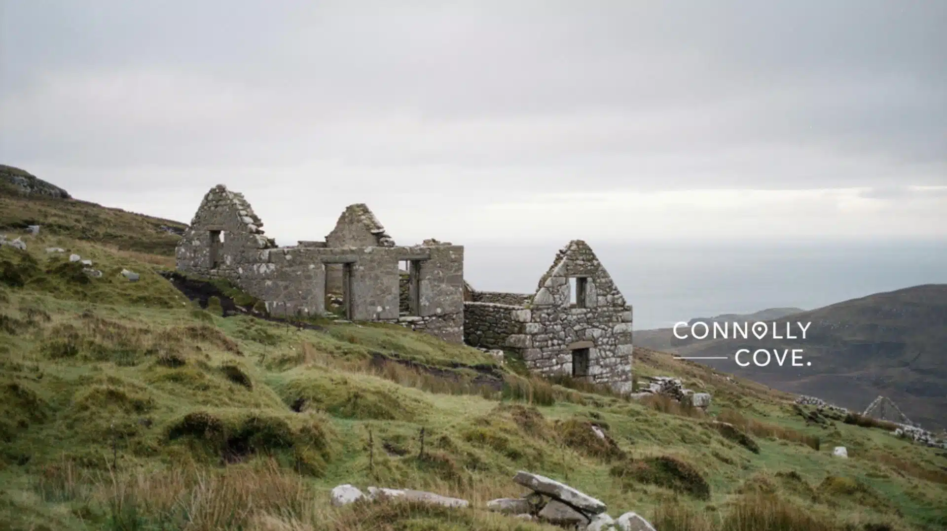
Slievemore Deserted Village, on Achill Island in County Mayo, is one of Ireland’s clearest windows into the Great Famine years. Dozens of stone cottages sit abandoned on the mountainside, their families having left during and after the famine of the 1840s, part of a wider pattern of Irish emigration and rural collapse that reshaped the west of Ireland.
The Great Blasket Island, off the Kerry coast, held its last residents until 1953, when the Irish government decided the island’s isolation had become unworkable. Travellers exploring this region can now reach the Blaskets by ferry from Dingle and walk among the roofless cottages where Irish was the first language of every household.
“A city doesn’t need to be thousands of years old to be lost,” says Ciaran Connolly, Founder of ConnollyCove. “Once the stories of the people who lived there stop being told, the stones become silent. Our job is to listen again.”
Finding What Was Never Mapped
The biggest recent shift in how lost cities are found has nothing to do with shovels. LIDAR, a laser scanning technique usually flown by aircraft or drone, strips away tree canopy in digital models and reveals earthworks, roads and building foundations invisible from the ground.
Between 2022 and 2024, LIDAR surveys across the Amazon basin and the Mayan lowlands identified urban networks far larger than researchers had assumed, including causeways, plazas and thousands of structures hidden under dense jungle for centuries. Rather than a single “lost city” waiting to be found, these surveys suggest entire lost regions of settlement that traditional excavation would have taken decades to map by hand.
This matters for how we think about the term itself. A city doesn’t need to have vanished from human memory to count as lost; it just needs to have been forgotten by everyone except the people who never left. Archaeologists working on these Amazon surveys have described finding causeway networks stretching for many kilometres, connecting settlements that earlier estimates assumed were isolated and small.
The same scanning technology is now being trialled closer to home, with heritage bodies in Ireland and the UK using airborne laser surveys to map earthworks under bracken and gorse that were previously visible only from the air on a clear winter’s day, if at all.
Myth or Memory? Hy-Brasil and the Line Between Legend and Loss
Not every lost place on a map was ever real. Hy-Brasil is a phantom island that appeared on European charts west of Ireland for centuries, said to be cloaked in mist except for one day every seven years. No expedition ever found it, because there was nothing to find.
Yet the legend persisted precisely because Ireland’s west coast really did lose land and settlements to the Atlantic, from Dunwich-style erosion to villages abandoned within living memory. Hy-Brasil sits at the point where genuine coastal loss and pure invention become difficult to separate, an overlap that runs through much of Ireland’s living folklore, from phantom islands out at sea to the fairy trees still left standing untouched in farmers’ fields today.
Visiting Lost Cities Responsibly
Growing visitor numbers put real pressure on sites that were never built to withstand modern tourism. Machu Picchu now limits daily entries and requires timed tickets booked well in advance, while Petra restricts access to certain fragile tombs during peak periods.
Local guides recommend booking through licensed operators, sticking to marked paths, and avoiding peak midday hours when crowds are heaviest. For quieter sites such as Skara Brae or Slievemore, the concern runs the other way: modest visitor numbers make these places feel undiscovered, but that same quiet leaves them reliant on far smaller conservation budgets than their famous counterparts, so a respectful approach and a willingness to pay entry fees where they exist genuinely helps.
Photography is welcome at nearly all of these sites, but drone use is often restricted or banned outright, particularly at Machu Picchu and around Neolithic monuments in the UK. Check local rules before travelling rather than assuming a permit will be issued on arrival.
Planning Your Own Lost City Journey
If you’re planning a trip built around these places, mix at least one internationally famous site with one lesser-known European ruin. A week that pairs Petra with a few days in Ireland’s Mayo or Kerry gives a genuinely different sense of scale, from a city built for an empire to a village abandoned within a single generation.
You can see this contrast for yourself by visiting the Great Blasket Island or Achill’s deserted village and standing where families lived until only decades ago. Many travellers combine these Kerry and Mayo stops with a trip to the Skellig Islands, a monastic outpost that feels every bit as remote as anywhere on this list. ConnollyCove’s guides to Ireland’s western coastline cover the practical details, from ferry times to what to bring for the weather.
Budget travellers should note that the Irish and British sites in this guide cost far less to visit than Machu Picchu or Petra, with most charging a modest entry fee or none at all, though ferry crossings to islands like the Blaskets depend heavily on sea conditions and are best booked with some flexibility built in.
Explore More of Ireland’s Lost and Legendary Places
ConnollyCove covers Irish heritage and mythology alongside destinations worldwide, and the sites in this guide are only a starting point. Readers curious about the myths behind Ireland’s lost places can explore our guide to Celtic mythology’s legendary creatures, the story of the Tuatha Dé Danann, or a closer look at Irish mythological symbols, all of which connect directly to the folklore surrounding places like the Blasket Islands and Ireland’s western coast.
FAQs
Here are quick answers to the questions travellers ask most often about lost cities and Ireland’s own abandoned settlements.
What is the oldest lost city ever found?
Göbekli Tepe in Turkey, dated to around 9500 BC, is among the oldest known settlements. It predates both Stonehenge and the Egyptian pyramids by thousands of years.
Can you actually visit these sites?
Most are open to the public, including Petra, Machu Picchu and Skara Brae. A few areas within them are restricted to protect fragile structures.
How do I pronounce Slievemore, and where is it?
Slievemore is pronounced “sleev-more” and sits on Achill Island in County Mayo, Ireland. It’s reachable by car across the Michael Davitt Bridge.
Are there lost cities in Ireland or the UK?
Yes, including Skara Brae in Orkney, Dunwich in Suffolk, and the deserted villages of Achill and the Blasket Islands in Ireland.
What is the best time of year to visit ancient ruins?
Spring and autumn generally offer smaller crowds and milder weather than midsummer. Always check individual site opening hours before travelling.
Are there still lost cities that haven’t been found?
Researchers believe parts of the Amazon and Central Asia’s steppe regions likely hide unmapped settlements. LIDAR surveys continue to narrow the search each year.