

The Ancient City of Petra: Unveiling the Wondrous Desert’s Architectural Masterpiece
Updated On: April 15, 2024 by  Miranne Khaled
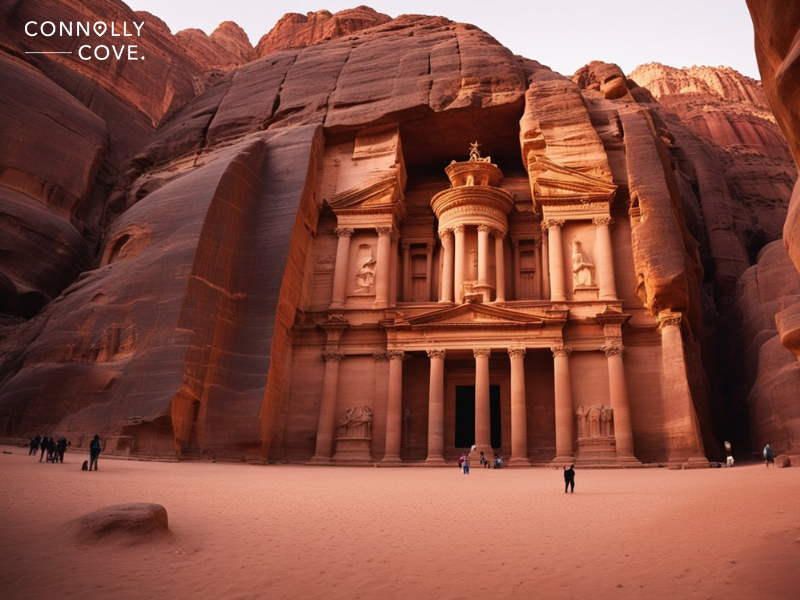
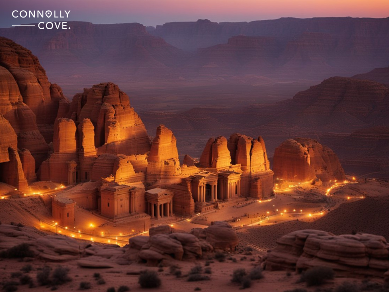
Nestled amidst the rugged desert and mountains of southwestern Jordan lies the ancient city of Petra, one of the most majestic archaeological sites in the world. Known as the ‘Rose-Red City’ for its striking red sandstone architecture, Petra was once a thriving trade hub and the capital of the Nabataean kingdom.
Its strategic location along caravan routes enabled it to flourish from the 4th century BCE until it fell into decline following the Roman conquest and a series of earthquakes. Carved directly into the vibrant bluffs, the monumental facades of Petra’s structures–from the iconic Treasury to the expansive Monastery–echo the ingenuity of its inhabitants.
The city’s sophisticated water management systems, which harnessed the arid climate to sustain life, are a testament to ancient engineering prowess. The architecture presents various cultural influences, indicating its historical role as a melting pot of civilisations.
Petra’s Geography and Climate
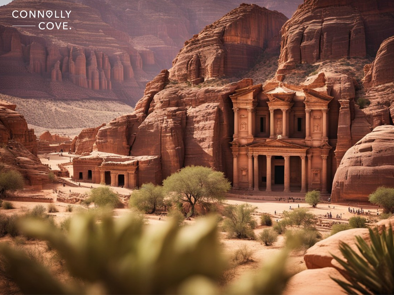
Petra’s enchanting landscape and climate are deeply intertwined, offering a rich tapestry of natural challenges and beauty. It’s one of the most exotic parts of the Middle East. Here, we explore the geography adorned by sandstone cliffs and the elements that shape its distinct seasonal patterns.
Desert Landscape
Our journey through Petra reveals a desert canvas punctuated by rugged sandstone cliffs that define its iconic façade. Erosion has sculpted these formations into a geological masterpiece, blending hues from dusty rose to deep reds. The desert terrain, shaped by centuries of wind and sporadic rain, unfolds amidst a network of gorges and escarpments, creating a natural fortress that has guarded ancient civilisations.
Climate and Seasons
The climate around here is characterised by its dry conditions. Rain is scarce, falling mainly during the cooler months. Spring and fall usher in more temperate weather, making these seasons ideal for exploring the city’s wonders.
Summer, however, can be intensely hot, and the sun beats down on the desert landscape, leaving it dehydrated. At the same time, winter can bring cooler temperatures and occasional downpours that rapidly transform the arid valleys.
Historical Context of Petra
The past spans thousands of years, marked by its origins as a Neolithic settlement, rise to prominence under the Nabataeans, and later transformations under Roman and Byzantine influence. The history of this ancient city can be traced back to prehistoric times. Archaeological evidence suggests that Edomites inhabited it, and later by the Nabataeans, who capitalised on its position on the incense and spice trade routes.
Nabataean Kingdom’s Rise
The Nabataean Kingdom emerged as a political force in the 4th century BCE, and Petra, with its unique architecture carved into the sandstone cliffs, became the kingdom’s capital. As a centre of commerce and craftsmanship, this ancient city flourished, showcasing the Nabataeans’ extraordinary hydraulic engineering capabilities, which sustained the city in the arid climate of Arabia.
Roman and Byzantine Rule
After the Roman Empire annexed the Nabataean Kingdom in 106 CE, Petra continued to thrive until seismic activity, including a devastating earthquake in 363 CE, contributed to its decline. During the Byzantine period, several Christian churches were constructed, adding a new chapter to the complex’s history, but eventually, trade routes shifted, leading to the city’s gradual abandonment.
Architecture and Urban Design
The urban design and architecture blend ancient cultures, predominantly Nabataean, with a solid Hellenistic influence. The city is renowned for its rock-cut facades, which exhibit craftsmanship that has endured for millennia. Amongst these architectural masterpieces, the Treasury and the Monastery are two crowning examples.
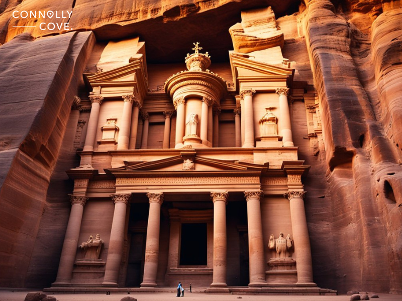
Rock-Cut Facades
The most iconic aspect of the architecture is undoubtedly its rock-cut facades. The Treasury, known locally as Al-Khazneh, is a prime example and a testament to the Nabataean’s exquisite stone-carving skills.
Beyond its striking exterior, the Treasury’s purpose remains mysterious, with some scholars suggesting it may have served as a temple or a royal tomb. Similarly, the Monastery, or Ad-Deir, showcases monumental Greek-inspired columns carved into the pink sandstone, mirroring the grandeur of Nabataean massive construction.
Public Buildings and Monuments
The public buildings and monuments echo the sophistication of its urban planning. The Colonnaded Street marks the city’s main thoroughfare, with ruins hinting at a once bustling epicentre of commerce and ceremony.
The Siq, a narrow gorge leading into the city, provided a dramatic entrance to Petra and served as part of the ingenious water conduit system supporting the city’s infrastructure. The Royal Tombs stand out among the widespread tombs’ impressive facades and interior chambers, indicating their use for high-status burials.
Petra’s architecture also reflects the influence of Roman styles, as seen in the city’s theatre and the later structures built during Roman annexation, marrying local traditions with external influences. Temples like Qasr al-Bint further emphasise the city’s sacred landscape, underscoring the societal importance ascribed to religious sites.
Water Management in Petra
Petra’s survival in the arid Jordanian desert was made possible by an advanced water management system involving intricate dams, cisterns, and irrigation networks.
Cisterns and Dams
The ancient Nabataeans were skilled in creating reservoirs and cisterns, collecting precious rainwater to sustain life during dry spells. These cisterns were strategically placed throughout Petra, carved into the rock and sealed to prevent evaporation.
In conjunction with the cisterns, dams were constructed to redirect water flow from wadis during the rainy season, mitigating the impact of flash floods and storing water for future use. Extensive research highlights the sophistication of these hydraulic structures, which were vital for water conservation in desert cities.
Irrigation Systems
Turning our gaze to Petra’s agricultural prowess, the ancient city thrived due to its extensive irrigation systems. Water drawn from springs and captured in cisterns was distributed via channels and pipes, some underground, to reduce water loss.
A documented system analysis reveals the balance between reservoir storage and continuous flow pipelines, ensuring a constant water supply, even in the arid climate of Petra. This allowed the inhabitants to engage in agriculture, turning the desert landscape into a veritable oasis.
Cultural Influence and Religion
The ancient city of Petra is real-life evidence of architectural mastery and the rich cultural and religious tapestry woven through its history. Within its walls, the confluence of multiple traditions has left an indelible mark that can be explored through Bedouin heritage and the blend of Hellenistic and Arab influences.
Bedouin Tribes
The indigenous Bedouin tribes have been integral to the cultural fabric of Petra. As nomadic herders and traders, their intimate knowledge of the desert and the ancient pathways through Petra was paramount for the survival of this caravan city.
The Bedouin’s oral traditions and customs offer us a glimpse into the past, where Islam and Christianity existed alongside ancient Arabian deities before Islam became the dominant religion in the region. This vibrant interplay of beliefs has shaped the Bedouin culture, evident in their storytelling, poetry, and music, which continue to be passed down through generations.
Hellenistic and Arab Influences
Hellenistic and Arab influences further enriched the region’s cultural landscape. The Nabataeans, Petra’s founders, were greatly influenced by Hellenistic practices. This is visible in the city’s grand architecture, which features classical facades and elaborate tombs, which reflect a blend of Eastern tradition with Hellenistic styles.
As Petra was absorbed into the Roman Empire, the influence of Arab customs also became prominent, infusing local traditions with new religious beliefs and practices. Christianity in Petra is traceable through numerous Byzantine churches, whereas the Islamic faith left its mark after the town’s decline, further contributing to the religious diversity of this ancient city.
Trade and Economy
By understanding the ebb and flow of the region’s economy, we can appreciate the grandeur of what was once a bustling, rich metropolis, now standing as an architectural marvel carved into the cliffs that bore witness to its former glory.
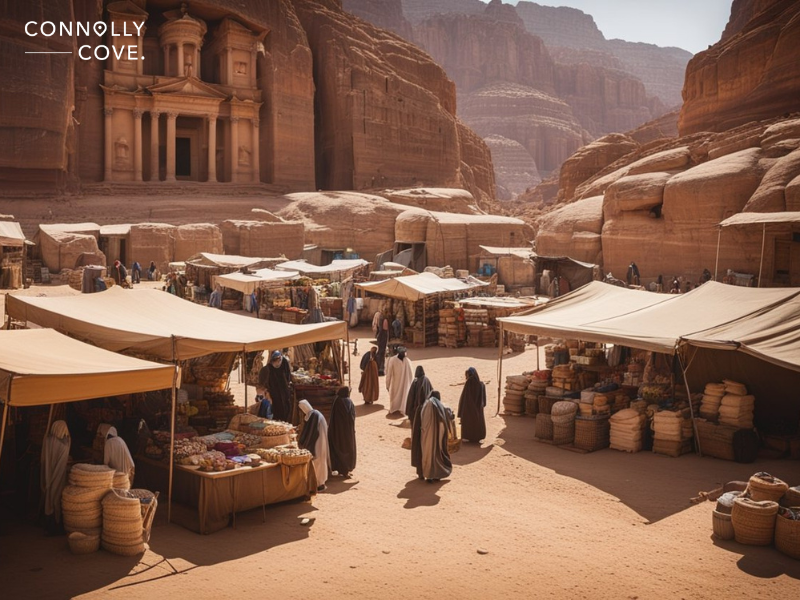
As we delve into the history of Petra, it’s imperative to understand the pivotal role trade and commerce played in the prosperity of this ancient city. Positioned strategically, Petra was a crucial hub for traders journeying through harsh deserts carrying valuable commodities.
Trade Routes and Commodities
Petra flourished due to its location on major trade routes that connected the Arabian Peninsula, Syria, and Egypt. The primary commodities traded included silks, spices, and incense. These were not only significant for the economic strength of Petra but also contributed to its cultural and architectural diversity. The Nabataeans, masters of water conservation, made Petra a stopover for caravans, giving rise to commerce and exchanging goods.
Economic Peaks and Declines
During its economic zenith, Petra became synonymous with wealth and was colloquially known as the ‘Lost City. However, the city’s affluence lasted only a short time. Economic declines were inevitable, brought on by shifts in trade routes and natural disasters. The once-thriving town saw a gradual decrease in trade activity, ultimately leading to its decline as a commercial hub.
Modern Petra and Its Significance
As we explore Petra’s vast and intricate history, we cannot overlook its present-day prominence and poignant cultural and historical resonance.
Tourism Impact
The allure of this magnificent desert as part of the New 7 Wonders of the World draws countless travellers eager to witness its majestic structures and unique landscapes. The influx of tourism is a vital source of income, positively impacting the local economy.
The Bedouins, indigenous to the region, have found opportunities in servicing the tourism sector, from guiding tours to selling traditional wares. However, the Petra Archaeological Park faces the challenge of accommodating visitors and preserving the site’s integrity.
Cultural and Natural Conservation
Conservation efforts in Petra are multi-faceted, aiming to protect its cultural significance and natural beauty. The park has implemented measures to sustain the historical monuments while safeguarding the surrounding ecology.
These efforts encompass strict regulations to minimise the environmental footprint of tourism, preserving Petra for future generations and continuing archaeological research that unravels the city’s storied past.
Petra: A UNESCO World Heritage Site
In 1985, we witnessed the designation of Petra as a UNESCO World Heritage Site, which is a testament to its historical significance and the need for its preservation. This ancient archaeological site, often described as the rose-red city due to the colour of the stone from which it is carved, represents a fusion of Hellenistic architecture with Eastern traditions.
Petra is a proud reminder of the region’s historical wealth and role in shaping human history. We take pride in this wonder, committing ourselves to preserving its mysteries and stories.
Breton Language: Safeguarding the Rhythmic Pulse of Brittany’s Celtic Heart
Culture Exploration
29/04/2024

The Enchanting Helen’s Bay Beach – Northern Ireland
Northern Ireland
29/04/2024

Discover The Mythical Valkyrie Horses: Steeds of Legend
Mythology and Folklore
28/04/2024

Exploring the Concept of Anam Cara: A Celtic Perspective on Soul Friendship
Culture Exploration
29/04/2024

Kensington Palace – London Attractions
England
29/04/2024