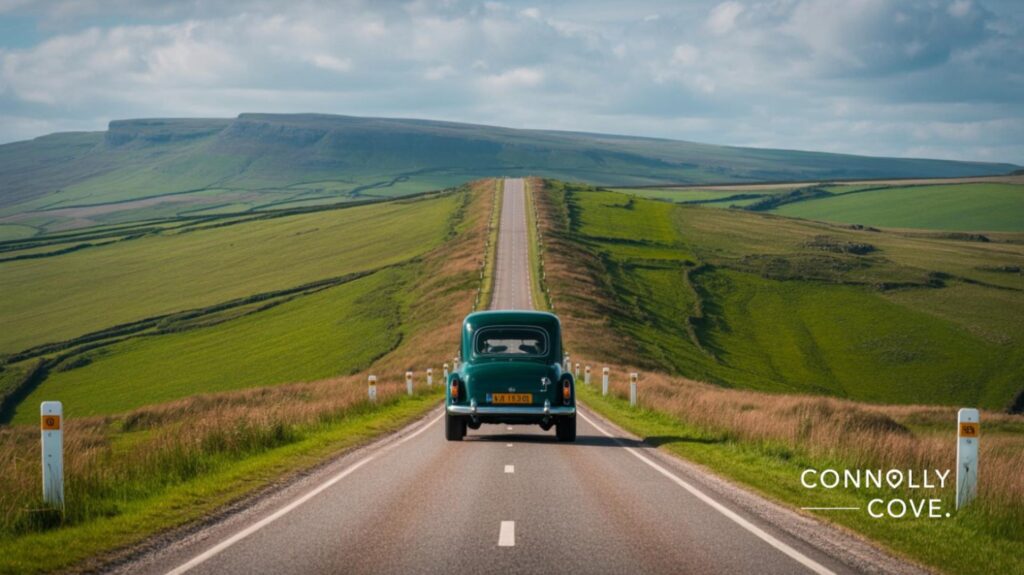
Scenic drives in England take you through some of the most varied landscapes in Europe. Within a few hours’ driving distance of each other, you can cross heather-covered moorland, drop into limestone gorges, follow a coastline that has barely changed in a century, and wind through villages built from the same stone as their medieval churches. England is compact enough to road-trip properly.
What follows is a practical guide to seven routes worth building a trip around. Each one offers something distinct: a different terrain, a different pace, a different reason to pull over. Whether you’re crossing from Ireland for a week or planning a domestic break, these drives give you something to aim for.
Table of Contents
What to Know Before You Drive in England
England’s road network mixes motorways with genuinely narrow rural lanes. If you’re arriving from abroad, particularly from the US, Australia, or mainland Europe, a few things are worth knowing before you set off.
Traffic in England travels on the left. Roundabouts give way to traffic already on the roundabout. Many scenic routes use single-track lanes with passing places, particularly in the Peak District and Yorkshire. These are manageable at low speeds but can catch out drivers used to wider roads.
The routes in this guide range from well-maintained A-roads to winding B-roads. A standard hatchback handles all of them in good condition. Check weather and road conditions before attempting mountain passes like Hardknott or the Snake Pass in winter, both of which can close with snow.
For visitors planning to drive several routes across a week or two, ConnollyCove’s guide to dates and experiences in Belfast provides a useful companion for those crossing the Irish Sea to continue exploring the wider Celtic landscape of the British Isles.
The 7 Best Scenic Drives in England
The routes below are grouped by region rather than strictly ranked; each one excels in a different way. The comparison table gives you a quick overview before the details.
| Mountain/moorland | Region | Distance | Terrain | Best Time |
|---|---|---|---|---|
| The Atlantic Highway (A39) | South West | ~100 miles | Coastal / clifftop | May–September |
| The Snake Pass (A57) | Peak District | 26 miles | Villages/farmland | April–October |
| The Cotswolds Circular | Central England | ~100 miles | Lakes/fells | April–June, Sept |
| The Lake District Circular | Cumbria | ~80 miles | Moors/coast | May–September |
| Yorkshire Moors and Coast | North Yorkshire | ~90 miles | Mountains/waterfalls | May–October |
| The Brecon Beacons | South Wales border | ~70 miles | Coast/castles | Year-round |
| Northumberland Coast | North East England | ~60 miles | Coast / castles | May–August |
1. The Atlantic Highway (A39) — The Celtic Coast of the South West
The Atlantic Highway runs along England’s western edge from the Devon and Somerset border down through Cornwall to the tip of the peninsula near Land’s End. This is the drive for anyone interested in the deep Celtic history of Britain. Cornwall was a Celtic kingdom long after the Romans left, and the names, the stone hedges, and the standing stones along this route reflect that.
The road itself hugs clifftops and dips into wooded river valleys, passing through towns like Bude, Camelford, and Wadebridge. Tintagel, the site associated with the Arthurian legends, sits just off the route. Whether or not you follow those stories, the headland above the castle ruins is one of the most dramatic viewpoints in England.
The best section for driving is between Bude and Bodmin Moor, where the landscape opens up, and the Atlantic appears repeatedly on the horizon to the west.
2. The Snake Pass (A57) — Peak District Drama
The Snake Pass is 26 miles of concentrated landscape between Glossop in the west and Sheffield in the east. At its highest point, it reaches 512 metres. The road is named after the serpentine family crest of the Duke of Devonshire, whose land it crosses, though the name suits the road perfectly.
This is a route for drivers who want to feel the landscape rather than just pass through it. The gritstone edges that define the eastern Peak District drop away on either side as you climb, and on clear days the views stretch well beyond the national park boundary.
Check road conditions before travelling in winter. The pass closes periodically with snow and ice from December through February. Spring and autumn give the best combination of clear air and manageable traffic.
3. The Cotswolds Circular — Villages and Limestone
The Cotswolds Circular covers roughly 100 miles between Chipping Campden in the north and Cirencester in the south, passing through the core of the Area of Outstanding Natural Beauty. The landscape here is gentler than the north: honey-coloured stone villages, sheep-grazed hillsides, and market towns that have looked much the same for three or four centuries.
Bourton-on-the-Water, Burford, and Bibury are the most visited stops, and they earn the attention. The trade-off is that weekends between May and September bring significant visitor numbers. An early start or a midweek visit makes a considerable difference.
The elevated section around Broadway and the Broadway Tower gives panoramic views across the Vale of Evesham. The tower was built in the 18th century as a folly and now functions as a viewpoint and small museum.
4. The Lake District Circular — England’s UNESCO Landscape
The Lake District is England’s only UNESCO World Heritage Site listed for its cultural landscape, not just the geography, but centuries of farming, literature, and human habitation that shaped it. Windermere, Coniston, and Ullswater are the three lakes most accessible by road, and a circular route connecting them covers around 80 miles.
The driving is not always fast. Roads between the lakes are often single-track with passing places, and popular car parks fill quickly on summer weekends. Approach this drive as a slow journey rather than a route to complete efficiently.
The Hardknott Pass and Wrynose Pass, linking the Duddon Valley to the central lakes, are optional additions for drivers who want a genuine mountain road experience. Both are steep, narrow, and rewarding in good conditions.
5. Yorkshire Moors and Coast — Heather, Steam Trains, and Gothic Ruins
Starting in Helmsley and following the edge of the North York Moors National Park east toward the coast, this route covers around 90 miles of some of England’s most open landscape. The moors themselves bloom purple in late August when the heather flowers; if you can time the visit, the drive across the central moorland between Pickering and Whitby is exceptional.
Whitby sits at the end of the coastal section and earns its reputation. The ruined abbey on the clifftop above the harbour was the direct inspiration for Bram Stoker’s Dracula, and the town has built carefully on that connection without letting it overpower the working fishing port below.
The North Yorkshire Moors Railway runs steam trains between Pickering and Whitby, parallel to part of the driving route. It’s worth stopping at Pickering to watch a departure before continuing.
6. The Brecon Beacons — Mountains and Water
The Brecon Beacons National Park sits on the border between England and Wales, and the A470 running through it is the main artery of a route that connects waterfalls, mountain summits, and market towns across roughly 70 miles.
Pen y Fan is the highest peak in South Wales at 886 metres. The drive to the base of the main walking routes gives you a clear view of the ridge from below, and the surrounding moorland is open and dramatic even from the road.
The Beacons are designated a Dark Sky Reserve. If you’re overnighting in the area, clear nights between October and March give exceptional star visibility away from town light pollution.
7. The Northumberland Coast — Castles, Saints, and the North Sea
The Northumberland coast road runs from Alnmouth in the south to Berwick-upon-Tweed near the Scottish border, covering around 60 miles. This is England’s least visited coast, despite holding some of its most significant history. Bamburgh Castle stands on a basalt outcrop above the beach.
The Holy Island of Lindisfarne, accessible by causeway at low tide, was the centre of early Northumbrian Christianity and the location where the Lindisfarne Gospels were produced in the 8th century. The landscapes here share something with the west coast of Ireland and the Hebrides: a feeling of being at the edge of something, with nothing between you and the North Sea.
ConnollyCove covers the broader cultural connections between the Celtic and early Christian heritage of Ireland and Northumbria in our guides to Celtic mythology and the British Isles. The road itself is straightforward A and B-class driving; the challenge is finding the time to stop at every point that deserves it.
Planning Your English Road Trip
When to go: May through September gives the most reliable weather across all seven routes. August is the busiest month in the Lake District and Cotswolds; late May, June, or early September offer a better balance of weather and visitor numbers.
How long to allow: A focused two-week trip covers four or five of these routes comfortably. A week is realistic for two adjacent routes explored properly.
Car hire: Standard hire cars handle all seven routes. A higher-ground-clearance vehicle is useful for Hardknott Pass and some moorland tracks, but not strictly necessary. Fuel up in towns before heading into national parks. Petrol stations on scenic routes are infrequent.
Explore More on ConnollyCove
ConnollyCove covers travel destinations across the British Isles and beyond, with a focus on cultural depth and practical guidance. For travellers extending a road trip into Northern Ireland or the Republic of Ireland, our destination guides cover Celtic mythology sites and landscapes, coastal routes, and the cultural heritage that connects the islands. Visit ConnollyCove for travel guides built around the stories, traditions, and landscapes that make a journey worth making.
Frequently Asked Questions
England’s roads hide some of the country’s most dramatic landscapes, and most travellers never leave the motorway to find them. These questions cover the routes, practicalities, and planning details that make the difference between a good drive and a memorable one.
What is the most scenic road in England?
The Atlantic Highway along the Cornish coast and the Snake Pass through the Peak District are widely considered the most dramatic. The best choice depends on whether you prefer coastal or mountain scenery.
Where is the best place for a 3-day road trip in England?
The Yorkshire Moors and Coast route covers enough variety for three days, combining moorland, heritage steam railways, and the coast at Whitby. The Lake District is a strong alternative for those who prefer mountain landscapes.
Is driving in the Lake District difficult?
The main lake roads are straightforward, but the mountain passes — Hardknott and Wrynose — are steep and narrow. For most visitors, the core circular route between Windermere, Keswick, and Ullswater presents no serious difficulty.
Is the Snake Pass suitable for motorhomes?
The Snake Pass is not recommended for large motorhomes or caravans due to steep gradients and limited overtaking space. Standard campervans can manage it in good conditions, but check the current road status before travelling.