

Exploring Phantom Islands: Charting the Myths and Histories of Nonexistent Shores

Updated On: April 23, 2024 by  Ciaran Connolly
Throughout history, sailors and cartographers have been enticed by the mystery of uncharted territories. Phantom islands, lands once charted on maps but non-existent in reality, represent the intriguing confluence of exploration, myth, and error. These elusive locales appeared in navigational maps, fuelled by a combination of hearsay, flawed sightings, and wishful speculation, leading many adventurers on fruitless quests across the vast oceans. The allure of these phantom islands captivated the imaginations of explorers and storytellers alike, spawning a rich tapestry of myth and folklore.
Our understanding and technology have evolved, and today we know that these islands were mirages of the high seas—yet our fascination with them remains undiminished. The quest to uncover the truth behind these legendary lands has given rise to a different kind of exploration: delving into historical records, investigating scientific phenomena, and examining the cultural impact these islands have had on society. The stories of phantom islands prompt us to ponder the limits of human perception and the enduring quest for discovery, reminding us that reality can be as elusive as fiction.
Key Takeaways
- Phantom islands captivated both explorers and the lore of societies.
- Their non-existence has been revealed through advancements in navigation and science.
- These legends reflect the intersection of human imagination and the pursuit of knowledge.
The Allure of Phantom Islands

Phantom islands have captivated our imaginations for centuries. These elusive landforms, often born from the blend of optical illusions at sea and mariners’ hopeful stories, represent the quintessential desire for discovery beyond the horizon. It’s the allure of the unknown and the potential for adventure that draws us to the tales of phantom islands.
Often, these islands were depicted on historical maps, supported by legends and sporadic sightings. Over time, some of these landforms were proven to be mere mirages or illusions, while others remained shrouded in mythology. The stories surrounding phantom islands weave a fascinating tapestry of natural phenomena and human desire to believe in something greater than ourselves.
We find a certain romance in the narratives of phantom islands, such as Saint Brendan’s Island, a place that haunted the Canary Islands and played with the sight of many hopeful explorers. The myth of this island could be an interplay between desire and the atmospheric phenomenons that trick the eye—known scientifically as Fata Morgana.
In the realm of imagination and reality, these mysterious islands serve as reminders of our world’s secrets yet to be unveiled. They tap into our innate curiosity and provide a narrative for human ambition in the face of the vast and uncharted seas.
Through stories and expeditions, we have ventured in search of these islands, often finding ourselves instead, and learning that the true discovery lies in the journey, not just the destination. The allure lies not just in the potential physical presence of these islands, but in what they represent: the quest for knowledge and the infinite possibilities that unfold before us when we dare to explore.
Mapping the Nonexistent
In the realm of cartography, the drawing of maps expands beyond the recording of known territories. It’s a narrative of exploration, where imagination and erroneous data often led to the inclusion of non-existent lands, or ‘phantom islands,’ that captivated and misguided seafarers and scholars alike.
Cartographic Errors
In the history of mapmaking, errors were commonly propagated due to limited information and the inherent difficulties of early exploration. Cartographers often relied on the reports of sailors who might have misinterpreted natural phenomena or were intentionally deceitful. Misplaced coordinates or misidentified landforms also contributed to these errors, and some islands were mistakenly sketched into existence, such as the elusive Sandy Island, which persisted on maps into the 21st century until Google Maps and satellite imagery conclusively disproved its existence.
Myths and Tall Tales
Anchored in the tradition of storytelling, these non-existent islands often stemmed from myths and tall tales shared among seafarers. These fabricated lands sometimes held the promise of untold riches or were feared for alleged curses. Cartographers, lured by such stories, incorporated these islands into their maps, reinforcing the myths. The Island of Frisland, a phantom island often found on 16th-century maps, is one such example that likely originated from misidentified real islands or fictional tales among sailors.
Technological Advancements
With advances in technology and more accurate surveying instruments, cartography shifted to a more empirical science. Mistakes and errors can now be systematically corrected, unlike in the past when dubious islands might remain on maps for centuries. The modern era of digital mapping platforms, such as Google Maps, shows how technology has enabled us to create detailed and accurate depictions of the world’s geography. Yet the allure of phantom islands endures, highlighting our continuing fascination with the unknown and the allure of exploration.
Famous Phantom Islands
As we navigate through the annals of maritime exploration, we encounter tales of islands that captivated the imaginations of sailors and explorers but ultimately proved to be illusions. These ‘phantom islands’ were often included in nautical charts and maps, reflecting a blend of legend, optical phenomena like the Fata Morgana, and genuine cartographic mistakes.
Isle of Demons
Located in the frigid waters of the Atlantic, near Greenland, the Isle of Demons was once charted due to mariners’ and cartographers’ reliance on hearsay and seafaring lore. Believed to be inhabited by demons and other fantastical creatures, it served as a stark warning for those considering a journey into the unknown.
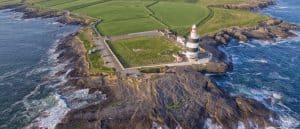
Hy-Brasil
Off the coast of Ireland lies the legend of Hy-Brasil, an island said to be cloaked in mist except for one day every seven years. It was sought by many but remained elusive, existing only in the realm of myth and mirage, woven into the rich fabric of Irish culture through centuries of folklore.
Sandy Island
In the vast expanse of the Pacific, Sandy Island was documented in numerous charts, even appearing on Google Maps before being undisputedly debunked. Once thought to lie east of Australia in the Coral Sea, expeditions revealed it to be nonexistent, highlighting the enigmatic nature of maritime exploration and cartography.
Bermeja
To the north of the Yucatan Peninsula, the phantom island of Bermeja was depicted for over three hundred years. Mysterious in its disappearance, it fueled conspiracy theories and disputes over oil in the Gulf of Mexico, though it was likely an error or an illusion influenced by the shifting sands of time and sea.
The Role of Nature

In exploring phantom islands — landmasses once charted but now vanished — we must consider how nature has shaped maritime history through its deceptive and dynamic forces.
Optical Illusions at Sea
When we sail the vast oceans, our eyes can be deceived by complex phenomena. Fog and optical illusions at sea, such as Fata Morgana, can distort the appearance of objects, creating illusions of islands where none exist. Mariners historically navigated by sight under challenging conditions where wind, waves, and fog could combine to trick the eye. This natural trickery often led to the charting of non-existent landforms based on transient, illusory sightings.
Geographic Changes
Geography is not a constant; nature is always in flux. Volcanic activity with its potential for eruption and rising sea levels are forces that can give birth to islands only to reclaim them. Throughout history, islands have emerged from volcanic eruptions, only to be eroded away or sunk by tectonic movements. Similarly, erosion driven by wind and water can gradually wear down landmasses, potentially causing islands that once poked above the surface of the sea to disappear, further fuelling the legend of phantom islands.
Legends and Lore
In this journey through myth and narrative, we uncover the mysterious tapestry of phantom islands that have captivated explorers and dreamers alike.
Mythical Islands of Adventure
The search for fantastical islands has long sparked the imagination of adventurers. Among the most whispered-about is the legend of Atlantis, a supposed utopian civilization that Plato claimed sank into the ocean in a single day and night of misfortune. Despite numerous theories about its location—ranging from the Mediterranean Sea to the Caribbean—Atlantis remains as elusive as ever, inviting speculation and exploration.
Venturing towards the Atlantic, the Isle of Saint Brendan is often summoned from the mists of myth, where it is believed that Saint Brendan and his monks embarked on a voyage possibly reaching as far as Newfoundland. Their accounts of an “Isle of the Blessed” echo the human yearning for a paradisiacal utopia and continue to inspire spiritual and physical voyages in search of revelation and discovery.
Islands in Literature
Literature has proven to be a fertile ground for the brewing of island myths. We see this in works like Thomas More’s Utopia, a fictional island society that has become synonymous with the very idea of a perfect society; a blueprint so influential it has permeated our language and our political thought.
Canonised in fiction, these isles often serve as backdrops for introspection and societal critique. Phantom islands like Hy-Brasil, which features in Celtic mythology and is sometimes linked to the stories of Saint Brendan, are depicted in literature as places of enigma and ephemeral beauty, as explored in detailed imagery on platforms like Connolly Cove. Fiction, therefore, becomes a canvas for projecting our deepest desires and fears about what lies beyond the sea’s horizon.
Exploring Phantom Locations

The veil of mystery surrounding phantom islands has long captivated us, beckoning explorers to embark on quests that blend the lines between myth and reality.
Expeditions and Discoveries
Throughout history, there have been numerous expeditions launched to uncover the truths behind these elusive lands. A case in point is Saint Brendan’s Phantom Island in the Canary Islands, which some adventurers believe to be more than mere legend. Efforts to locate this island proved fruitless, even though it appeared on various maps until the 19th century. Reports, such as the one by photographer Manuel Rodríguez Quintero in 1957, only added to the island’s mystique, with sightings that sparked further intrigue amongst modern explorers and historians.
Like the search for the aforementioned phantom island, the discovery of Bouvet Island presents a compelling narrative. First sighted in 1739 and long considered a ghost, this island eluded confirmation until it was finally recognised as a real location over two centuries later. Bouvet Island now features as a waypoint for some Antarctic cruises, offering a unique adventure for those who yearn to stand where once was thought to be only the illusion of land.
The Modern Adventurer
Today, our adventures are fueled not by the sails of ships but by digital exploration and the consolidation of historical data. The compilation of materials such as The Phantom Atlas reveals how errors and imagination shaped the geographical knowledge of ancient times. Dedicated explorers have used these resources to inform their travels, tracing the ghostly outlines of lands once believed to be real.
Modern technology and the expansive reach of organisations such as the CIA have made it possible to survey the world like never before, leaving few corners uncharted. Yet, the allure of phantom locations persists, encouraging a new breed of adventurers to undertake tours in search of understanding the past’s misconceptions. These adventurers don’t navigate by stars but by satellites, transforming what was once an exhibition into a digital quest that can be embarked upon from anywhere in the world, as reflected by resources found on the comprehensive platform at Connolly Cove.
Vessels of False Hopes

In the annals of exploration, our search for new lands has often led us astray. Navigators and explorers charted the unknown with a mix of both fact and fiction, giving rise to the term ‘phantom islands‘. These are lands once believed to exist, marked on maps but never truly there.
We recount stories of Benjamin Morrell, an American explorer whose accounts of discoveries were later proved to be erroneous. His tales of new lands were often woven with inaccuracies, feeding the imaginations of many but leading to no real shores. Similarly, a Frenchman once reported the sighting of ‘Saxemberg Island’ in the South Atlantic, a phantom that captivated many, including reputable charts until the 1850s.
Not all quests for phantom islands concluded without legacy. The recognised Arctic explorer Robert Peary aimed for the North Pole but came across ‘Crocker Land’—an illusion. His earnest pursuit illustrates the allure that these non-existent islands held for explorers, serving as vessels carrying their hopes and dreams of new findings.
Here is a brief table of such phantoms:
| Phantom Island | Region | Notable Pursuer |
|---|---|---|
| Saxemberg Island | South Atlantic | Various navigators |
| Crocker Land | Arctic | Robert Peary |
These vessels of false hopes were part of a collective fascination with map-making and discovery, despite often leading to disappointment. While they do not exist in reality, these islands are firmly anchored in the rich repository of navigational lore and continue to ensnare the curious minds.
Islands Vanishing from Maps
In the realm of cartography, islands often appear and disappear, much to the fascination and confusion of mapmakers and explorers alike. Throughout history, the existence of certain islands, such as the elusive Bermeja in the Gulf of Mexico, has been contested. Once featured on maps, Bermeja has since vanished, leaving a trail of mystery and speculation in its wake.
Our maps have evolved significantly with advances in technology. While early cartographers once relied on sailor’s tales and exploratory reports, modern mapmakers can use satellite imagery and advanced surveying techniques. Still, the phenomenon of phantom islands persists, even in the age of Google Maps. Some of these islands were removed after careful re-examination revealed they never existed, products of errors, or misinterpretations.
Consider the table below, outlining a brief history of islands that have disappeared from modern maps:
| Island Name | Location | Map Appearance | Disappearance |
|---|---|---|---|
| Bermeja | Gulf of Mexico | Shown on 16th-century maps | After 17th century |
| Sandy Island | Coral Sea | Included in 19th-century nautical charts | 2012 satellite imagery |
It remains our responsibility as stewards of geography to continue updating and correcting our maps, ensuring that they reflect the most accurate representation of our world. Despite the occasional cartographic error, this ongoing process illustrates our commitment to precision and the dynamic nature of geographical knowledge.
Cultural Impact of Phantom Islands
Phantom islands have left an indelible mark on our collective psyche, stirring the imagination and influencing both artistic expression and voyages of discovery. These fabled lands have been more than just cartographic errors; they are a testament to humanity’s longing for the unknown and the allure of the stories we weave around them.
Inspiration for the Arts
Our fascination with phantom islands has often found its way into the arts. They have served as muses to a myriad of creatives – writers, filmmakers, and artists have drawn upon these enigmatic locales to craft narratives that capture our sense of wonder. Notably, phantom islands like the elusive St. Brendan’s Island in the Canary Islands have been immortalised through tales that blend the boundaries of piety and adventure. Our curiosity about these non-existent lands continues to spark creativity, fuelling artworks and literature that resonate with the mysterious allure of the unexplored.
Influence on Exploration
Phantom islands have also played a significant role in driving explorers to embark on daring expeditions, shaping the course of maritime discovery. The quest to locate these islands has led to accidental discoveries and expanded our knowledge of the globe. French noblewomen like the storied Marguerite de La Rocque were marooned in places once believed to be phantom islands, their lives transforming into survival tales woven into the fabric of maritime lore. The drive to find these islands did not just alter maps; it changed our understanding of the world and our place within it.
Our forays into the unknown were not always based on evidence; tales of phantom islands such as those described by Malachy Tallack in his explorations of myths and legends have fuelled a long-standing affair with the mysterious and the potential of ‘what could be’. Our eagerness to believe in the existence of these islands demonstrates a collective yearning for mystery and the inherent desire to be part of a story larger than ourselves.
Scientific Explanations

Before diving into the specifics, it’s essential to grasp that the scientific explanations behind phantom islands hinge on natural optical illusions and human mistakes. These elements have historically led to the inclusion of nonexistent lands in nautical charts and maps.
Natural Phenomena
Optical effects, particularly a type of mirage known as fata morgana, are natural occurrences in which the bending of light rays in certain atmospheric conditions creates the illusion of landscapes or islands that don’t actually exist. These complex mirages can project distant objects or the sky onto the horizon, leading sailors to mistakenly believe they see new lands.
Human Error
Navigation and mapping inaccuracy, including errors and mistakes due to dead reckoning—predicting one’s position based on estimated speeds over time without celestial navigation—have often resulted in the charting of phantom islands. These unintentional slip-ups, combined with the lack of precise measuring devices of the past, accounted for the belief in islands that were later disproven.
Conclusion

In our quest to understand the allure of phantom islands, we have traversed through a tapestry of intrigue woven by legends and explorations. The concept of phantom islands is an enthralling subject that has captivated mariners, cartographers, and adventurers alike. With our investigations, we have unravelled the mystery behind these enigmatic landfalls that, for a time, claimed a place on maps and in the collective imagination of explorers.
Historical records provide evidence of the powerful draw of these non-existent isles. Their stories range from Saint Brendan’s imaginary voyage to the Canary Islands to the charted but elusive destinations born from navigational errors and fanciful yarns. Even with advancements in navigation and cartography, the lore of phantom islands continues to ignite a spirit of adventure.
As we chart the ebb and flow of these legends, let us acknowledge the relentless human pursuit of the unknown that gave rise to them. Phantom islands may have faded from nautical charts, but their legacy endures, painting a rich portrait of human curiosity and the ever-evolving map of our world’s geography. Through our exploration of these myths, we have glimpsed the profound desire to discover and make sense of the world around us—a desire that, like the tales themselves, remains an indelible part of our history.
Frequently Asked Questions

In this section, we’ll explore some of the most intriguing inquiries regarding phantom islands, places once charted and believed to be real, yet later discovered to be illusions of the high seas.
What defines a phantom island in historical cartography?
A phantom island refers to a landmass that was recorded on historical maps for periods of time during exploration but later was proven not to exist. Such islands appeared due to a variety of errors, including misidentification of icebergs, fog banks, or even deliberate fabrications.
Can you detail any myths surrounding islands that vanish?
Myths often weave tales of islands that are said to disappear, shrouded in the mist of seafaring lore. For instance, the myth of Saint Brendan speaks of an elusive island visited by the saint during his legendary maritime voyages, as its story haunts the local tales of the Canary Islands.
Is there evidence supporting the existence of Frisland?
Frisland is a phantom island that appeared on many maps of the North Atlantic from the 1560s through to the 1660s. Despite its frequent depiction, no concrete evidence has surfaced to support the existence of Frisland; it remains a product of cartographic errors or perhaps wishful thinking of the mapmakers of the time.
Which islands were frequently believed to exist but proved to be nonexistent?
Certain islands consistently found their way onto maps despite their nonexistence. Phantom islands such as Antillia vanished from maps post-Columbus’s voyages in light of the New World discoveries, with historic speculation linking Antillia to real-life places like Cuba.
How have phantom islands influenced maritime exploration?
Phantom islands often spurred oceanic exploration as mariners sought to locate these elusive lands and capitalise on the resources they were believed to hold, guiding many explorers’ routes and contributing to the discovery of actual lands and new trade routes.
What are some notable navigational errors resulting in the charting of nonexistent islands?
Navigational mistakes were commonplace in the era of early exploration, occasionally leading to the charting of islands that would later vanish from nautical maps. For example, Bermeja, an island reputedly located in the Gulf of Mexico, was documented as early as the 1530s but later could not be found in subsequent surveys or expeditions.

The Fascinating Genetics Behind Red Hair: Exploring the Rarity and Origins of Redheads
Culture Exploration
05/05/2024
The Authenticity of East Ireland at Wexford County
County Wexford
05/05/2024

Must See Belfast: An Insider’s Guide to the Best of Belfast
Northern Ireland
05/05/2024

Florence Court: 18th Century House in County Fermanagh
County Fermanagh
05/05/2024

History’s Most Successful Female Pirate Queen: Zheng Yi Sao
History and Heritage
05/05/2024