
Article Summary
What this article covers: How Bedouin trails and camel caravans crossed the deserts of Arabia and Sinai, and how those old paths now form the 1,200km Bedouin Trail between Jordan and Egypt, including which sections are open today.
Who this is for: Travellers planning a trip to Jordan or Egypt’s Sinai, hikers researching the Bedouin Trail, and culture lovers curious about desert nomads and caravan history.
Key takeaway: The Bedouin Trail was designed to run from Petra to Luxor, but only its Jordanian sections are currently open; the Wadi Rum Trail is the best place to walk a real Bedouin route with the tribes who manage it.
Expert insight: “The Wadi Rum Trail describes itself as old trade, shepherd, hunting, and Hajj paths joined into one circuit, and that’s what draws me to Bedouin trails. Traders and shepherds walked these routes long before hikers arrived, and the best way to follow them is still with the families who know every well and pass.”, Ciaran Connolly, Founder of ConnollyCove
Quick facts:
- The Bedouin Trail runs more than 1,200km from Petra in Jordan to Luxor in Egypt, through the territories of seven Bedouin tribes.
- The Wadi Rum Trail is a 120km, ten-day circuit in southern Jordan, created and guided by Wadi Rum’s Bedouin tribes.
- According to the Bedouin Trail organisation, the Egyptian sections have been closed to hikers since late 2024.
Table of Contents
Bedouin trails are the paths that desert nomads used for centuries to move herds, carry trade goods and reach pilgrimage routes across Arabia and the Sinai. Camel caravans followed them from well to well, guided by people who read the stars, the wind and the shape of the rocks. Many of those same routes are now walkable again, as part of a long-distance hiking project run by the tribes themselves. ConnollyCove, an Ireland-based travel and culture platform, has covered the region’s society and customs in our guide to the Bedouins of the Arabian Desert. This article follows their roads instead.
Bedouin trails stretch across Jordan, Egypt’s Sinai Peninsula, and the wider deserts of Western Asia. Below, you’ll find how camel caravans worked, which ancient routes mattered most, and what the modern Bedouin Trail covers. We also cover what’s open now, when to go, and how travellers from Ireland, the UK and beyond can plan a trip. Along the way, we point out a few parallels with Ireland’s own traditions of seasonal herding and oral storytelling.
What Are Bedouin Trails?

Bedouin trails are the traditional routes desert nomads used to move between grazing grounds, wells, markets and pilgrimage roads. They were never marked on the ground. They lived in memory, passed from one generation of herders and caravan guides to the next.
Movement followed the seasons. Many Bedouin groups moved deeper into the desert during the rainy winter months, when fresh grazing appeared. When the land dried out, they returned towards wells and cultivated areas. The trails linked these seasonal places, and the camel made the whole system possible.
The camel earned its old nickname, the “ship of the desert”, by carrying people and heavy loads over long distances with little water. Bedouin herders favoured the one-humped dromedary, which suits the hot deserts of Arabia and North Africa. The animals also supplied milk, a daily staple on the move. A family’s camels were transport, food and wealth all at once.
What Is a Camel Caravan?
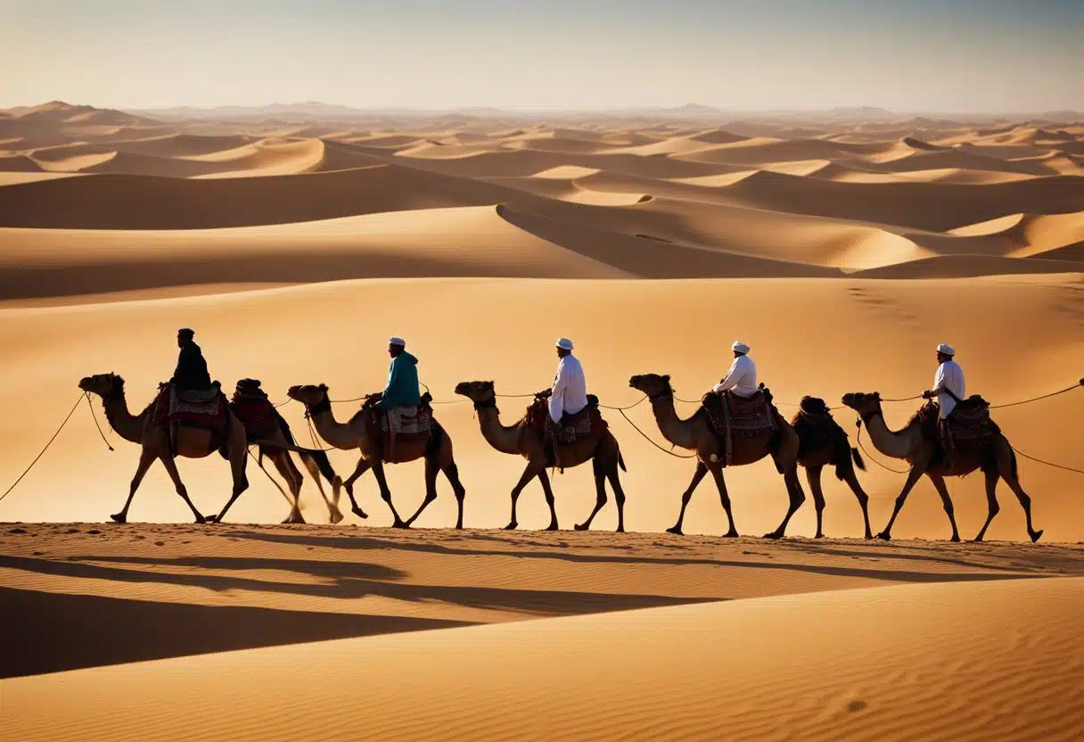
A camel caravan is a group of people and pack camels travelling together, usually for trade or pilgrimage, across desert country. Travelling as a group offered safety in numbers, shared supplies and the benefit of an experienced guide. A Bedouin caravan could be a family moving camp or a long commercial train carrying goods between cities.
Caravans in ancient times planned around water. Routes ran between known wells and oases, and on the long Saharan crossings, caravans set out in the cooler months from October to March. Travel happened at the coolest times of day. The guide’s knowledge of where water could be found was the most valuable thing the caravan carried.
How Did the Bedouins Once Travel Across the Desert?
The Bedouins travelled across the desert on foot and by camel, finding their way by the stars, the sun and the shape of the land. At night, star positions gave direction and marked the changing seasons. By day, the sun’s path and the shadows it cast told a guide which way was which.
Landmarks did the rest. Experienced guides recognised individual rock formations, dune shapes and the lines of dry riverbeds, known in Arabic as wadis. This knowledge was local and detailed, which is why each tribe guided travellers through its own territory. Wadi Rum’s guides still share star lore with visitors today, something we explore in our guide to cultural stargazing and astro-tourism.
Caravan Routes in Ancient Times: The Incense Route and Beyond
The most important caravan routes linked southern Arabia to the Mediterranean, carrying incense, spices and other valuable goods north through the desert. The Incense Route is the best-known of these. Frankincense and myrrh from southern Arabia travelled by camel through a chain of trading stops.
Petra sits at the heart of this story. The Nabataeans built their rock-cut capital on the caravan trade, and the city’s wealth came from controlling the routes that passed through it. If you’re visiting, our guide to Petra, the Rose City, covers the local Bedouin communities who lived among its monuments until the 1980s.
Bedouin trade shaped these routes in practical ways. Tribes supplied camels, guides, and protection, and caravans often paid for safe passage through tribal land. Over time, many of the same paths also served the Hajj, carrying pilgrims towards Mecca.
One correction to a common myth: the great Trans-Saharan caravans to places like Timbuktu were not mainly Bedouin enterprises. Historians credit Berber groups as the main guides and middlemen of the Saharan salt and gold trade. The Arabian Bedouin story centres on the Arabian Peninsula, the Levant and the Sinai.
Caravans also had their own songs. Al-Taghrooda is a tradition of short chanted poems, recited by men riding camels across the desert and passed on by ear. UNESCO lists it as intangible cultural heritage of the UAE and Oman. You can compare it with memory techniques from other oral cultures in our look at ancient storytelling techniques across cultures.
The last great camel journeys were recorded within living memory. The restored fort in Al Ain holds an exhibition of Wilfred Thesiger’s 1940s photographs of Bedouin life, covered in our guide to things to do in Al Ain. Soon afterwards, pick-up trucks largely replaced the camel for daily transport.
The Bedouin Trail Today: A 1,200km Route Between Africa and Asia
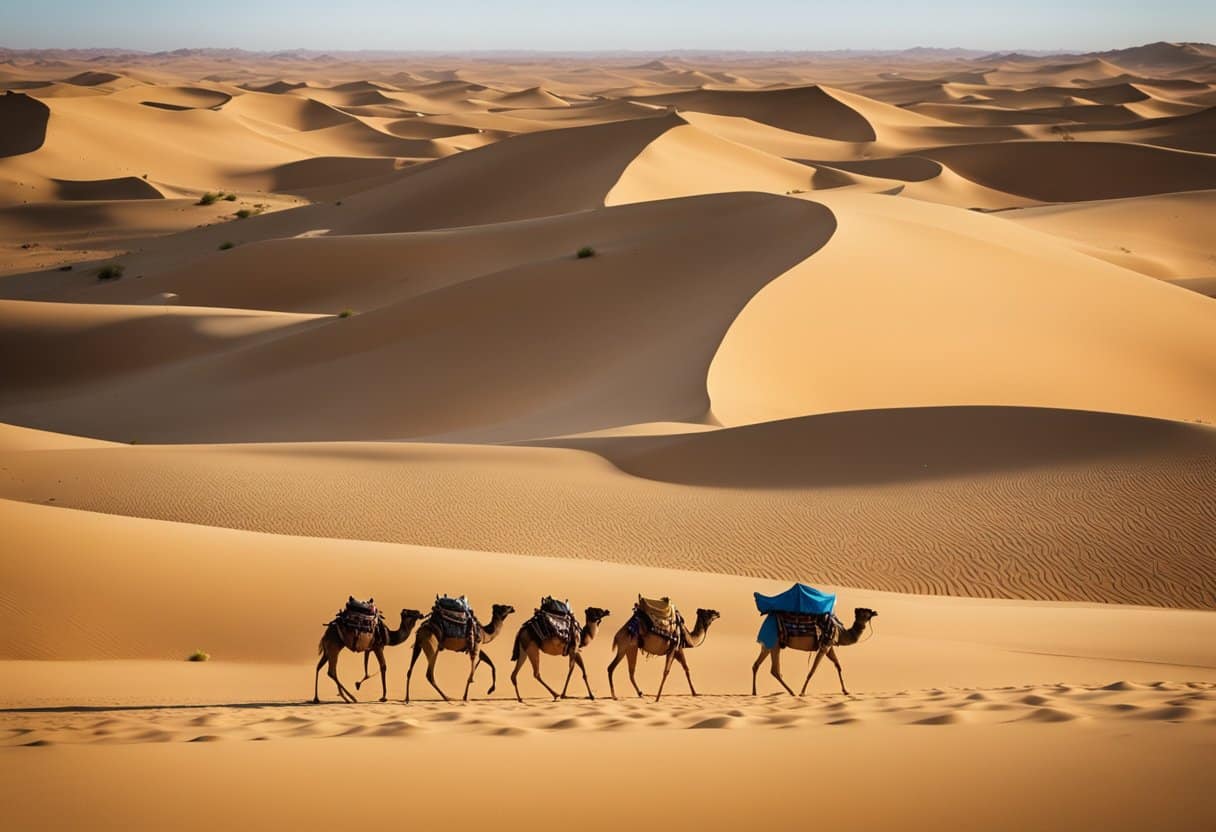
The Bedouin Trail is a long-distance route of more than 1,200km that connects Petra in Jordan with Luxor on Egypt’s Nile. It crosses the territories of seven Bedouin tribes. It is described as the longest hiking route in the Arab world and the first to link Africa and Asia.
The trail took around ten years to create. At its heart are three sister projects, each developed and managed by the tribes of its home region: the Wadi Rum Trail in Jordan, the Sinai Trail and the Red Sea Mountain Trail. A transnational collective oversees the whole passage. A full thru-hike was designed to take most walkers more than two months.
The idea behind it is simple. Rather than inventing new routes, the Bedouin Trail brings old Bedouin trails back into use for a new kind of traveller. For the official route details and updates, see the Bedouin Trail overview from the Wadi Rum Trail.
| Trail | Country | Length / duration | Highlights | Current status |
|---|---|---|---|---|
| Wadi Rum Trail | Jordan | 120km circuit, about 10 days | Sandstone massifs, Jebel Um Adami, Bedouin climbing routes | Open, guided by Wadi Rum’s Bedouin |
| Petra to Wadi Rum link | Jordan | 140km, about 6 days | Nabataean capital to desert heartlands | Open (Jordanian section) |
| Sinai Trail | Egypt | About 20 days on the Bedouin Trail route | High Sinai mountains near St Catherine | Closed to hikers since late 2024 |
| Red Sea Mountain Trail | Egypt | Mainland mountains towards the Nile | Remote peaks and grazing lands | Closed to hikers since late 2024 |
The Wadi Rum Trail (Jordan)
The Wadi Rum Trail is the open heart of the Bedouin Trail today, and the best way to walk a Bedouin route in the company of the people who made it. It links old trade, travel, shepherd, hunting, and Hajj routes into a 120km, ten-day circuit around Wadi Rum. The circuit covers around 450 square kilometres, split into six trail regions.
It is the most technical of the Middle East’s long-distance trails, with sections of scrambling, easy rock climbing and abseiling. Every difficult section can be avoided on an easier walking alternative, and you can choose these day by day. Shorter sections of a few days, or even half a day, are possible too.
Highlights include Jebel Um Adami, Jordan’s highest peak at 1,854m, where views on a clear day stretch across the Red Sea to the Sinai highlands. Wadi Rum itself is a UNESCO World Heritage Site. Film fans will recognise it from Lawrence of Arabia, much of which was shot there in 1962, and from The Martian. Our set-jetting travel guide and our feature on Jordan’s filming sites cover the screen side of the valley.
On the Bedouin Trail, walkers reach Wadi Rum from Petra on a 140km link that takes most hikers six days. They then follow about 100km of the Wadi Rum Trail and exit on a 50km route to Aqaba.
The Sinai Trail and Red Sea Mountain Trail (Egypt)
The Egyptian sections of the Bedouin Trail cannot currently be hiked as official routes. According to the Bedouin Trail organisation, the Sinai Trail and the Red Sea Mountain Trail both closed to hikers in late 2024. The organisation says this followed years in which official hiking permits became harder to obtain, until they were practically unobtainable.
Both projects had strong track records. The Sinai Trail opened in 2015 as Egypt’s first long-distance hiking route, and the Red Sea Mountain Trail followed with its inauguration in 2019. The Bedouin Trail organisation has said it hopes both will reopen, allowing the full passage between Africa and Asia to be walked again.
What Can You Still Experience in the Sinai?
You can still visit the Sinai’s Bedouin heartlands on established tourist routes, even though long-distance hiking is closed. According to the Bedouin Trail organisation, official hiking is currently limited to a few routes, such as the tourist path up Mount Sinai.
The pre-dawn climb up Mount Sinai remains one of Egypt’s best-known walks. At its foot stands St Catherine’s Monastery, built between 548 and 565 and often described as the world’s oldest continuously inhabited Christian monastery. Our guide to Saint Catherine in South Sinai covers the monastery and town. For the surrounding peaks, including Mount Catherine, Egypt’s highest summit, see our round-up of mountains in Egypt.
On the coast, Bedouin culture is easy to meet. Bedouin-run camps, tea, and food are part of a visit to the Ras Abu Galum area north of Dahab, as described in our guide to Dahab. Our wider South Sinai guide and our tour of Egypt’s coastal destinations add more options.
Rules in the Sinai change, so check what is currently permitted before you book. Choose licensed operators and ask directly whether an excursion has the required permits. Unpermitted activities put your hosts at real legal risk.
Why Trek With Bedouin Guides?

Trekking with Bedouin guides is how the Bedouin Trail was designed to work. Apart from the final Nile Valley stretch in Egypt, every section was meant to be walked with Bedouin guides and support. The guides know the water sources, the safe lines through the mountains, and the history of every valley.
There’s a cultural reason too. These trails pass through tribal land, and walking with local guides keeps income and decisions in the hands of the communities who live there. Wadi Rum’s tribes took a leading role in creating their trail, and they manage every journey on it today. For the Jordanian sections, the Bedouin Trail recommends organising hikes through Bedouin operators in Wadi Rum Village or Petra.
Bedouin hospitality is part of the experience. Guests are traditionally offered protection, food and coffee, and a few words of Arabic go a long way. Useful terms include wadi (valley or dry riverbed), jebel (mountain), and ahlan wa sahlan (welcome).
Celtic Connections: Seasonal Herding and Oral Tradition in Ireland
Ireland has its own version of the seasonal movement that shaped Bedouin trails. It was called booleying. Families moved their cattle to upland summer pastures and lived in simple booley houses until the grazing ran out, then returned to their lowland homes for winter.
You can walk among the remains of this tradition at the deserted village on Slievemore, on Achill Island in County Mayo. Some of its stone dwellings were seasonal booley houses, as our guide to things to do on Achill Island explains.
“Standing among the booley houses at Slievemore on Achill, you see the same logic Bedouin herders followed: take the animals to where the grazing is for the season, then come home. The climate couldn’t be more different, but the thinking behind it is recognisably the same.”, Ciaran Connolly, Founder of ConnollyCove
The second parallel is oral tradition. Bedouin guides carried routes, genealogies and poetry in memory. In Ireland, the seanchaí (pronounced “shan-a-kee”) kept local history, place-name lore and legend alive by the fireside. Our feature on the craft of Irish storytelling shows how that skill worked in practice.
Both traditions stored practical knowledge in memorable forms. Irish seanfhocail pack weather lore and advice into a single line, as our collection of Irish proverbs shows. The Irish language itself survived longest in home and community settings, as our guide to how folklore shaped the Irish language shows. Ireland’s myths are also tied closely to real places, much as Bedouin stories attach to particular wells and rocks. You can see this in our guide to creatures from Celtic mythology.
These are parallels of practice, not claims of shared history. ConnollyCove covers Irish heritage and global destinations side by side because comparing traditions like these helps travellers notice more wherever they go.
Planning Your Trip: A Guide for UK, Irish and Global Travellers

The practical starting point for walking a Bedouin trail today is southern Jordan, with Wadi Rum as your base. Petra, Wadi Rum and Aqaba form a compact triangle, and most visitors combine all three.
Getting There
Most travellers from Ireland and the UK fly into Amman’s Queen Alia International Airport, then travel south by road. Aqaba’s King Hussein International Airport is closer to Wadi Rum and handles some seasonal and connecting flights. From Dublin, expect to connect through a European or Gulf hub; London has more direct options. Check current schedules before booking, as routes change by season.
From Aqaba, Wadi Rum Village is about an hour’s drive away. Bedouin operators can usually arrange transfers as part of a trek.
Visas, Permits and Safety
Irish and British passport holders can generally get a Jordanian visa on arrival. Many visitors buy the Jordan Pass, which bundles the visa fee with entry to Petra and other sites. Check the current conditions on the official Jordan Pass site before you travel.
Read official travel advice before you go: the FCDO for UK travellers and the Department of Foreign Affairs for Irish travellers. Both publish region-specific guidance for Jordan and Egypt, including border areas.
Take out travel insurance that explicitly covers remote trekking. If you plan to do the Wadi Rum Trail’s scrambling or climbing sections, check that the policy covers those as well. Many standard policies exclude them.
Current Conditions & Seasonal Information
The best time to walk Bedouin trails in Jordan is autumn and late winter into spring. For the Jordanian sections of a Bedouin Trail thru-hike, the trail’s own guidance points to October through the first ten days of November, or mid-February to mid-March. Summer heat makes long desert days hard going, and winter nights can be very cold.
| Period | Conditions in southern Jordan | Suitability for trekking |
|---|---|---|
| October to early November | Warm days, cooling nights | Recommended window |
| Mid-November to mid-February | Short days, cold nights, occasional rain | Possible with warm kit; check forecasts |
| Mid-February to mid-March | Mild days, cold nights | Recommended window |
| Mid-March to May | Warming quickly | Good early in the season |
| June to September | Intense daytime heat | Generally avoided for multi-day trekking |
Water is the defining logistical issue, just as it was for camel caravans. On guided Wadi Rum treks, support teams usually handle water resupply. Carry enough for each day, and follow your guide’s advice rather than looking for water yourself.
Pack for big temperature swings: sun protection and light layers for the day, and warm layers and a good sleeping bag for desert nights. For real-time updates, trail status, and booking, go to the official trail organisations rather than third-party listings.
Planning Your Visit?
Bedouin trails began as practical routes between wells, markets and pilgrimage roads, and the Wadi Rum Trail is where you can walk one today with the tribes who know it best. Start in Jordan, travel in the cooler months, and keep an eye on the Egyptian trails in case they reopen.
ConnollyCove is an Ireland-based travel and culture platform that connects Irish heritage with destinations worldwide. For more on the region, read our guides to the Bedouins of the Arabian Desert and Petra’s Bedouin heritage, or subscribe to the ConnollyCove YouTube channel for video travel guides.
FAQs
What is the Bedouin Trail?
The Bedouin Trail is a 1,200km-plus route from Petra in Jordan to Luxor in Egypt, crossing seven Bedouin tribal territories. It combines the Wadi Rum Trail, Sinai Trail, and Red Sea Mountain Trail.
How long is the Bedouin Trail?
The full route runs more than 1,200km and was designed to take most hikers over two months. The Wadi Rum Trail section alone is a 120km, ten-day circuit.
What is a camel caravan?
A camel caravan is a group of travellers and pack camels crossing desert country together, usually for trade or pilgrimage. Caravans moved between known wells and relied on experienced local guides.
Why should you trek with Bedouin guides?
Bedouin guides know the water sources, safe routes, and local history, and the trail was designed to be walked with them. Hiring them keeps income within the communities who manage the land.