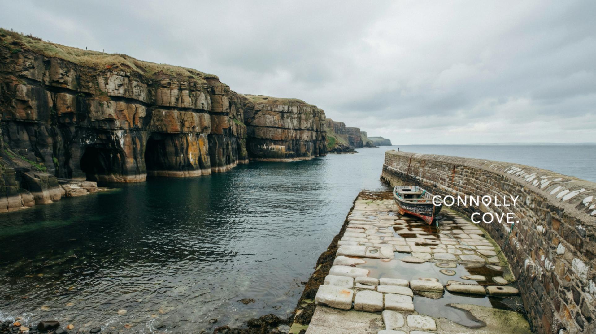


Ballintoy Harbour is the small County Antrim fishing port that Game of Thrones turned into the Iron Islands, and it remains one of the most visited film locations on the Causeway Coast. Long before HBO arrived, this was a working harbour carved from limestone cliffs, and that raw, weathered character is exactly why the show’s location scouts picked it for Pyke and Lordsport.
Below, you’ll find the specific scenes filmed here, an honest breakdown of what’s real versus CGI, the harbour’s own history, and the practical details for visiting, including the one safety point most guides leave out: the tide.
Table of Contents
Why Ballintoy Harbour Became the Iron Islands
Ballintoy Harbour was chosen as the Iron Islands because its stark limestone cliffs, grey waters, and exposed slipway needed almost no set dressing to look like Westeros. Production crews used the harbour from the show’s second season onwards, and the location returned across multiple seasons for scenes tied to House Greyjoy. Unlike more manicured filming spots, Ballintoy already had the bleak, salt-worn atmosphere the Iron Islands required.
Location scouts working on Game of Thrones favoured Northern Ireland’s Causeway Coast precisely because so much of it already looks otherworldly without much intervention. Ballintoy’s combination of a small natural harbour, dramatic sea stacks, and near-constant Atlantic weather gave the production a ready-made version of the Iron Islands that would have been costly to recreate on a soundstage.
The harbour sits on the Causeway Coastal Route in County Antrim, close to the Giant’s Causeway and the Dark Hedges, which is why most visitors combine it with a wider Northern Ireland Game of Thrones itinerary rather than a standalone trip.
The Key Scenes Filmed at Ballintoy Harbour
Ballintoy Harbour appears in several pivotal Iron Islands scenes across the series, most memorably Theon Greyjoy’s homecoming and the Ironborn baptism rituals. The location first appeared in the show’s second season and returned in later seasons as the production revisited House Greyjoy’s storyline, making it one of the more recurring Northern Ireland filming spots rather than a single-scene cameo. The table below sets out where each scene sits in the show and what you can still see standing on the harbour wall today.
| Season | Scene | What You’ll Recognise Today |
|---|---|---|
| Season 2 | Theon Greyjoy returns to Pyke and reunites with his sister Yara | The stone slipway and harbour wall were used for his arrival |
| Season 2 | Theon admires his ship, the Sea Bitch, in the harbour | The natural harbour basin, largely unchanged |
| Season 6 | The Kingsmoot, where the Ironborn choose their ruler | The rocky shoreline and cliffs surrounding the harbour |
| Season 6 | Ironborn baptism and Drowned God ritual scenes | The sea caves and rock pools near the harbour mouth |
The Kingsmoot scene, in which Ironborn captains gather to choose a new ruler after Balon Greyjoy’s death, used the wider stretch of coastline around the harbour to suggest a much larger crowd and setting than the real location could hold on its own. Watching that scene again after visiting makes the scale of the digital work involved much clearer, since the camera angles stretch a fairly compact stretch of coast into something resembling an island-wide gathering.
Fans often ask whether the Iron Islands’ Drowned God rituals were inspired by any real maritime folklore. Irish coastal communities have their own long tradition of sea deities and drowned-god style superstition, most notably Manannán mac Lir, the sea god of Celtic mythology, and readers curious about that wider tradition can explore ConnollyCove’s guide to the Tuatha Dé Danann for the Irish myths behind figures like him. The parallel isn’t exact, since Manannán is a protector rather than a demanding god who claims sacrifices, but the deep cultural association between Irish coastal life and the sea is genuine and predates the show by well over a thousand years.
CGI vs Reality at Ballintoy Harbour
Most of what you see on screen at Ballintoy Harbour is real, but Pyke Castle itself was never built here. The castle was added digitally in post-production, layered onto the cliffs above the harbour, so visitors expecting to find ruins should know there’s nothing physically standing beyond the natural rock formations.
What is real: the harbour wall, the slipway, the sea caves, and the small whitewashed buildings along the shore. What’s digital: the castle, some of the more dramatic cliff extensions, and the wider Iron Islands skyline used in establishing shots. Wide aerial shots of Pyke also blend the real coastline with digitally extended cliffs, which is why the harbour can look larger and more fortress-like on screen than it does when you’re standing on the slipway in person.
Ballintoy’s History Before Game of Thrones
Ballintoy Harbour existed as a working limestone port long before it became a filming location, and that history is worth knowing before you visit. The harbour was built to export limestone quarried from the surrounding cliffs, and the small stone buildings on site date from that era of maritime trade, when local boats carried stone and other goods along the North Antrim coast.
The name Ballintoy comes from the Irish Baile an Tuaighe, meaning “townland of the axe,” a reference lost on most fans arriving purely for Westeros. Nearby Ballintoy Church, rebuilt in 1663 after repeated attacks, and the ruined Ballintoy Castle, largely demolished by 1800 and sold off piece by piece for its timber and stone, add further layers of local history that predate the show by centuries.
Just above the harbour, Bendhu House, a striking 1936 clifftop design built from materials gathered along the shore, gives another reason to slow down rather than head straight back to the car. Travellers with an interest in Ireland’s coastal heritage will find as much to explore in the village itself as on the harbour wall.
Current Conditions and Seasonal Information
Ballintoy Harbour is open to visitors year-round, though conditions along this stretch of coast change quickly with the weather. Late spring and early autumn tend to offer the calmest seas and the best light for photography, while winter brings dramatic waves that suit the Iron Islands’ atmosphere but make the harbour wall and slipway slippery underfoot. Summer is busiest, particularly late morning through mid-afternoon when coach tours tend to arrive.
Tides matter more here than most guides mention. Some of the sea caves and rock pools used in the baptism scenes are only accessible at low tide, and the harbour can feel considerably more exposed when the tide is in, with waves reaching parts of the slipway that are dry at other times. Check the Met Office forecast and a local tide table before planning to explore beyond the main harbour wall, and avoid the rocks entirely in poor visibility or high wind, since conditions here can shift faster than they do further inland.
Visiting Ballintoy Harbour: Roads, Access and Practical Tips
Getting to Ballintoy Harbour means driving down a narrow, winding road from the main coastal route, and this descent catches out drivers unfamiliar with the area. Locals sometimes call this stretch the Ballintoy Bends, and while the road is manageable in a standard car, it’s tight for campervans or larger vehicles, with few passing places once you commit to the descent. Allow extra time, drive slowly on the final stretch down to the water, and give way to oncoming traffic where the road narrows.
Parking at the harbour is currently free, though space is limited during peak summer months and coach tour arrivals. There are public toilets on site and a small café, Roark’s Kitchen, for refreshments after the walk down. Mobile signal along this part of the coast is patchy at best, so it’s worth downloading maps or directions before you set off rather than relying on data once you arrive.
| Visitor Cheat Sheet | Detail |
|---|---|
| Cost | Free to visit, free parking |
| Facilities | Public toilets, small café |
| Mobile signal | Weak to patchy |
| Best light | Early morning or late afternoon |
| Road access | Narrow descent, unsuitable for large campervans |
Nearby Stops to Combine With Ballintoy Harbour
Ballintoy Harbour sits close enough to several other Northern Ireland highlights that most visitors turn it into a half-day or full-day loop. The Giant’s Causeway is a short drive further along the coast, and travellers exploring the full Causeway Coastal Route often stop at both on the same day, along with Bushmills and its centuries-old distillery. Those with more time can add a ferry crossing to Rathlin Island, just off the coast, for cliffs, seabirds, and a quieter pace than the harbour car park in high season.
Game of Thrones fans in particular tend to pair Ballintoy with the Dark Hedges, the beech avenue used as the Kingsroad, and the ten Game of Thrones Doors carved from timber salvaged after storm damage to those same trees. Those based in or passing through Belfast can extend the theme further with the Game of Thrones tapestry at the Ulster Museum or the Glass of Thrones stained-glass trail along the Maritime Mile.
Explore More of Northern Ireland’s Screen Heritage
Ballintoy Harbour is one stop on a much larger map of Northern Ireland locations that shaped Westeros, from the Dark Hedges to Belfast’s own Titanic Studios. ConnollyCove’s guide to Game of Thrones filming locations across Northern Ireland covers the full list if you’re planning a longer trip, and our complete guide to County Antrim rounds out the wider region beyond the show, from the Glens of Antrim to Bushmills. For more on the Celtic sea-god parallels mentioned earlier, the legend of Finn McCool is a good next stop.
Whether you’re chasing every Westeros filming spot or simply drawn to the North Coast’s cliffs and folklore, Ballintoy Harbour rewards a slow visit rather than a quick photo stop. Bring proper footwear for the descent, check the tide before you explore the caves, and leave time for the village itself, since the harbour’s history runs a good deal deeper than one television series.
Frequently Asked Questions About Ballintoy Harbour
Quick answers to what fans ask most before visiting.
How do I get to Ballintoy Harbour?
Ballintoy Harbour is reached via a narrow road off the main Causeway Coastal Route, roughly an hour from Belfast by car. There’s no train station nearby, so a car or organised tour is the most practical option.
What does Ballintoy mean in Irish?
Ballintoy comes from the Irish Baile an Tuaighe, meaning “townland of the axe.” The name predates the harbour’s Game of Thrones fame by centuries.
Is Pyke Castle real?
No, Pyke Castle doesn’t exist at Ballintoy Harbour. It was added digitally in post-production onto the real cliffs and harbour.
Can I visit the sea caves at any time?
Not always. Some caves and rock pools used in filming are only safely accessible at low tide, so check a tide table before exploring beyond the main harbour.
Is there a cost to visit Ballintoy Harbour?
No, visiting Ballintoy Harbour and parking there is currently free. Facilities are limited to public toilets and a small café.
What’s the best time of year to visit for photography?
Late spring and early autumn generally offer calmer seas and softer light. Winter delivers dramatic waves but rougher, wetter conditions underfoot.