


Article Summary
What this article covers: The Curragh Plains in County Kildare, Ireland, explained in full: where they are, what the name means, the legends of St Brigid and the Fianna, the military and racing history, the laws that protect the grassland and practical advice for visiting.
Who this is for: Travellers planning a trip to Kildare or a day out from Dublin, readers with Irish roots researching the places their families knew, and anyone curious about one of the oldest stretches of common land in Europe.
Key takeaway: The Curragh is a working common of roughly 4,870 acres where sheep graze under nineteenth-century law, racehorses train on the same turf used for centuries, and the Irish Defence Forces keep their main training centre, so visitors are welcome but share the ground with all three.
Expert insight: “Most people drive past the Curragh on the M7 and see a big green space. Once you know that St Brigid’s cloak, a bare-knuckle fight from 1815 and the battle scenes in Braveheart all belong to the same few miles of grass, it becomes one of the most rewarding places in Kildare to walk.”, Ciaran Connolly, Founder of ConnollyCove
Quick facts:
- The Curragh covers about 19.7 square kilometres (roughly 4,870 acres) of unenclosed grassland between Newbridge and Kildare town.
- The Curragh Racecourse hosts all five Irish Classic races, including the Irish Derby.
- There has been a permanent military camp on the Curragh since 1856, and it is now home to the Defence Forces Training Centre.
Table of Contents
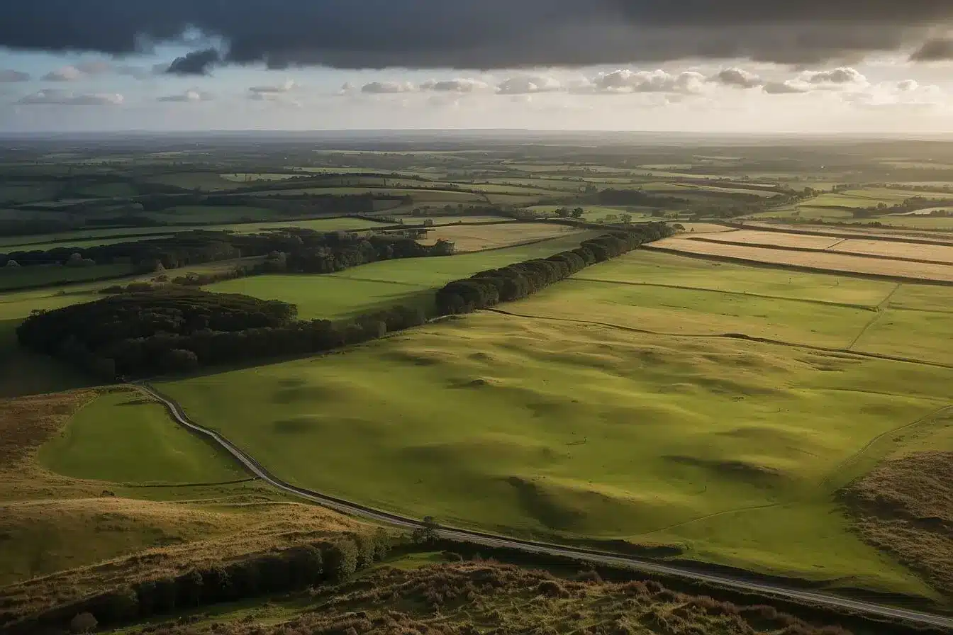
The Curragh Plains are a wide, flat expanse of open grassland in the middle of County Kildare, about an hour by road from Dublin. In Irish, the place is called An Currach, and for more than a thousand years it has served as a meeting ground, a battlefield, a sheep common, a racecourse and an army camp, often at the same time. The soil sits on sand left behind by an esker at the end of the last Ice Age, which is why the turf drains so well and why trainers have prized it for generations.
ConnollyCove, the Ireland-based travel and culture platform, covers places where Irish history and folklore can still be walked, and the Curragh is one of the clearest examples in the country. This guide brings together the legends, the documented history and the practical detail you need for a visit. It sits naturally alongside our wider guide to things to do in Kildare and the rest of our County Kildare travel coverage.
The Curragh lies between Newbridge and Kildare town

The Curragh is an unenclosed plain of about 4,870 acres in County Kildare. It lies between the towns of Newbridge to the east and Kildare to the west, with the M7 motorway running along its southern side. Local politicians and the press often round the figure up to 5,000 acres, and it is frequently described as one of the largest areas of semi-natural lowland grassland left in Europe.
Ask where the Curragh is in Ireland, and most people in Kildare will point you towards the racecourse grandstand, which is visible for miles across the flat ground. The Irish National Stud and the Japanese Gardens at Tully sit on its western edge near Kildare town, and the Curragh Camp occupies its centre. For readers planning a wider trip, our Ireland travel guide covers routes into the midlands. The Curragh is also an easy addition to the itineraries in our Dublin travel guide, since Newbridge and Kildare both have direct trains from Dublin Heuston.
The meaning of the word Curragh is debated. In Irish place names, currach is commonly linked to marshy or open low ground, while some local writers connect the Curragh with an old word for a racecourse, which would suit its history. Either way, the name has been attached to this plain for many centuries, and the earliest surviving legal reference to it dates from 1299.
Sandy soil, a protected fen and winter birdlife shape the plains
The Curragh owes its character to its geology. Glacial meltwater laid down a sand load along an esker, leaving a free-draining sandy soil rather than the heavy, peaty ground found in much of the Irish midlands. That drainage keeps the turf firm in wet weather, which suits both the sheep and the racehorses.
Because the land has never been ploughed or enclosed in the way surrounding farmland was, it supports grassland plants that have disappeared from more intensively farmed fields, including patches of yellow-flowering furze (gorse). Birdwatchers visit in winter for flocks of golden plover and lapwing that feed on the open sward, though numbers vary from year to year.
Just to the northwest lies Pollardstown Fen, the largest fen in Ireland. It is fed by springs rising from the same gravel and sand deposits, and it is managed as a protected nature reserve with a boardwalk for visitors. If you enjoy the ecology of the plains, the fen makes a quiet second stop. The folklore that grew up around old trees and raths elsewhere in the country, described in our guide to fairy trees in Ireland, helps explain why some features of the Curragh were left untouched for so long.
St Brigid’s cloak and the Fianna gave the Curragh its legends

The best-known story about the Curragh involves St Brigid, one of Ireland’s patron saints. According to legend, in about 480 AD Brigid wanted land to found her monastery at Kildare and asked the King of Leinster for it. He agreed to give her as much land as her cloak would cover, and when she spread the cloak on the ground, it grew until it covered the whole of the Curragh.
The story is still told in Kildare town, where St Brigid’s Cathedral stands on the site traditionally linked to her monastery. Visitors who come in early February can join the celebrations covered in our guide to Saint Brigid’s Day customs. You can also learn to weave one of the rush crosses made in her honour with our guide to Brigid’s Cross. Her life and influence are also covered in our profile of famous Irish women.
To the north of the plains rises the Hill of Allen, or Almhain in early Irish sources. It is the legendary home of Fionn mac Cumhaill and the meeting place of his warrior band, the Fianna. Fionn appears in stories all over Ireland, including the tale of how he built a road to Scotland, told in our article on the legend of the Giant’s Causeway. The Fianna stories belong to the Fenian Cycle, one of the main groups of early Irish tales. Readers interested in the wider cast of gods and monsters can explore our guide to creatures from Celtic mythology and our account of the Tuatha Dé Danann.
The Curragh was a gathering place in pre-Christian times, and that role continued into the medieval period with fairs and assemblies. Earthworks survive across the plains, including the rath known as Gibbet Rath, although much of this record is easier to read on a map than on the ground.
Medieval battles: Gibbet Rath and the Curragh Camp form its military history
The Curragh has been used by armies for at least eight centuries. On 1 April 1234, Richard Marshal, 3rd Earl of Pembroke, was defeated and wounded in a battle on the plains against men loyal to Henry III of England, and he died at Kilkenny Castle a fortnight later. Through the later medieval and Tudor periods, the plain was a regular mustering ground for the armies of the Pale.
The darkest episode came during the 1798 Rebellion. At Gibbet Rath, rebels who had gathered to surrender to Crown forces were attacked and killed, and contemporary and later accounts put the dead in the hundreds. The event is remembered locally as the Gibbet Rath massacre, and visitors should treat the site with the same respect as any place of mass loss. Our overview of the history of Ireland places the rebellion in its wider context.
A permanent military presence began in 1856, when the British Army built the Curragh Camp as a training base. Social historians have also documented the “Wrens of the Curragh”. These were women who lived in shelters dug into the banks of the plain and worked for or alongside soldiers from the 1840s until the 1880s, which shows that the camp shaped civilian lives too. After the foundation of the Irish Free State in 1922, the camp passed to the new Irish army, and today it is home to the Defence Forces Training Centre. On 2 January 1941, during the Emergency, a German aircraft dropped bombs on the Curragh, causing minor damage. The Curragh Military Museum opened in 2010, and it is worth checking opening arrangements before you travel.
Sheep grazing rights and nineteenth-century law still govern the Curragh
The Curragh is public land held by the State, and its use is still shaped by Victorian legislation. The earliest legal reference, from 1299, was an order to stop pigs feeding on the plain and damaging the turf. In the 1860s, a parliamentary commission examined the Curragh. Its findings led to the Curragh of Kildare Act 1868, which created the office of Ranger to look after the plain for horse racing and training.
A second act in 1870 set out the sheep grazing rights that local commoners still hold, which is why you will see flocks wandering freely across the grass and sometimes the road. When the Irish Free State was founded in 1922, the lands passed from the Crown to the Minister for Finance. The Curragh of Kildare Act 1961 abolished the office of Ranger and transferred its duties to the Department of Defence, which remains responsible for the plains.
In recent years, the pressures on the Curragh, including illegal dumping, unauthorised encampments and damage from vehicles, have led to calls for better management. Kildare County Council and the Department of Defence prepared a Curragh Plains Conservation Management Plan, and the Department of Defence announced its publication along with a strategy for signage and interpretation. The plan recommends reviewing the bye-laws and the governing legislation, and it also recommends considering a dedicated body to manage the plains. These changes still require legislation and funding before they take effect.
The Curragh Racecourse and the gallops anchor Irish flat racing
The Curragh Racecourse is the home of Irish flat racing and hosts all five Irish Classics every year: the Irish 1,000 Guineas, the Irish 2,000 Guineas, the Irish Derby, the Irish Oaks and the Irish St Leger. The Irish Derby, first run in 1866, is the highlight of the summer and draws racegoers from Britain, France and much further afield.
The two Guineas races are run over a mile in spring for three-year-olds. The Irish Oaks is restricted to three-year-old fillies, while the Irish St Leger is open to older horses as well. The racecourse calendar also includes the Curragh Cup and many smaller meetings, and the current fixtures and ticketing details are published by the racecourse itself.
Away from race days, the plains are criss-crossed by gallops used by the training yards around Kildare and Kilcullen. Early in the morning you can often watch strings of thoroughbreds working on the turf, a sight that has changed little in two hundred years. The Irish National Stud, on the edge of Kildare town, offers guided tours that explain how champions are bred, and its Japanese Gardens make a calm contrast to the open plain. Readers who would rather ride than watch can find options in our guide to horseback riding in Ireland. Those who enjoy a summer festival atmosphere may want to compare the Curragh with the Galway Races.
Boxers, racing drivers and Braveheart all left their mark on the plains
The Curragh has a sporting history that goes well beyond horses. In 1815, at a natural bowl in the grass now called Donnelly’s Hollow, the Irish boxer Dan Donnelly beat the English champion George Cooper in front of a large crowd. Donnelly became a folk hero, and his preserved arm was displayed for many years at a pub in nearby Kilcullen. He would sit comfortably in our list of successful Irish athletes, and the hollow remains one of the most visited spots on the plains.
Motor racing also came to the Curragh. The 1903 Gordon Bennett Cup was the first international motor race held in what was then the United Kingdom of Great Britain and Ireland, and it used a circuit through Kildare that passed across the plains. The British team raced in Shamrock Green as a complement to Ireland, which is often given as the origin of British racing green. After the Second World War, car races were held on a circuit at the Curragh from 1947 to 1954, and a young Stirling Moss won the Wakefield Trophy there in 1951. Royal Curragh Golf Club, which describes itself as Ireland’s oldest golf course, still plays across part of the plain.
International visitors searching for the Curragh as a Braveheart filming location are in the right place. The Curragh Plains were used for the battle scenes in Mel Gibson’s 1995 film, including the Battle of Stirling Bridge, with members of the Irish Defence Forces taking part as extras. Our guide to films shot in Ireland covers the other Braveheart locations in Meath and Wicklow. Our cinematic journey through Ireland suggests routes that link several sets in a single trip. More recently, the 2020 coming-of-age film Dating Amber was set and filmed on the Curragh.
The main landmarks sit within a short drive of each other
The table below sets out the places most visitors look for, with our suggestion for each. Donnelly’s Hollow, Gibbet Rath and the racecourse are on the plains themselves, while the Hill of Allen and Pollardstown Fen are a few minutes away by car.
| Landmark | What it is | Our recommendation |
|---|---|---|
| Donnelly’s Hollow | Natural bowl where Dan Donnelly beat George Cooper in 1815 | Start here for an easy, short walk with a clear story |
| Gibbet Rath | Earthwork and site of the 1798 massacre | Visit quietly and allow time to read the local signage |
| Curragh Racecourse | Home of the five Irish Classics | Book ahead for Irish Derby weekend in summer |
| Curragh Camp and Military Museum | Irish army base since 1922 and home of the Defence Forces Training Centre | Check opening arrangements before travelling |
| Irish National Stud and Japanese Gardens | Working stud farm and gardens at Tully | Combine with a morning watching the gallops |
| Hill of Allen | Legendary home of Fionn mac Cumhaill, north of the plains | Drive there for views back across the Curragh |
| Pollardstown Fen | Ireland’s largest fen, on the north western edge | Use the boardwalk and bring binoculars |
Walking the Curragh safely and responsibly
You can walk freely across most of the Curragh, but it is a working common rather than a park, and a few habits make a visit easier for everyone. Parking is informal, with laybys and small car parks around the edge of the plain and near Donnelly’s Hollow. Newbridge and Kildare stations also put the plains within reach of a walk or a short taxi ride.
The ground is open and exposed, so wind and rain can feel much stronger than in nearby towns. Wear sturdy footwear, as the turf is uneven and the sandy soil can hide rabbit holes, and pack a waterproof layer whatever the forecast says. There are few facilities on the plains themselves, so plan food and toilets around Newbridge, Kildare town or the racecourse.
Dogs must be kept on a lead because sheep graze freely across the whole area, and lambs are about in spring. Keep clear of the gallops in the morning, since racehorses travel at speed and riders cannot always stop. Parts of the plain near the Curragh Camp are used for military training, so obey any signs, flags or instructions from Defence Forces personnel, and do not pick up any metal objects you find. Our team at ConnollyCove also asks readers to take all litter home, as dumping is one of the biggest problems the plains face.
“The thing I tell people about the Curragh is to give it a whole morning rather than ten minutes from the car. Watch the horses on the gallops, walk out to Donnelly’s Hollow and then stand quietly at Gibbet Rath, and you will have covered almost a thousand years of Irish history without leaving the grass.”, Ciaran Connolly, Founder of ConnollyCove
Seasonal conditions and the best time to visit the Curragh
Late spring to early autumn is the most comfortable time to walk the Curragh, with longer days and firmer ground. Summer brings the main racing festivals, and Irish Derby weekend is the busiest period of the year, so book accommodation in Kildare, Newbridge or Naas well in advance if your dates coincide.
Spring is lambing season, which makes it a lovely time to see the flocks but also the time when dog control matters most. Early February is worth considering for the St Brigid’s Day events in Kildare town, which grew from the older festival of Imbolc described in our guide to the origins of Celtic festivals. Winter is quiet, cold and often windy on the open plain, but it is the best season for birdwatching. Race fixtures, museum hours and any temporary restrictions change from year to year, so check official sources before you set out.
Plan your Kildare trip around the Curragh
ConnollyCove, founded by Ciaran Connolly, produces travel guides that connect Irish heritage with places visitors can reach, and the Curragh shows how much history can sit in one open field. Start with a morning on the plains and add the National Stud or Kildare town in the afternoon. Then use our guide to things to do across County Kildare to fill a second day. For video tours of Irish heritage sites, visit the ConnollyCove YouTube channel.
FAQs
What does the Curragh mean?
In Irish, the place is called An Currach, a word usually linked to open or marshy low ground in place names. Some local writers connect it with an old word for a racecourse, but the exact origin is uncertain.
Where is the Curragh in Ireland?
The Curragh is in County Kildare, between Newbridge and Kildare town, about an hour by road southwest of Dublin along the M7. Newbridge and Kildare railway stations are both on the line from Dublin Heuston and sit at either end of the plains.
How big are the Curragh Plains?
The plains cover about 19.7 square kilometres, or roughly 4,870 acres, a figure often rounded to 5,000 acres. That makes it one of the largest areas of unenclosed semi-natural grassland in Europe.
Who owns the Curragh Plains?
The Curragh is State land, and the Department of Defence has been responsible for it since the Curragh of Kildare Act 1961. Local commoners hold sheep grazing rights set out in the 1870 Act.


