
County Tipperary: Behold the Treasures of Ireland’s Nature
Updated On: April 05, 2024 by 
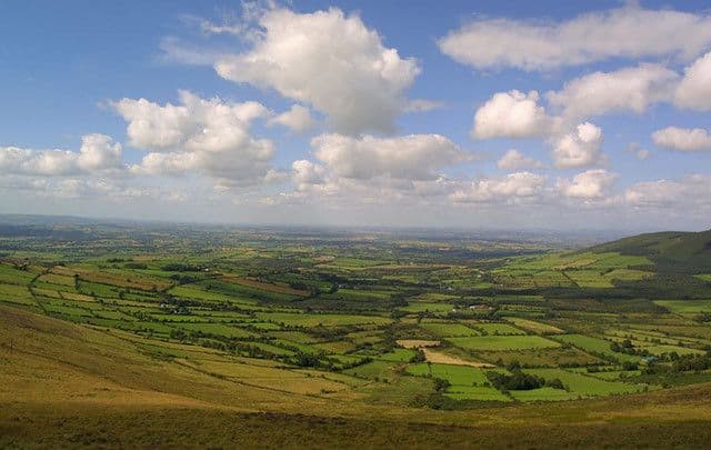
Wholly landlocked and rural, County Tipperary is Ireland’s largest inland county. The county is famous for its rich and fertile farmland, raised bogland, and the Galtee Mountains in the south. More impressively, the lands of Tipperary have consistently ranked amongst the most productive in Ireland. The land has always been an excellent destination for gazing, with extensive tracks of bog and mountain and captivating scenery.
Table of Contents
Geography
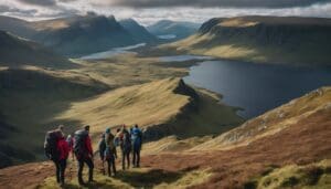
Tipperary is a very picturesque region, with the stunning Galtee Mountains and the River Suir and a rich, lush, green landscape famous for its horse studs. Rising from here are several colossal mountain ranges. Among them, the Arra Hills and the Silvermine Mountains, compiled with The Galtee, comprise Ireland’s most significant inland mountains. Lough Derg, one of the largest lakes in Ireland, also spreads down the west side of North Tipperary along the River Shannon. The county has a lot of records to break to get your attention.
Tipperary is better known as the “Premier County”, dating from the 1840s when Thomas Davis in the Nation newspaper lauded Tipperary for its patriotic atmosphere and sense of serenity and claimed, “Where Tipperary leads, Ireland follows.” Raised bogland dominates The central area of the county, some 12,000 years old. Splitting the county into its two halves: North Tipperary, administered from the town of Nenagh, close to Lough Derg. South Tipperary, administered from Clonmel, is on the border with County Waterford.
History of Tipperary
History and heritage flow through the veins of County Tipperary. It is one of Ireland’s oldest counties. Having been administrated to Ireland in the 13th century, just after the Norman invasion. Thanks to the early invaders, the county has an abundance of castles. The main towns in the south include Tipperary town, Clonmel, Cahir, the central market town of Thurles and Cashel, where you’ll find the famous landmark the Rock of Cashel. When visiting Tipperary, you’ll want to get the name right, emphasizing the third syllable rather than the first for a sound like tip-er-rare-ee.
It was also in Thurles, at Hayes’ Hotel, in 1884, that a group of hurling enthusiasts came together to form the earliest incarnation of the Gaelic Athletic Association, which would become the governing body of the traditional Irish sports of hurling, camogie, Gaelic football, handball, and rounders.
Sports in Tipperary
The landed elite and military officer classes helped promote the growth and development of different sports in County Tipperary in the mid-19th century. In cricket, rugby union and association football, the military was the principal agency through which these sports spread and became known among the different factions of people in the county. Sporting trends fashionable in Great Britain also became evident in Ireland, and by extension, County Tipperary.
The degree to which horse racing and hunting to hounds became an integral aspect of the social lives of the elite class is reflected countywide. The associational culture among this class became evident in summertime recreations, most notably archery, lawn tennis and cricket. Cricket was the one sport that quickly diffused throughout the sporting community of Tipperary. In the 1870s, it became the most prolific team sport in the county, and all classes played it.
Sport took place without borders, and to this end, patronage was a vital element of this support. Some notable supporters gave their time and money to ensure that the best resources were in place to bring this about.
Key Attractions in Tipperary
The Rock of Cashel is one of the most famous of County Tipperary’s landmarks. A group of mediaeval buildings sits on top of a rocky outcrop, dominating the skyline of the town of Cashel. Lough Derg is the largest of the lakes along the River Shannon. It is the longest river in Ireland and is almost an inland sea. In essence, Tipperary’s nature is as authentic and diverse as possible.
The Galtee Mountains

The Galtees are Ireland’s highest inland mountain range. As the name suggests, the Galtymore is the highest peak within the range, standing at 3,009 feet. The Galtees have several corrie lakes, such as Lough Musky, Lough Curra, and Lough Bohreen. The entrance to its centrepiece, the Glen of Aherlow Nature Park, is close to the Christ the King statue and adjacent to the car park.
The Galtee Mountains, or “a walker’s paradise”. The Glen of Aherlow has a variety of mapped walking routes across forest tracks and open moorland. The Glen of Aherlow has eight looped walks on Slievenamuck and two linear walks in the Galtee Mountains.
Cahir Castle
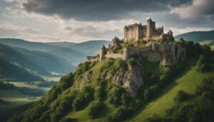
Cahir Castle (Irish: Caisleán na Cathrach) is one of the largest ancient castles in Ireland. It was built in County Tipperary in 1142 by Conor O’Brien, Prince of Thomond, on an island in the river Suir. The original castle was at the north end of the present-day castle, the highest point of the island, and was probably just a simple fort. A thick wall eventually surrounded it, and, with tours at each corner, it was as safe a place as possible to construct.
The castle is a glorious testament to the skills of medieval architects and builders, gleaming in the sun and surrounded by the formidable yet beautiful River Suir. It is impossible not to imagine the Norman Knights and Medieval ladies that once graced these high and intimidating Curtain Walls. Walls that loom overheard telling the story of this place with silent beauty.
The castle remained in the Butler family until the last Lord Cahir, died in 1961. At that point, it became the property of the state. It is open to visitors all year round, and guided tours are available, although there is an entrance charge.
River Suir
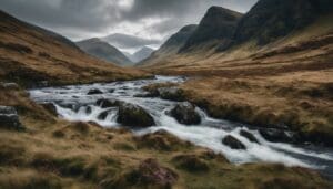
The River Suir (pronounced ‘sure’) rises in the Devil’s Bit Mountain in County Tipperary. It flows from Borrisnoe Mountain north of Templemore all the way down through County Tipperary. Winding eastward, it eventually joins its sister rivers, Nore and Barrow, before finding its way to the Irish Sea in County Waterford. It is 115 miles long, and together with its tributaries, it drains a total catchment of 1,394 square miles.
The main river’s flow has deep and shallow glides interrupted by shallow riffles. Its width increases as it proceeds downstream, and the sequence of relatively shallow glides and riffles is maintained. This rich limestone base and vast, relatively shallow glides make the Suir ideal for producing brown trout.
Knockmealdown Mountains
The Knockmealdown range of mountains straddles the Tipperary Waterford border for much of its length. The highest peak is Knockmealdown, with other peaks including Knockshanahullion, Sugarloaf Hill, Knocknagnauv, Knocknafallia, and Knockmeal.
This popular beauty spot is famous for its magnificent display of rhododendrons in late May and early June. The valley sides offer a perfectly chevron-shaped scene of the fields of Tipperary laid out far below, a panoply of greens, browns, and yellows. The Tipperary Heritage Way north to Cashel begins at The Vee, while the seventy-kilometre East Munster Way starts down at Clogheen and heads east from The Vee to Carrick-on-Suir via the northern foothills of the Knockmealdowns and the Comeraghs.
St. Patrick’s ll
The counties of Ireland contain more than 3,000 holy wells, each associated with a saint, legend, or healing property. These holy wells have been sites of worship and prayer for centuries, and those who seek the miraculous cures offered by the waters still visit today.
In Bellcoo, Tipperary, down a narrow road marked only with an old high cross, lies the ancient site of St. Patrick’s Well. Steeped in legend, the holy well of Patrick is not a well at all but a wide stream surrounded by stones—a stream that bubbles with what is said to be the coldest water in all of Ireland.
Rock of Cashel
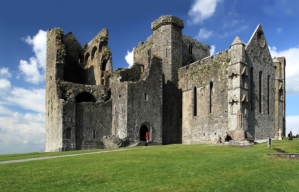
It should be no surprise that Cashel is quite famous for the massive limestone rock in the town’s centre: the Rock of Cashel (Carraig Phádraig), more formally named St. Patrick’s Rock, also known as Cashel of the Kings. The site is a walled area built atop a huge rock. It was a brilliant defensive choice and an ideal spot for the castle they built there (hence the name).
To be more accurate, the name originates from Caiseal, meaning “stone fort,” and the hill was originally the residence of the kings of Munster. Excavations have revealed some evidence of burials and church buildings from the 9th or 10th century. Still, in the early 12th century, the Rock began to develop into a major Christian centre. Numerous buildings have occupied the cold and exposed Rock over the years, but the ecclesiastical relics have survived.
A County’s Legacy
Among Tipperary’s most famous children are Former Australian Prime Minister Ben Chifley, James Dewey Watson, winner of the Nobel Prize in Physiology with two others in 1962 for their discovery of DNA structure, and Irish folk group The Clancy Brothers. Former U.S. President Ronald Reagan’s ancestors were also from Tipperary.
Other Worthy Reads:
Mesmerising Beauty of County Sligo| Castle Ward: A Place with A Remarkable History| Clare and the Irish Wonder of the Atlantic| The Unendowed and Rich History of County Down|
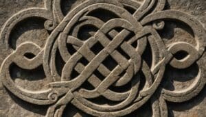
Mastering the Art of Creating Circular Knots: A Comprehensive Guide to Celtic Knot Designs!
History and Heritage
19/04/2024
The Ultimate 5-Day Scotland Itinerary: Exploring the Highlights of the Highlands!
Travel Tips
19/04/2024
The Ultimate Guide for a Memorable Trip to Scotland from London!
Travel Tips
19/04/2024
Discovering the Breathtaking Beauty of the North Coast of Northern Ireland!
Northern Ireland
19/04/2024
Unveiling the Reign of the Kings of Ulster: Thrones of Power
Mythology and Folklore
19/04/2024