

Discovering Ireland: An Ultimate Journey through History – Top Historical Locations in Ireland
Updated On: April 13, 2024 by  Marise
If you want to explore the history of Ireland and the Irish outdoors, look no further.
At ConnollyCove, we have created this guide on historic walkways around Ireland, which we think you should explore from north to South.
Table of Contents
Causeway Coast Way, Ireland
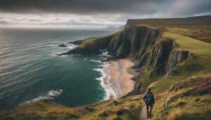
This walkway is located in County Antrim. It takes you up the North Coast, offering views of cliffs, beaches, harbours and many historic landmarks. While exploring this region, you will encounter the landmarks The Giants Causeway, Carrick-a-Rede Rope Bridge, Dunluce Castle, and Dunservick Castle. The route is roughly 33 miles and starts at Portstewart and ends at Ballycastle.
History of Ireland
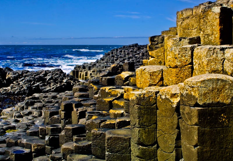
Giant’s Causeway
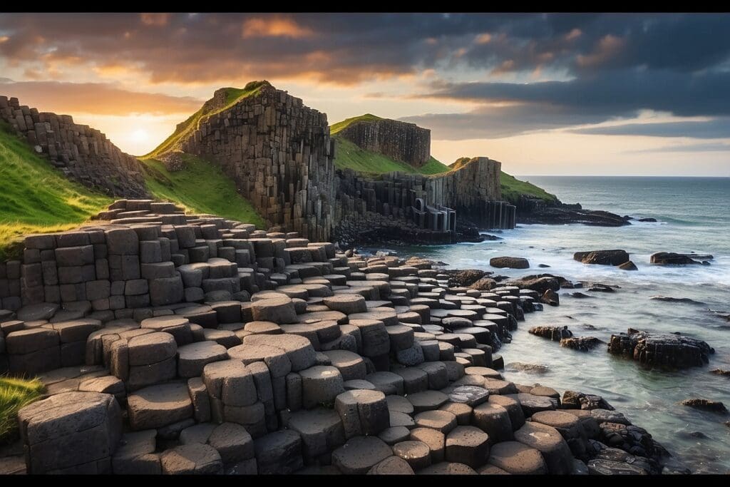
One of the historic landmarks you will pass during your travels is the Giants Causeway. The legend of giant Fin MacCool lives here.
It is said that the columns and rocks were once a path across the North Channel to Scotland. Finn MacCool built this path after accepting to fight the Scottish Giant Benandonner. There are two versions of this legend:
- In the first version, Finn defeats Benandonner
- The second is more interesting. Finn discovers that Benandonner is much larger than him and hides. Finn’s wife then dresses him as a baby. Then, when Benandonner sees the baby’s size, he assumes Finn must be a gigantic giant and runs away. While retreating, he destroys the causeway so Finn cannot follow him.
While visiting, you will see the ‘Giant’s Boot’. Said to have been lost by Finn when he ran to hide from Benandonner.
There are similar columns across the sea on the Scottish coast.
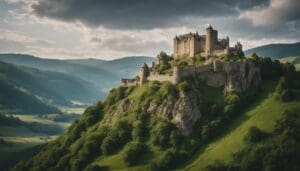
Dunluce Castle
Check out the history and legends behind his medieval castle at:
Dunluce Castle – Incredible Medieval Castle on Cliffs in County Antrim
Dunsevick Castle- One of the five Great Royal Highways of Ancient Ireland
This castle is situated near the village called Dunseverick and the Giant Causeway.
It is recorded that St Patrick, the Patron Saint of Ireland, visited this castle in the 5th century. Here, he baptised a man called Olcán, who later became a Bishop of Ireland.
In 1642, the castle was destroyed by General Robert Munro. Today, only the ruins of the gate lodge remain.
Mourne Mountains
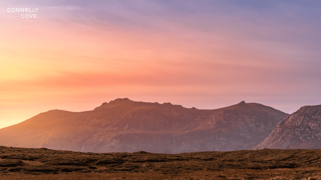
The Mourne Mountains are located in County Down. Many hikers enjoy visiting the Mourne Mountains, which have many different paths. The highest peak is Slieve Donard, which is 853 meters high.
This area is full of history and legend. With its rich history and natural beauty, it is no surprise that C.S. Lewis greatly inspired it.
History and Legend in Ireland
There is a deep history and many legends in this area of Ireland. We have listed some of the most interesting:
- St Patrick’s Stream:
It is said that Saint Patrick banished the snakes in Ireland in the Mourne Mountains. He spent much time here converting the local people to Christianity. There is a small stream named after him. A rock along the stream bank is said to have embedded an impression of his hand from when he drank the water from the stream.
- Cloughmore Stone
This is a giant granite boulder which rests on Slieve Martin. Our giant, Finn Mac Cool, threw it from the opposite side of Carlingford Lough at an enemy.
- Deirdre of the Sorrows
Conchobar mac Nessa, King of Ulster, wanted Deirdre, the most beautiful woman, as his wife. He captured her and hid her on the slopes of Slieve Gullion. However, she met another and fell madly in love with a young warrior named Naoise.
They fled away from Conchobar. However, he found Deirdre and convinced her to marry him after having someone kill Naoise. Deirdre hated him, and in an attempt to stop her hatred of him, Conchobar offered her the man who killed Naoise.
It is said that Deirdre died of heartbreak. It is also said that from the two graves grew two trees; they grew and became so intertwined that nothing could come between them, symbolic of their everlasting love.
- Spelga Dam
Near the dam, an Irish Chieftain is said to be buried in the trees and haunts the land.
- Jenny Black’s Hill
Beware Jenny Black’s tricks; she said she enjoyed tricking travellers. An infamous witch lived here. The hills were covered with an enchanted forest full of evil spirits, devils and hobgoblins. She was burned at the stake for her wrongdoings; however, it is still said that she haunts the hill like a white hare.
- Lough Shannagh- ‘Lough of the Fox’
It is said that a hunter called Sheelagh was on a hunt in the Mournes. She found a fox and chased it. She was too fast for the rest of the hunt to keep up with her. It became cloudy, and visibility dropped.
The fox ran into the lough, and the woman on her horse followed. She tried to escape but only sank lower with her horse. It is said that when the mist closes in like it did that day, the woman on her horse haunts the area, repeatedly chasing the fox into the lough.
- The Ice House
An igloo-shaped building it was built in the 1840s and used by the Annesley family to store ice. The ice would have been collected and stored here during winter to last the rest of the year. The National Trust restored it in 1996.
- The Brandy Pad
Today, a popular route for hiking in the 1800s is a popular route for smuggling items. It was used to smuggle many goods from the coast, such as coffee, tea, silk, and brandy. It was said that they would have crossed the Bloody Bridge to access the mountains.
- The Mourne Wall
The wall started to be built in 1904 and took 18 years to complete. It is 3 meters high and runs 22 miles across the 17 mountain peaks. If you follow the wall, you are guaranteed an arduous journey full of stunning scenery.
- Hill of Tara
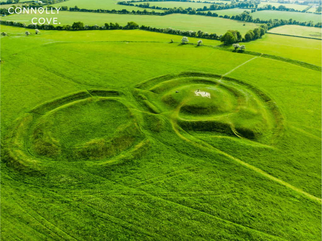
It is located in County Meath, surrounded by natural beauty. It is a fantastic place to explore Ireland’s history while enjoying the outdoors. The area is entirely of monuments and myths.
History
This area is one of the most significant Celtic monuments in Europe, dating back 6,000 years. Hundreds of monuments in this location are filled with historic value. We have noted some of the most important:
Place of Royalty
During historic and prehistoric times, over 142 kings ruled this area. Located north of the Mound of Hostages is the King’s Seat or The Stone of Destiny. It was said to have been brought by the Gods and roared when the rightful ruler sat upon it.
- Standing Stones
In a churchyard, you will find the ancient standing stones. There are two of them. The taller is believed to have featured the figure of the Celtic fertility God Cernunnos.
Temple under the hill
One under and surrounded by 300 oak posts was a vast temple. This temple dates back to around 2,500-2,300 BC.
The Famine Walk – The Killary Fjord
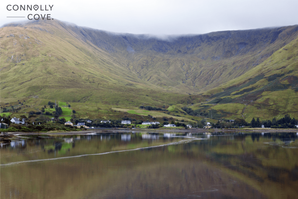
This area is in Connemara, creating a natural border between County Mayo and County Galway. Surrounded by mountains and dolphin sightings, it is no wonder that The Killary Fjord is famous for hikers. However, it has a rather upsetting history.
History
During the Irish Potato Famine, the people who lived in Loughborough were told that if they went to the landlords at Delphi Lodge, they would be given food. The people set up this walkway in horrendous conditions. Some died on the walk there. When some people got to the Lodge, they were refused. On the walk back to the town, most of the people died.
Travellers can see the ridges of lazy beds and home ruins along the trail.
Glendalough Lake Walk
The Glendalough Valley is in the Wicklow Mountains National Park. With many route options, this is a popular destination for hikers. With over 20,000 hectares of land and many roads to explore, travels are spoiled for choice of path and scenery.
Monastic City
In the 6th century, Saint Kevin founded the early Christian monastic settlement, which developed into the Monastic City. While exploring, you will see many of this ‘city’ ruins. You can explore some ruins: the Round Tower, which is 30 meters high, and many other remains. You will also discover the Priest’s House, built in the 12th century; a large granite cross built in the 6th or 7th century; and the ‘Cathedral’, the largest site here and built in the 11th and 12th centuries.
Mines
Mining in this area began in the 1790s and continued for 150 years until 1957. Visitors can explore these mining villages, where once 2,000 people worked.
Cobh Town
This town in Cork offers three trails where visitors can walk through the history of this town. As it has the second largest harbour in the world, there is much heritage here, from the Famine emigrants to the Titanic’s visit. Each route will take visitors through the history and provide stunning seafront scenery and colourful streets. The best part of these trails is that they are entirely self-guided! With sighs guiding people and plaques at places of interest, this is perfect for people who want to explore the area and its history at their own pace.
Route 1: The Quayside
This 2.5-kilometre route takes visitors across the length of the town along the prom walk. Some of the historic areas you will explore on this route are The Former White Star Office, The Five Foot Way Walk, and the Cobh Museum.
Route 2: The Cathedral
This route is 1.3 kilometres long, the shortest but steepest route. However, the scenery and history you will explore will compensate for the added walking efforts. This route takes visitors towards St. Colman’s Cathedral. Some historic areas you can explore are the Old Church Cemetary and the Titanic Memorial.
Route 3: The Holy Ground
This final route is the longest, 2.8 kilometres long. It starts from the town centre and leads to The Bench on the opposite side of Cobh. From The Bench, visitors can delight in the amazing scenery of the harbour and surrounding islands. Some of the historic areas you can explore on this route are the former Residence of Father Matthew, the Clock Tower Gallery, and the Holy Ground.
Valentia Island
Visitors can access Valentia Island by road bridge at Portmagee or by car ferry at Renard Point. This island is filled with beauty and history, and many routes contain elements of Ireland’s rich history.
History
Like most destinations in Ireland, this tiny island has an entire history for people to explore. Here are some stories of this island’s history:
Tetrapod Tracks
On this island, visitors can behold the wonders of evolution with their own eyes. These Tetrapod Tracks are dated to have been made between 350 and 370 million years ago. Although they may not look like much, they show the transition between water and land-living animals.
Mug Ruith
This island is said to have been home to the blind druid Mug Ruith. He could grow to enormous heights, and his breath blown could cause storms and turn men into stone.
The Knights of Kerry
There were three Anglo-Irish hereditary knighthoods in Ireland. The Fitzgeralds were one of these families. They resided on the island of Valentia in 1780.
Lighthouse
This lighthouse is located at Cromwell Point on the island. The site where the lighthouse is located was originally a Fort built in the 16th century. Today, you can still see the bastions and the barrack walls. Later, in 1828, Right Honorary Maurice Fitzgerald, Knight of Kerry, ordered light from this point. The first light shone in 1841 and still shines out to sea today.
If you enjoyed reading about historic locations around Ireland, please enjoy more of ConnollyCove’s articles about the rich history of Ireland:
Irish Castles: Where History and Paranormal Activity Combine | Malahide Village: A Great Seaside Town Outside Dublin | Dunluce Castle – Incredible Medieval Castle on Cliffs in County Antrim | Climbing Carnmoney Hill, County Antrim | The Famous Carrick-a-Rede Rope Bridge
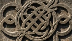
Mastering the Art of Creating Circular Knots: A Comprehensive Guide to Celtic Knot Designs!
History and Heritage
19/04/2024
The Ultimate 5-Day Scotland Itinerary: Exploring the Highlights of the Highlands!
Travel Tips
19/04/2024
The Ultimate Guide for a Memorable Trip to Scotland from London!
Travel Tips
19/04/2024
Discovering the Breathtaking Beauty of the North Coast of Northern Ireland!
Northern Ireland
19/04/2024
Unveiling the Reign of the Kings of Ulster: Thrones of Power
Mythology and Folklore
19/04/2024