

A 360 Degree Video Experience of Ballintoy Harbour
Updated On: February 21, 2024 by  Ciaran Connolly
Check out this amazing 360 Degree Video Experience of Ballintoy Harbour and see it in all of its beautiful glory. The harbour offer’s stunning views and peaceful walks and there are some lovely Ballintoy harbour cottages and its possible to see sheep island and the rope bridge in the distance. All this in our 360 degree video!
Northern Townland
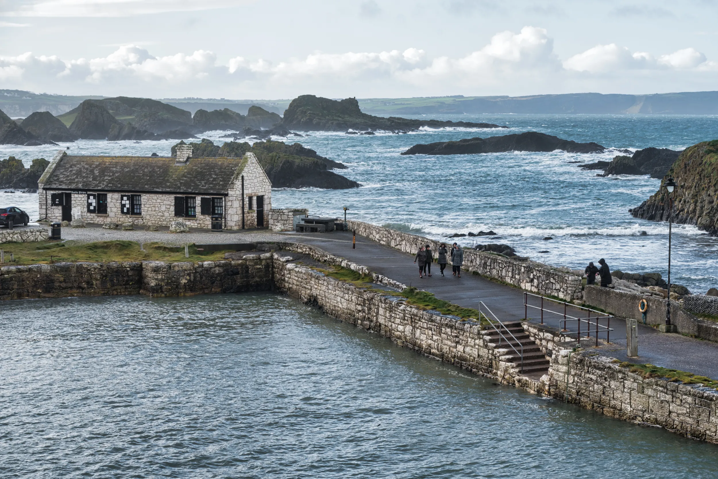
Ballintoy is a nice small village having a small harbour there. There are plenty of rocks in the water around the place. During the high tide, the water from the waves splashes on (or over) them continuously. The combination of the wind and the splashing sound makes the place is amusingly lyrical.
The small fishing harbour can be found at the end of a small narrow steep road down Knocksaughey Hill, which passes by the entrance to Larrybane and Carrick-a-Rede Rope Bridge.
Ballintoy provides an exposed anchorage where the rock stacks and islands afford limited shelter in settled or offshore conditions but an entirely comfortable overnight stop would be unlikely. In northerly conditions, the Atlantic Ocean rolls directly into the harbour with formidable force and groundswell batters the harbour area. Access requires attentive navigation preferably in daylight as there are islands, stacks and covered rocks on one side of the entrance path. The direction and velocity of the tide should be the central feature of any navigation planning in this area.
When to Experience Ballintoy Harbour’s Magic
The best time to visit Ballintoy Harbour is during the spring and summer months, from April to September when the weather is generally mild and the days are long. During this time, visitors can enjoy pleasant temperatures ideal for exploring the coastal trails, relaxing on the beach, or taking a stroll through the charming village. Additionally, spring and summer bring an abundance of wildflowers to the cliffs and meadows surrounding the harbour, adding bursts of colour to the already stunning landscape.
However, it’s worth noting that these months are also the busiest, particularly during the peak tourist season in July and August. For those seeking a quieter experience, the shoulder seasons of early spring and late autumn can also be a delightful time to visit, offering fewer crowds while still showcasing the natural beauty of Ballintoy Harbour.
Steep in History of Ballintoy Harbour
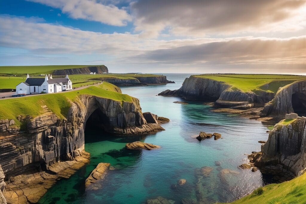
The village itself, which is just one kilometre from the harbour, has a charming array of small shops, two churches, including the quaint white Ballintoy Parish Church on the hill above the harbour, as well as tourist accommodation, restaurants, commercial and social facilities.
Ballintoy Harbour, meaning ‘Town of the North’, is built with limestone blocks in a roughly triangular shape at the edge of Ballintoy town. No matter the weather, the crowd of small boats and surrounding rocks make for a fantastic photo of the Northern Irish coast, which extends to Ballycastle on one side and Whitepark Bay on the other.
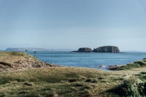
The harbour extends to Sheep Island with a further reef to Larrybane, the perfect arrangement for a professional photo enthusiast. The popular walk from Whitepark to Ballintoy has some fantastic sights to explore; the rock formations between the two are colloquially known as ‘The Park End’ and attract some of Ireland’s most ferocious waves, given their shape and positioning.
Ballintoy Harbour has a rich history affixed to it, and to this day, it is a respected fishing and trade post. While exploring the maritime culture celebrated here, you will feel as though you have taken a true step back in time through Northern Ireland’s past. The aesthetic matches that of the hobbit homeland of The Shire – a stunning array of rocky shores, quaint hills and village shops that delight the travellers who visit.
The walk between Ballintoy to Whitepark Bay, which follows an ancient pathway, is also worth taking. The bay is known as a ‘raised beach.’ Rich in flora and fauna, the ancient sand dune system also contains several carbon-dated Neolithic sites, and arrowheads are occasionally found there.
Nature and Wonder
There are several small pots (holes) in the stone. Water uses to come inside during high tide with a fierce might. It looks like the water is trying to crash the hole down. But the solid stone is still standing there. Those holes are really deadly. The level of water rises very quickly. And sometimes too much water cannot escape, and that causes hissing sound.
The Harbour has been used as a filming location in HBO’s epic series Game of Thrones. The stunning harbour location has been used for exterior Pyke shots and as the Iron Islands.
Village Charm
At the heart of Ballintoy Harbour lies the charming fishing village that shares its name. Here, traditional whitewashed cottages line narrow streets, their brightly coloured doors adding a touch of cheer to the scene. Time seems to slow down in Ballintoy, and visitors can’t help but be enchanted by its peaceful atmosphere.
The village is also home to a handful of quaint shops and cafes, where visitors can sample local delicacies and pick up souvenirs to remind them of their time by the sea. Whether enjoying a leisurely meal overlooking the harbour or browsing for handcrafted gifts, there’s a warmth and hospitality in Ballintoy that leaves a lasting impression.
Exploring the Surroundings
While Ballintoy Harbour is undoubtedly the main attraction, the surrounding area is also well worth exploring. The Giant’s Causeway, Northern Ireland’s most famous natural landmark, is just a short drive away. Formed millions of years ago by volcanic activity, the Causeway’s hexagonal basalt columns and UNESCO World Heritage Site are sights to behold.
Nearby, the Carrick-a-Rede Rope Bridge offers another thrilling experience. Suspended high above the sea, the bridge allows daring visitors to cross to a tiny island once used by salmon fishermen. The views from the bridge are spectacular, with the rugged coastline stretching away in both directions.
For those interested in history, the ruins of Dunluce Castle are a must-visit. Perched dramatically on a cliff top overlooking the sea, the castle dates back to the 13th century and has a storied past involving sieges, battles, and even a shipwreck. Exploring its atmospheric ruins is like stepping back in time and offers a fascinating glimpse into Northern Ireland’s past.
Practical Information
Visiting Ballintoy Harbour is relatively straightforward, with ample parking near it. The village is also accessible by public transport, with regular bus services from nearby towns such as Ballycastle and Bushmills.
Those planning to explore the coastal paths should come prepared with sturdy footwear and weather-appropriate clothing, as conditions can change quickly along the coast. It’s also good to check tide times before setting out, as some areas may be inaccessible at high tide.
Whether you’re a fan of “Game of Thrones” seeking out filming locations or simply looking to experience the natural beauty of Northern Ireland’s coastline, Ballintoy Harbour has something to offer everyone. With its stunning scenery, rich history, and warm hospitality, it’s a destination that will capture the hearts of all who visit.
Also, check out some of our other 360 Video experiences of Belfast and Northern Ireland.
Discovering the Breathtaking Beauty of the North Coast of Northern Ireland!
Northern Ireland
19/04/2024

Unveiling the Reign of the Kings of Ulster: Thrones of Power
Mythology and Folklore
19/04/2024

Boudica: Iceni Queen and Roman Rebellion
History and Heritage
19/04/2024
Discover the Breathtaking Scenic Drives in Wales: Exploring the Beauty of the Country!
Wales
19/04/2024

10 Spectacular Scenic Drives in Ireland: Explore the Beauty of the Emerald Isle!
Ireland
19/04/2024